![]() Mention Northern California to trail runners, and they’ll gush about the Marin Headlands north of San Francisco or, farther north, the Sierra Nevada foothills and the iconic Western States Trail.
Mention Northern California to trail runners, and they’ll gush about the Marin Headlands north of San Francisco or, farther north, the Sierra Nevada foothills and the iconic Western States Trail.
But, what about Oakland? Yes, Oakland.
A hilly greenbelt hugs one side of the urban core of Oakland and offers dozens of miles of sublime trail running, with arguably more variety of terrain and foliage than the headlands across the bay. The greenbelt, linked by trails through regional parks, stretches more than 30 miles south to north from the city of Hayward, through Oakland and Berkeley, and to the city of Richmond. This area is collectively known at the East Bay of San Francisco.
As an East Bay resident for 25 years, Oakland—both the city and its redwood-and-eucalyptus-filled hills—never failed to impress and inspire me by offering such a wide variety of scenic and satisfying places to run. The city features not one, but two glassy lakes rimmed by vibrant neighborhoods. You can warm up with a lap or two around Oakland’s Lake Merritt or Lake Temescal, then bust your lungs charging up the hills to access trails where coyote, bobcats, and wild turkeys often cross. High on the ridgeline above Oakland, you’ll see a sweeping view of San Francisco Bay.
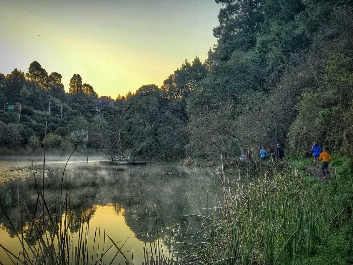
The Breakfast Club group runs at Oakland, California’s Lake Temescal at dawn. Photo: John Zulim
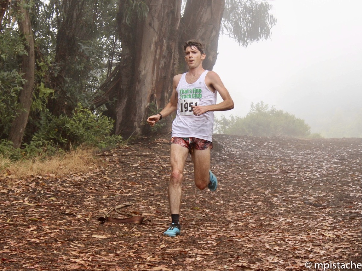
On the streets or in the hills, you might spot Olympian and Western States 100 champion Magda Boulet, a longtime resident of Oakland’s Rockridge neighborhood, or legendary ultrarunner Errol “The Rocket” Jones, who lives a few blocks from downtown’s Lake Merritt. Whoever you see, you’ll be struck by the diversity and friendliness of the people.
“Oakland has a fantastic, supportive running community,” says dedicated trail runner and East Bay resident Nyobugi Okullo, who frequently runs around the Oakland hills and has raced Oakland’s classic Skyline 50k several times. She says a misimpression persists that Oakland “is unsafe and sketchy… which is far from true.”
“Oakland is one of the most diverse cities in the world, and there is something for everyone,” she says.
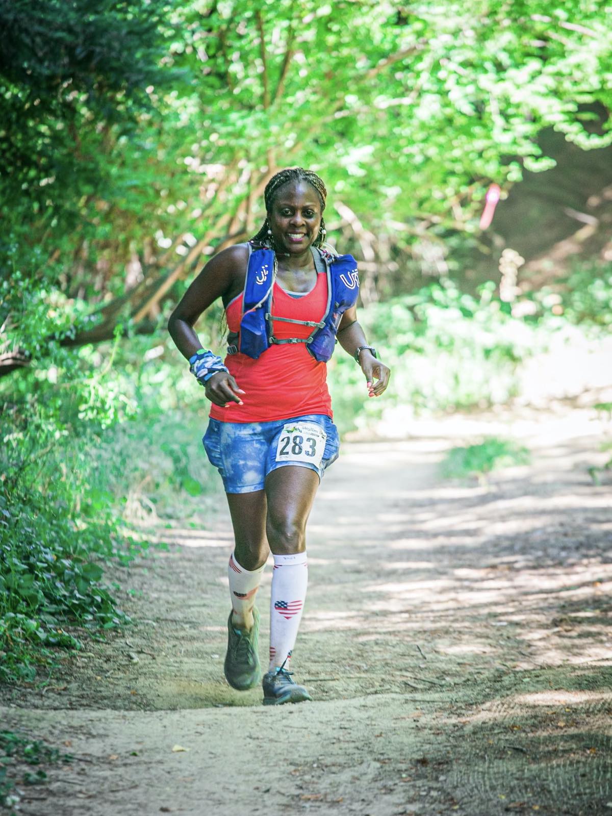
Nyobugi Okullo racing the Skyline 50k. Photo courtesy of Nyobugi Okullo.
Getting to Oakland’s Trails
To orient yourself to the regional trail system, download maps to the East Bay Regional Park District here and to the lesser-used East Bay Municipal Utilities District trails here.
Redwood Regional Park is the best starting point for experiencing the Oakland hills. As its name implies, groves of towering redwood trees fill the park’s center, creating a shady canopy under which ferns and moss thrive on the banks flanking the trails. Where the redwoods thin out, fragrant groves of eucalyptus and bay laurel trees grow.
Getting There by Vehicle
Skyline Gate, along Skyline Boulevard—the main road traversing the Oakland ridgeline—is the most popular trailhead for Redwood Regional Park, and it conveniently leads to the double-wide East Ridge and West Ridge trails ringing the park, as well as the woodsy Stream Trail that bisects the park.
Skyline Gate gets overly crowded on weekends. For better parking and fewer people, enter the park on its southern edge through Redwood Gate on Redwood Road—and pay the $5 entrance fee to support the park system.
Getting There on Foot
If you want to run, rather than drive, to the trails from downtown Oakland, start anywhere on Park Boulevard in Oakland’s Glenview or Montclair districts. Run all the way up Park. Or, better yet, seek out the local’s trail called Bridgeview that parallels Park Boulevard along Sausal Creek. Park Boulevard hits Highway 13. Run south on the frontage road along the highway, on the bayside, for about a half mile, and you’ll discover a pedestrian tunnel under the highway. Go through the tunnel and hang a left to find a cul-de-sac on Joaquin Miller Court.
Tucked into this cul-de-sac, you’ll find the Palos Colorado Trailhead. Take this forested singletrack trail that ascends for a little over a mile to Joaquin Miller Park. This city-owned park is a favorite spot for high school cross-country teams to train, and it abuts Redwood Regional Park. Follow any of the trails that lead up the hill to the smoothly undulating Sequoia-Bayview Trail, and from there connect to the West Ridge Trail for full access to all that Redwood Regional Park has to offer.
Another great way to run, rather than drive, from urban Oakland to the trails is to start at Lake Temescal next to the Caldecott Tunnel near the northern border between Oakland and Berkeley. This lovely lake, featuring picnic spots and a small swimming beach, has a one-mile path around it. Run the lake, then hop on Broadway—the Highway 24 frontage road—toward the tunnel and use the highway overpass to get to Tunnel Road. The steady, windy uphill climb of about 2.5 miles on Tunnel Road tours the 1990s neighborhood that residents rebuilt after the devastating 1991 firestorm. The road eventually meets Skyline Boulevard; head south on Skyline about a mile and you’ll reach Sibley Volcanic Regional Preserve, another fantastic regional park with miles of trails through wind-swept grasslands, connecting to Redwood Regional Park on the south and Berkeley’s Tilden Regional Park to the north.
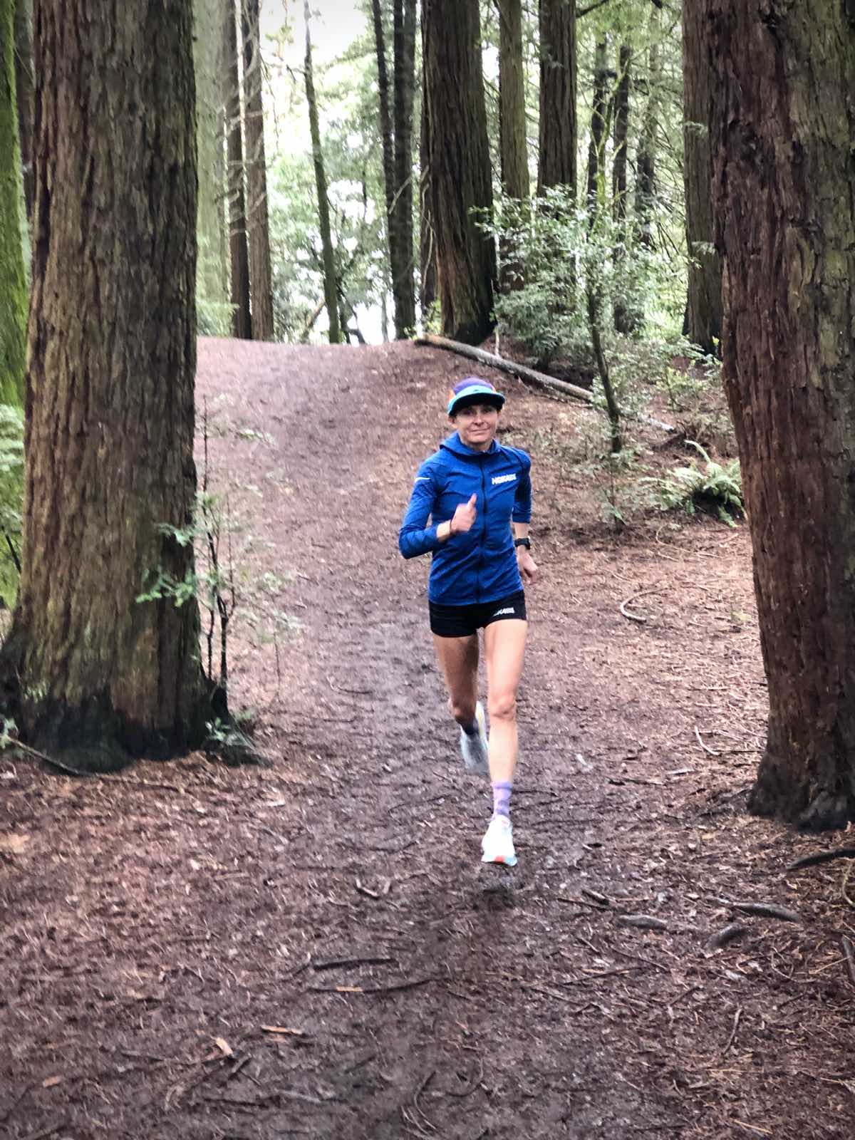
Magda Boulet training in Oakland’s Redwood Regional Park. Photo: Richie Boulet
Sample Oakland’s Best Trails
Here are three routes to sample Oakland’s best trails.
Run Long
For an extra-long run that traverses several of Oakland’s best trails, I recommend the following in whole or in part. Be prepared to climb or descend hills several hundred feet high.
Park at the small staging area called Big Bear on Redwood Road, just up the road from the main Redwood Gate in Redwood Regional Park. I like this parking area because it’s in the middle of a figure-eight route, positioned in between Redwood Regional Park to the north and Anthony Chabot Regional Park to the south. But, it lacks restrooms or water; if you need those amenities, then park at Redwood Gate and pick up the trails from there.
Directly across the road from Big Bear Staging Area, hop on the Golden Spike Trail and follow it east to a bridle trail that leads through the central area of Redwood Regional Park. From there, you have numerous loop options to circle the whole park, each of which will take about seven to 10 miles. Whatever loop you choose, be sure to include the deep-woods French Trail, perhaps the most enchanted and arduous trail in the whole East Bay.
Back at Big Bear Staging Area, you can restock at your car and begin the southern half of this figure eight: the Chabot loop. Run the connector trail between Big Bear and MacDonald staging areas and then ascend a dirt fire road called MacDonald Trail. You’ll climb a tough mile uphill, then descend another 1.5 miles to a wide-open area called Bort Meadow. From Bort, you can do a short loop of about 3.5 miles by running down Grass Valley Trail and returning to Bort via Brandon Trail.
Or, if you want a bigger bite of the East Bay, you can follow a map to run to and around beautiful Lake Chabot. The whole loop from Big Bear Staging Area around Lake Chabot and back takes about 18 to 20 miles, depending on which trails you choose.
The Redwood Regional Park trail map and Anthony Chabot Regional Park trail map will help you plan your route.
Run Shorter
For a short run that samples both the dense forest and wide-open ridge views of Redwood Regional Park, try this six-mile loop I call the “Misty Redwood 10k” because a trail race of that name, on this route, took place in the mid-2000s. Enter the park through Redwood Gate and park at Canyon Meadow Staging Area. Run approximately 2.5 miles uphill on the fairyland-like Stream Trail, amidst the redwoods. At the top, you’ll pop out at Skyline Gate. Pick up the double-wide East Ridge Trail and run eastward on it for three miles. Then hang a right and plunge down the steep Canyon Trail for a little over a half mile to return to the start. Of course, you can also start and finish this loop by parking at Skyline Gate. Use the Redwood Regional Park trail map to navigate.
Run the Ridgeline
If you desire a panoramic view of the entire East Bay, San Francisco, and Marin—plus the double-humped Mount Diablo to the east in the suburbs around Walnut Creek—then you should start at Sibley Volcanic Regional Preserve and head north about six miles into Tilden Regional Park. Or for a shorter run, start in Tilden Regional Park’s Steam Trains area off Grizzly Peak Boulevard, and run just a couple of miles north.
The Bay Area Ridge Trail, aka the Skyline Trail, runs through Sibley and Tilden. Follow it north, through Tilden’s Steam Trains area, along Berkeley’s ridge. A couple of miles north of Steam Trains, look for a bench with a memorial plaque for runner and Powerbar founder Brian Maxwell, who died in 2004, and pause to appreciate the Bay Area’s best vista point.
The Sibley Volcanic Regional Preserve trail map and Tilden Regional Park trail map will help you plan this outing.
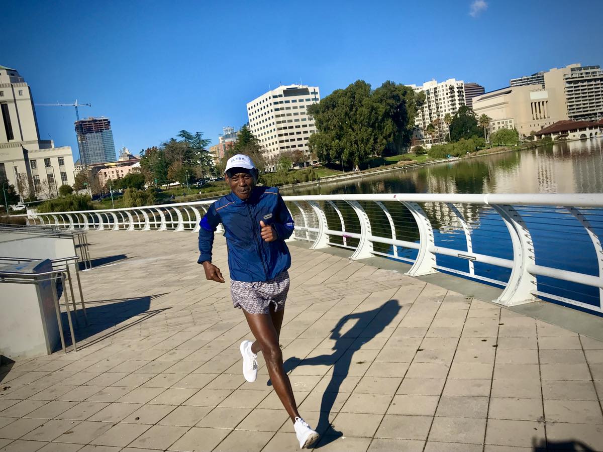
Errol “The Rocket” Jones running at Lake Merritt in Oakland, California. Photo: Sarah Lavender Smith
Run a Trail Race in California’s East Bay
[Author’s Note: Racing is on hold in 2020 and the start of 2021 due to the COVID-19 pandemic.]
Several race directors host numerous trail races, from 5ks to ultramarathons, in the Oakland-Berkeley hills. In addition to the early August Skyline 50k previously mentioned, which turns 40 years old in 2021, the Dick Collins Firetrails 50 Mile provides an expansive and challenging tour of the East Bay hills along the Bay Area Ridge Trail.
Coastal Trail Runs, Brazen Racing, and Inside Trail organize numerous races throughout the year in the East Bay and, a little farther east but well worth the drive, on Mount Diablo. A small team of dedicated East Bay volunteers also carries on the tradition of the East Bay Triple Crown trail race series on Berkeley-Oakland trails during three weekends in May and June, featuring the Tilden Tough 10 Mile, the Woodmonster 9 Mile, and the Lake Chabot Half Marathon.
Sam Robinson racing the Woodmonster 9 Mile. Photo courtesy of Sam Robinson.
Meet Other Oakland, California Runners
[Author’s Note: Organized group runs are on hold in 2020 and the start of 2021 due to the COVID-19 pandemic.]
To gear up and get locals’ insights on running, head to Oakland’s longtime independently owned running store, Transports on College Avenue. Owner Bev Nakashima, herself a longtime runner, employs knowledgeable runners for shoe fittings. The store organizes group runs through neighborhood streets and on Oakland trails.
Speedy runners enjoy the “Breakfast Club” that meets Thursdays at 6:30 a.m. for a run of seven or so miles at around a 7:00 to 7:40 minute/mile pace, organized by Oakland resident Sam Robinson. They meet on the north side of Lake Temescal for a clockwise loop around the lake and then a hilly run through North Oakland streets. There’s no need to sign up, just show up; check the club newsletter for details.
Oakland’s oldest running club, Lake Merritt Joggers and Striders founded in 1977, also organizes group training runs and casual trail runs, as well as hosts a 5k/10k/15k every fourth Sunday around Lake Merritt. Be sure to check out their website for news about Oakland running.
Call for Comments
- Do you run in Oakland and the East Bay? Leave a comment with a trail or route you love, to help add to this resource.
- What East Bay races do you enjoy?
[Editor’s Note: If you live in a city anywhere in the world with good trail running and would like to write a “Destination Dirt” article about it, contact us!]
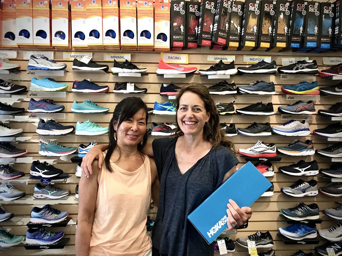
Transports owner Bev Nakashima (left) and author Sarah Lavender Smith at her store. Photo courtesy of Sarah Lavender Smith.
