[Editor’s Note: This article was written by Melissa Beaury and iRunFar Managing Editor Meghan Hicks.]
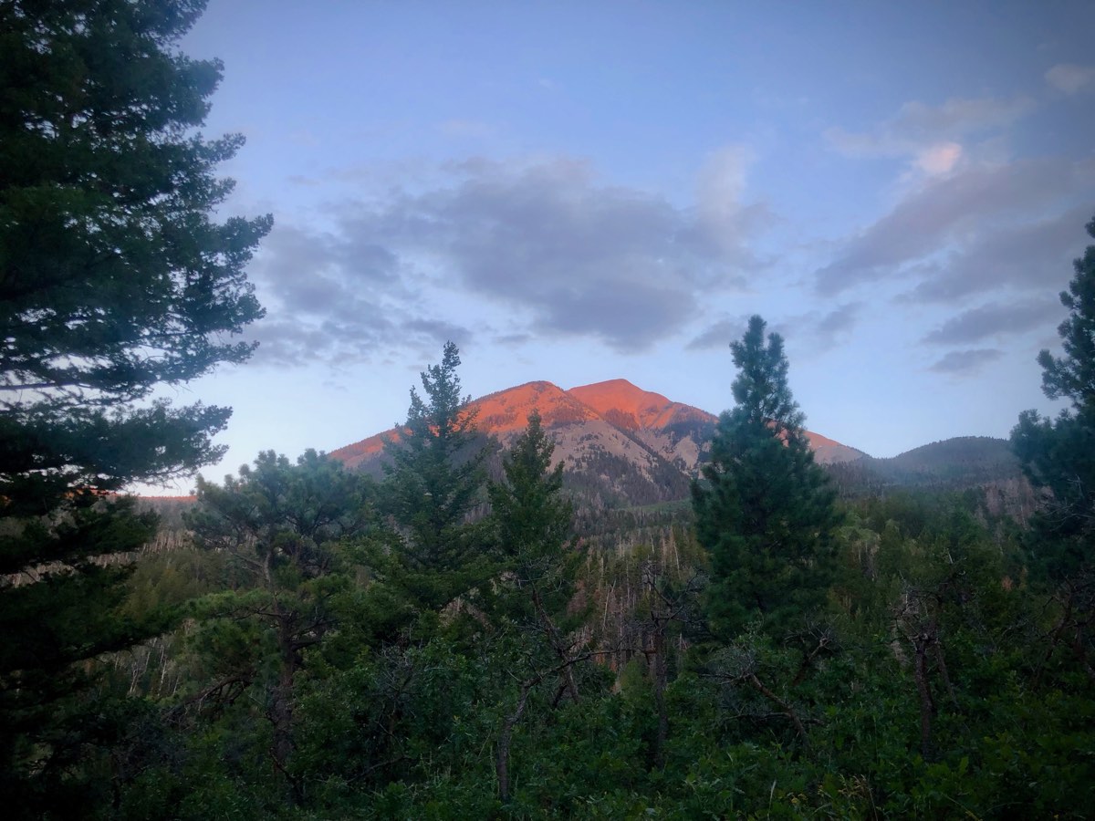
If measured strictly by land area covered, the La Sal Mountains are a relatively small mountain range located in east-central Utah, just southeast of Moab and right on the state’s border with Colorado. The range trends north-to-south and is composed of three distinct groups of mountains, the southern, middle, and northern groups. In the middle group rises the range’s tallest point, Mount Peale at 12,726 feet altitude. Moab itself lies at about 4,000 feet altitude, meaning that the La Sals possess more than 8,000 feet of vertical relief from the surrounding land, making the mountains a lot more than a blip on the horizon. Spanish explorers called these the Sierra La Sal, or ‘salt mountains,’ because they hold their snowy (‘salty’) cap for all but a few months of the year.
About five years ago, we became inspired by the La Sal Mountains ramblings of mountain runner Jared Campbell. He made a big loop, tagging all the mostly-off-trail 12,000-foot-plus peaks of the range before making his way back to where he started by trail. He wrote that his loop was inspired by a group of seven skiers who preceded him and who traveled south to north through all three groups of the La Sals in a day. We have also heard of a few locals who have linked up a bunch of the La Sals summits in one long day or a couple-day backpacking trip. (We don’t have details of these outings, so if someone reading this does, kindly send us in the right direction so we can learn more.) Finally, last month, we discovered the 2015 online post to the Fastest Known Time website by another group of runner gents who linked up the 12ers in the middle and northern groups in a point-to-point route.
After living locally, seeing these mountains in all form and fashion, and spending a lot of time playing in them, we found the highest spine of the mountains speaking the most strongly to us–regardless of the altitude or prominence of the peaks that are part of it. There’s just something about the range’s aesthetic, when viewed from Moab and many points east and west, when you can see its entire spine jutting above the horizon like the vertebrae of a slumbering dinosaur. We were most attracted to a route following that skyline as closely as possible.
Over the last couple of years, we’ve spent a lot of time in the La Sals, together and separately. We even had two failed attempts at following the skyline route we’d drawn on the map. Finally, we successfully traveled the La Sal Skyline in August of 2019. It was a magical day that only served to grow our love for these mountains. In the rest of this article, we share our experience as well as the beta others might want to repeat the route. For anyone who gives the La Sal Skyline a shot, we hope you come to love it as much as we do.
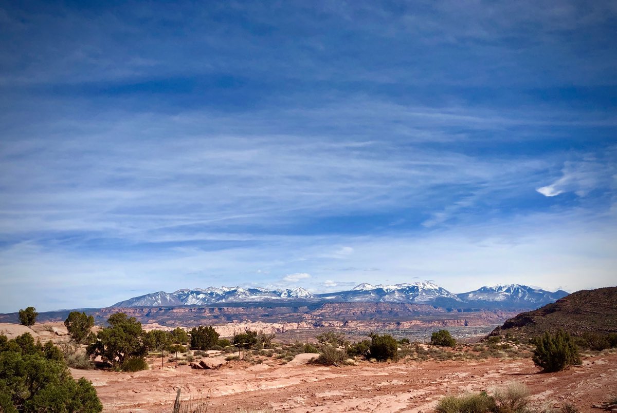
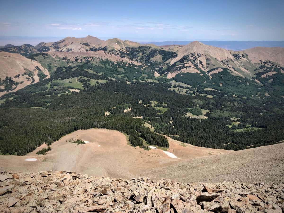
The La Sal Skyline viewed from Moab, looking southeast. From right to left are the southern, middle, and northern groups of the range. All photos: Melissa Beaury and iRunFar/Meghan Hicks
Our Adventure
From the driver’s seat, Meghan’s eagle eye assesses the pile of gear in the back seat with a quick, over-the-shoulder glance. “Did you bring your sleeping bag?” Meghan asks.
“Sheesh. No. What else have we forgotten?” Melissa answers. With a u-turn on Highway 191, we head back toward Melissa’s house in Moab. We are looking forward to getting to sleep early this evening but the sleeping bag is important, too.
Turns out, our timing is perfect. Sunset colors fade to blue as we arrive at our campsite in the southern foothills of the La Sals and the moon presents herself enormously on the horizon, brick red and rising fast. She is an exquisite omen. We sleep well in the back of Goldie, Meghan’s aging 4Runner. The desert air of August is warm to start, but cool by morning. It is good we both have sleeping bags.
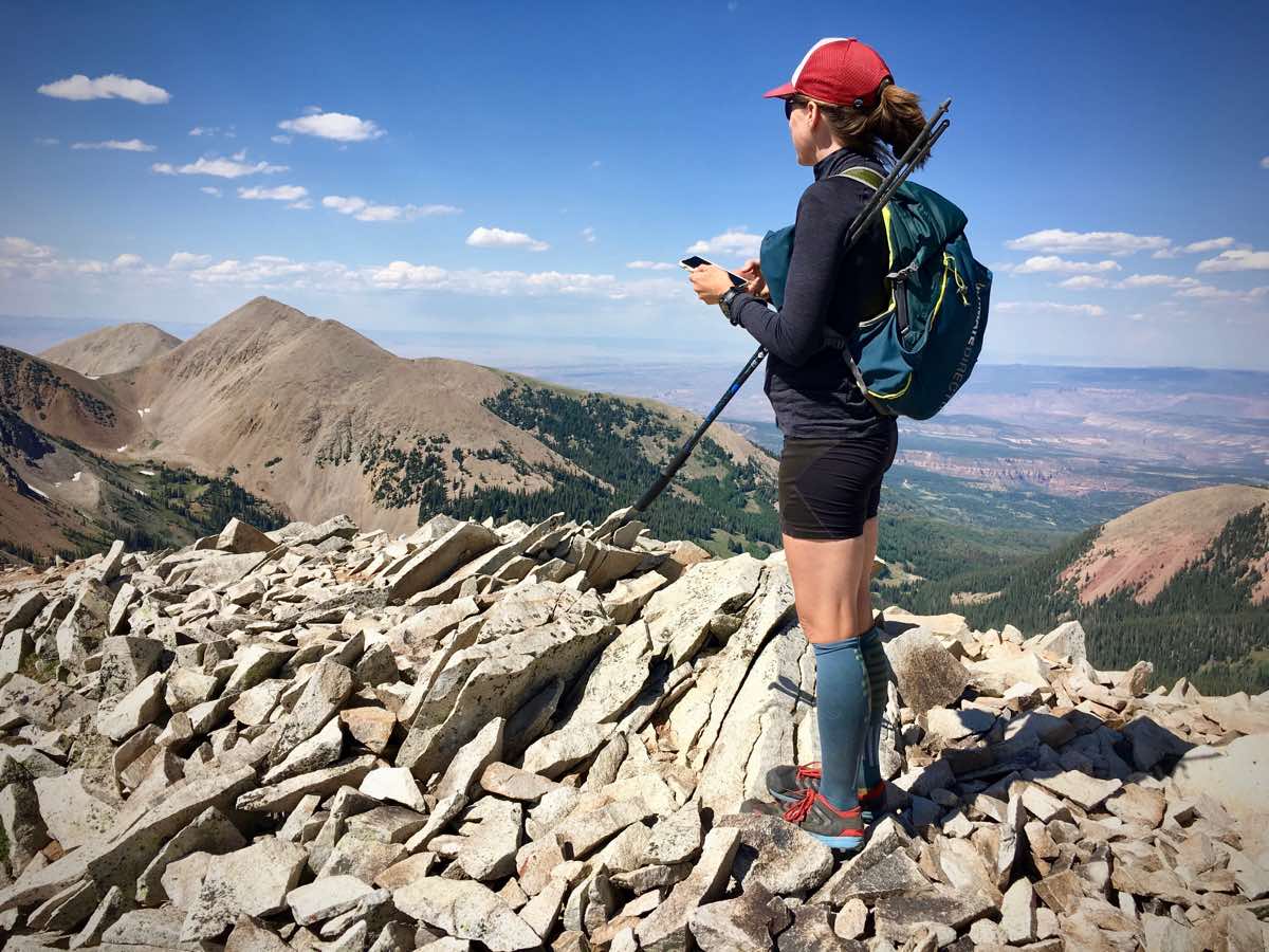
Morning comes with coffee and then the crunch of gravel under our feet to mark the beginning. The watches read 3:45 a.m. when we begin. Caffeine and our childish excitement gets us off at a quick pace with Melissa in the lead. We lose the trail once, blundering through the trees briefly, before we leave it behind to climb toward the sky. We take our off-trail line to top of our first peak, South Mountain, buzzing with excitement and bathed in the raspberry light of the sunrise.
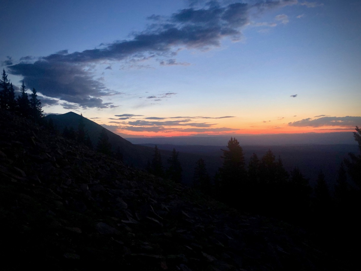
Pre-dawn on the flanks of South Mountain.
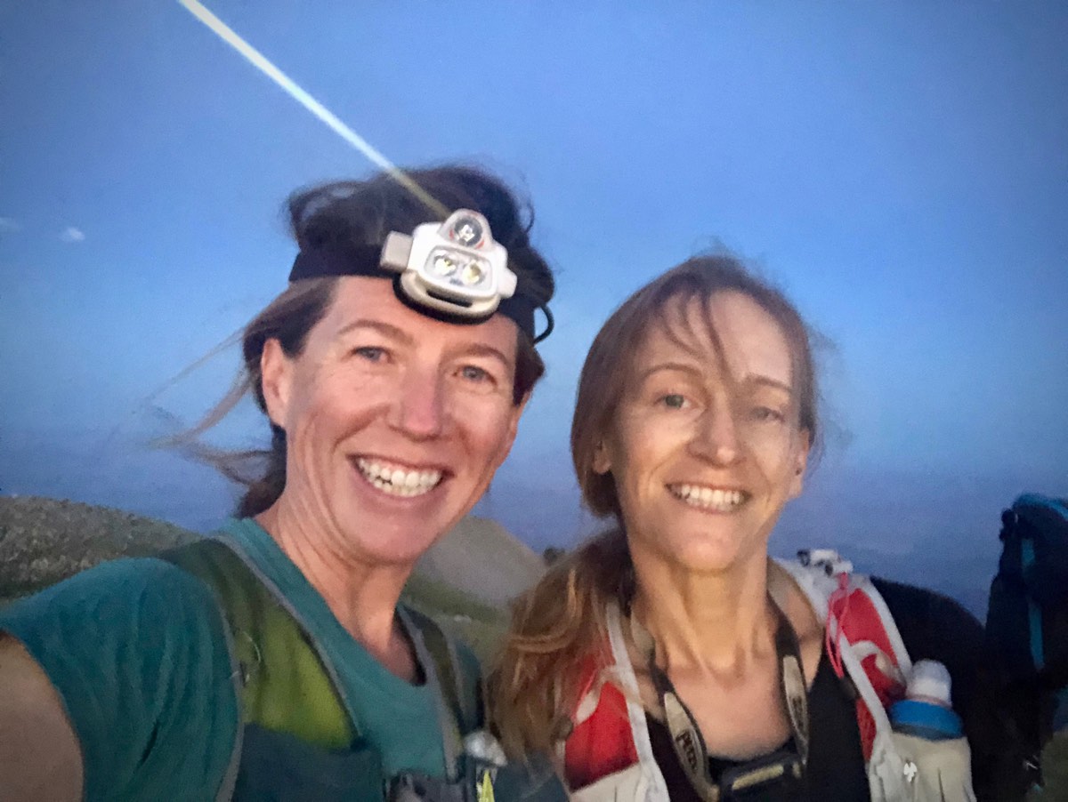
Melissa Beaury (right) and Meghan Hicks on South Mountain.
Defying topographic traps, we descend successfully to the South Mountain Trail and trot the rolling and rooted dirt toward our first water source, Medicine Lake, where the fish are jumping and the grass is tall. A flotilla of ducks circles noisily, hopefully, as we fill our bottles. Somewhere a bear sneezes (probably).
Campers sleep as we breeze across La Sal Pass and the trail to ‘Tuk,’ a local’s mountain favorite. We happily climb the well-maintained trail to the saddle. Our pace is good! Our spirits are high! Ascending Tuk, however, Melissa’s stomach temporarily turns. She thinks it’s the altitude and says, “What time I’ve spent training in the mountains this summer hasn’t contradicted what living at 4,000 feet will afford a body.”

Melissa and some Rocky Mountain goats below the summit of Mount Tukuhnikivatz. Mount Mellenthin dominates the background.
For a spell, we accordion out, Meghan arriving to the top a few minutes ahead of Melissa who is willing her stomach to cooperate and the power to return to her legs. Enthusiastically, we descend from Tuk’s top and toward the first real technical scramble of our adventure across the La Sals: the ‘Fang.’
There is at least one good way for bipeds to cross this jagged, decomposing, and exposed feature. Rocky Mountain goats seem to have many opinions on the best way of traversing the narrow strip of rocks, leaving several nice-looking game trails leading you the wrong way. Or rather, the right way for those four-footed creatures and the perilous route for those of us relegated to two feet only.
We know the Fang well, though, from previous adventures up here, and we cross it efficiently. The exposure makes every pass unforgettable, though.
Meghan on the ‘Fang’ between Mounts Tukuhnikivatz and Peale.
The weather is spectacular, crisp air and almost no breeze. We’ve seen in the past how much the wind can whip up here, and we’re in awe of today’s calm. Melissa’s stomach and legs recover too. She’s self-admittedly not a great eater in long days afield and the altitude has packed an additional rude punch. She takes nips off Muir Energy’s Cacao Almond slow burning gel, which reignites the fire within her. Refilling our bottles with snow on the shoulder of Mount Peale, the highest point of the La Sals, our spirits somehow fly even higher.
We pass deep wallows in the spongy tundra where the goats have rolled to shed their molting coats. Melissa pockets a small tuft and touches it often throughout the trip. As a side note, it stays in her pocket for weeks after, agitated by the wash cycle into a tight wad of off-white wool that fondly reminds her of this mountain day.
Mount Mellenthin’s summit, the final peak in our travels through the middle group of the La Sals, provides a spectacular look back across the terrain we’ve traversed so far today. And cell service: We momentarily switch off our phones’ airplane modes and shoot off texts to announce our progress to interested parties.
We grow excited for the next challenge, a good line off Mellenthin toward Geyser Pass, the pass between the middle and northern groups of the La Sals. We are not the first to go this way. There is a fine path through the scree for the upper two thirds. The massive boulders get a little looser after that, a little steeper. Down low, the sound of snow melt trickling under the scree has us sure that water is near. None materializes, and we’ve grown thirsty.
Looking north from the summit of Mount Mellenthin to Geyser Pass and the northern group of the La Sals beyond.
We skip our way across the rocks and through the woods to the singletrack trail beyond Geyser Pass. We’ve long since finished the water we collected from Medicine Lake as well as the snow up high. While we’ve previously recced a good spring at the start of the climb up Mount Tomasaki, not far ahead, our thirst is strong enough that we’d drink whatever we can find right now.
Our eyes search the sides of the singletrack as we wind through the aspens. We finally spy a trickle and with all the patience of desert dwellers accustomed to tiny water sources, we carefully angle our bottles beneath it, capture this nectar of the gods, and enjoy. In reality, we’re two grown adults mucking about in a mud puddle and we couldn’t be happier.
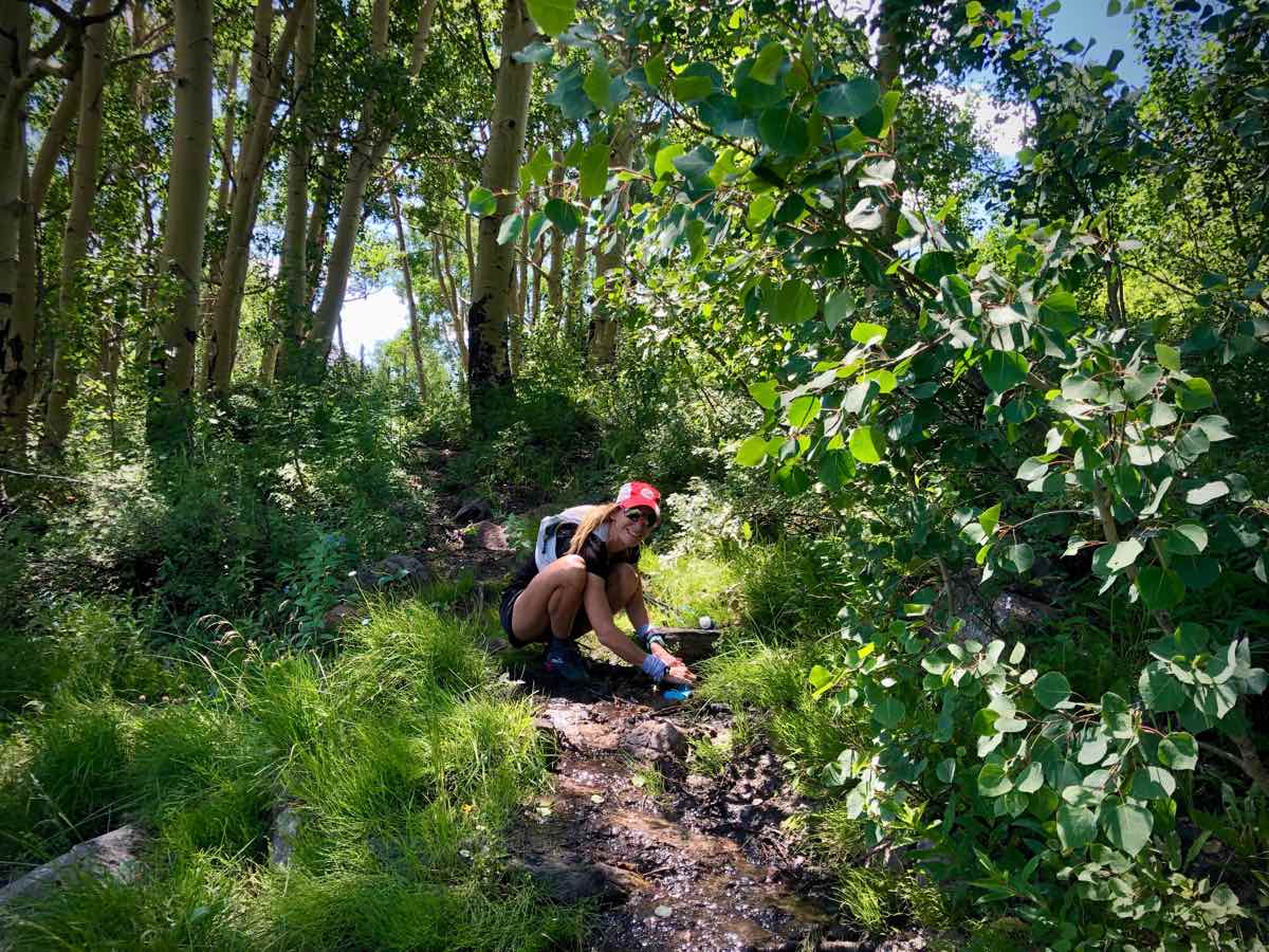
Melissa and the tiny spring.
Dog-hair-thick aspen stands cling to the drainages spidering down the steep slopes of Tomasaki. Hip-high skunk weed and wildflowers spread across the sharp terrain. The spring is hiding in this summer splendor, and a feeling of mild panic arises in Meghan.“What if we can’t find this spring?” she says.
The worrying is worthless because soon we hear the sound of moving water and follow it until we see the small cascade. We sit tight for a bit, drinking a full bottle each and eating some snacks. Cold spring water has to be one of nature’s greatest gifts.
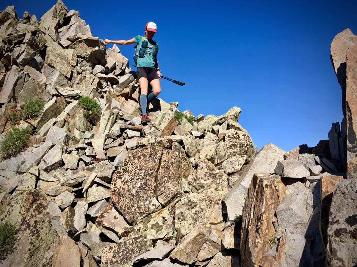
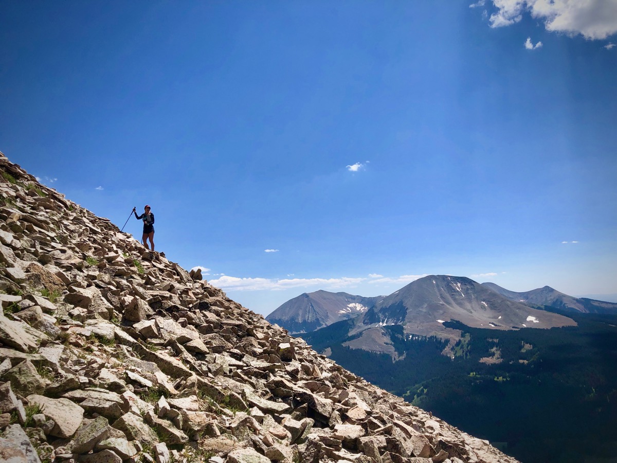
Tomasaki is more bark than bite. It’s intimidating to stare up at, for sure. Chin-scraper steep and slippery in spots. But with a little patience it is over before you know it. Steadily we climb, rising above the trees and hitting the summit at 3 p.m. Standing atop the first peak of this northern group, approaching the 12-hour mark on our day, we begin to think that the worst of everything–the steepest scree, the nastiest descents, and the greatest uncertainty–is behind us. This is the most popularly traveled part of the La Sals and at times our route follows old mining tracks. The peaks are also closer together, and we touch their tops in rapid succession. Looking behind us, southward, all of the peaks of today are strung out, beginning to glow in late afternoon’s lengthening light.
Melissa climbing the Mount Tomasaki steeps.
How did we forget the final off-trail descent to the Bachelor Basin Trail? Ignorance has been our bliss. But before we get to that, such joy we find at the top of our last peak, taking in what Melissa feels is the best view of the day, feeling pride inside our chests for moving as well as we have. We sit on the flat rocks of La Sal Peak, letting today sink into our bones.
The total drop to the trailhead is 5,000 feet and the first 3,000 is basically rolling, skidding, moving rocks of all sizes and shapes. “No mistakes,” we say. Toes lifted, stepping sidehill, and grounding down through our heels, we make our way down the sliding steeps.
What are we aiming for, anyway? There’s a waterfall to descend through and avalanche debris, too, courtesy of a huge last winter. And we of course should mention the thorny rose bushes. But every thorn does have its rose and among them we discover a couple raspberry bushes bearing ripe fruit. Is this Mother Nature’s peace offering amongst the tangle?
Meghan descending steep scree from La Sal Peak to the Bachelor Basin Trail.
All of this feels like forever, but really it takes just an hour, and suddenly here’s the trail. A trail! Now we lose altitude more gradually as the sky loses the light of today. The thick brush opens at just the right time, granting us a view of sunset’s light on La Sal Peak behind us and the desert ahead.
Some attention must be paid to our feet as we leap over the obstacles on this mining-era doubletrack, fallen trees, rolled rocks, and several big piles of black-bear scat. We check our position on the map and realize the trailhead is still a couple miles out. There’s just something about finishing before dark that pulls us more swiftly downhill, shouting hey-bear greetings so as to not surprise the critters with whom we might share this space. Suddenly, we pop out on the pavement where Melissa’s car awaits, 16 hours and 42 minutes after starting. Ginger ale, shoes off, and butts parked on the still-warm pavement of this remote road, we watch the light play in the layer-cake sky, each line of cloud alighted a different color. A case of perfect timing, indeed.
Last light on the Bachelor Basin Trail.
La Sal Skyline Fast Facts
Route
This is our Strava file from Saturday, August 17, 2019. We traveled in the south-to-north direction, and believe this direction is probably a little bit faster due to less cumulative climbing more cumulative descending. Our route was 30.2 miles long with 13,700 feet ascending and 14,600 feet descending. (The Strava file shows slightly inflated vert stats, a common error in Strava.)
Trailheads
We started at the intersection of Forest Service Roads 0073 (locally known as the La Sal Pass Road) and 0128 (called the Pole Canyon Road). Here’s the exact GPS location: 38.37381, -109.20271.
You can drive the short distance up FS0128 to the Doe Canyon Trailhead, but this road is pretty rough and requires significant ground clearance. FS0073, though dirt, from the pavement to this intersection is good for all vehicles, so it makes a more natural starting point. Additionally, this intersection has several dispersed campsites where you can leave a shuttle vehicle and/or camp before starting.
We finished at the Bachelor Basin Trailhead, located on paved Forest Service Road 0207. The GPS location is 38.59159, -109.26442.
All vehicles can drive to this trailhead as the road is paved until just after the Bachelor Basin Trailhead. There is also space to park a shuttle vehicle.
La Sal Skyline’s 16 Peaks (Listed in Order from South to North)
- South Mountain, 11,798 feet
- Mount Tukuhnikivatz, 12,482 feet
- Talking Mountain, about 12,225 feet
- Mount Peale, 12,726 feet
- Unnamed peak between Mount Peale and Laurel Peak, about 12,198 feet
- Laurel Peak, 12,271 feet
- Mount Mellenthin, 12,645 feet
- Mount Tomasaki, 12,239 feet
- Point 11,947 (feet)
- Manns Peak, 12,272 feet
- Point 11,849 (feet)
- Pilot Mountain, 12,200 feet
- Green Mountain, 12,162 feet
- Mount Waas, 12,331 feet
- Castle Mountain, 12,044 feet
- La Sal Peak, 12,001 feet
Conditions/Other Info
- The route is in the Manti-La Sal National Forest. No permits are required for day and overnight use by small groups. Permits are required for commercial activity and large groups.
- The route has 3 reliable water sources, Medicine Lake at La Sal Pass, a year-round spring at the foot of Mount Tomasaki, and a year-round creek in the drainage between Castle Mountain and La Sal Peak above the Bachelor Basin Trail. Snow patches may be additionally available, depending on conditions.
- Looking at the La Sal Mountains from afar, it looks like a lot of the above-treeline terrain is rocks. That’s exactly what it is! Most of this route is off-trail, and it includes severe scree, very steep boulder fields, and a couple places with dangerous exposure. Confidence moving on and navigating on a variety of kinds of off-trail terrain are required.
- The route should be traversable in summer conditions from sometime in June to sometime in October.
- Monsoon storms are typical in the summer and early fall; we recommend you do the route on a day when storms aren’t forecasted because you are above treeline most of the time with limited access to safe shelter from a storm. It’s often very windy, likely due to the huge vertical offset from the land below and the mountains.
- Please be an excellent steward of this sensitive terrain. Much of it is off-trail, either on tundra or various kinds of steep rocks. This terrain is susceptible to damage from our movement on it. If you are in a group, spread out to disperse your impact. Do not build cairns or other route-finding means. Think about where and how you step so as to protect the fragile organisms and to not induce erosion. If you aren’t willing to actively minimize the impact of your movements, this route is not for you.
La Sal Skyline Detailed Route Description (for the South-to-North Direction)
Travel a half mile up FS0128 to the Doe Canyon Trailhead. Turn right up the Doe Canyon Trail. Though an official trail, it’s not used often, so expect overgrowth, downed trees, and a few places where it’s hard to follow. Climb 1.8 miles until trail flattens on pass between Doe and Pole Canyons in an open meadow. Look for cairns and trail markers across meadow to the northwest and find the trail as it descends for about a half mile into Pole Canyon to intersect and terminate at the Pole Canyon Trail. This part is difficult to follow. Turn right on the Pole Canyon Trail and ascend. At about 4 miles on the GPS, the Pole Canyon Trail intersects and terminates at the South Mountain Trail. Turn right on the South Mountain Trail and continue a very short distance until the trail enters an open hillside and you gain a broad ridge. Leave the trail and proceed straight up the ridge to the summit of South Mountain, at 4.9 miles cumulatively. The terrain is tundra, a few tree stands, and a bit of rock. South Mountain is peak 1 at 11,798 feet altitude.
Leave the summit bearing east, sticking to the east ridge. The terrain is a mix of boulders, scree, and tundra. The rocks here offer the first glimpse into what much of the above-treeline, off-trail terrain of the La Sals is like. Re-enter the forest, staying on the east ridge until you intersect the South Mountain Trail. Turn left and proceed a short distance on South Mountain Trail as it descends steeply to an unmarked trail intersection. Turn left at about 6.3 miles cumulatively and travel about 1 mile until the trail pops out at Medicine Lake at La Sal Pass. Medicine Lake is 1 of 3 reliable water sources on this route. La Sal Pass is the pass in between the southern and middle groups of the La Sals. It’s a popular recreation area.
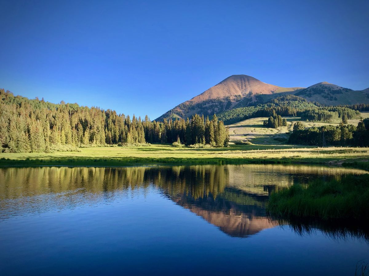
Mount Tukuhnikivatz reflects in the waters of Medicine Lake at La Sal Pass.
Head northwest across the open, flat terrain from Medicine Lake, cross FS0073/La Sal Pass Road (the same road you began at several hours ago), and intersect with the Mount Tukuhnikivatz Trail. Turn right and continue up the trail. A short distance ahead is a signed intersection where the Mount Tukuhnikivatz Trail continues left. The trail climbs and eventually ends on a tundra ridge at about 10 miles cumulatively on the GPS. The off-trail route to Mount Tuk is clear: take the ridge until it meets another ridge, turn left, and head toward Tuk’s summit. Blocky boulders make up the final 500 vertical feet or so, but a social/goat trail leads the way. ‘Tuk’ is peak 2 at 12,482 feet. Return to the ridge/saddle from where you came.
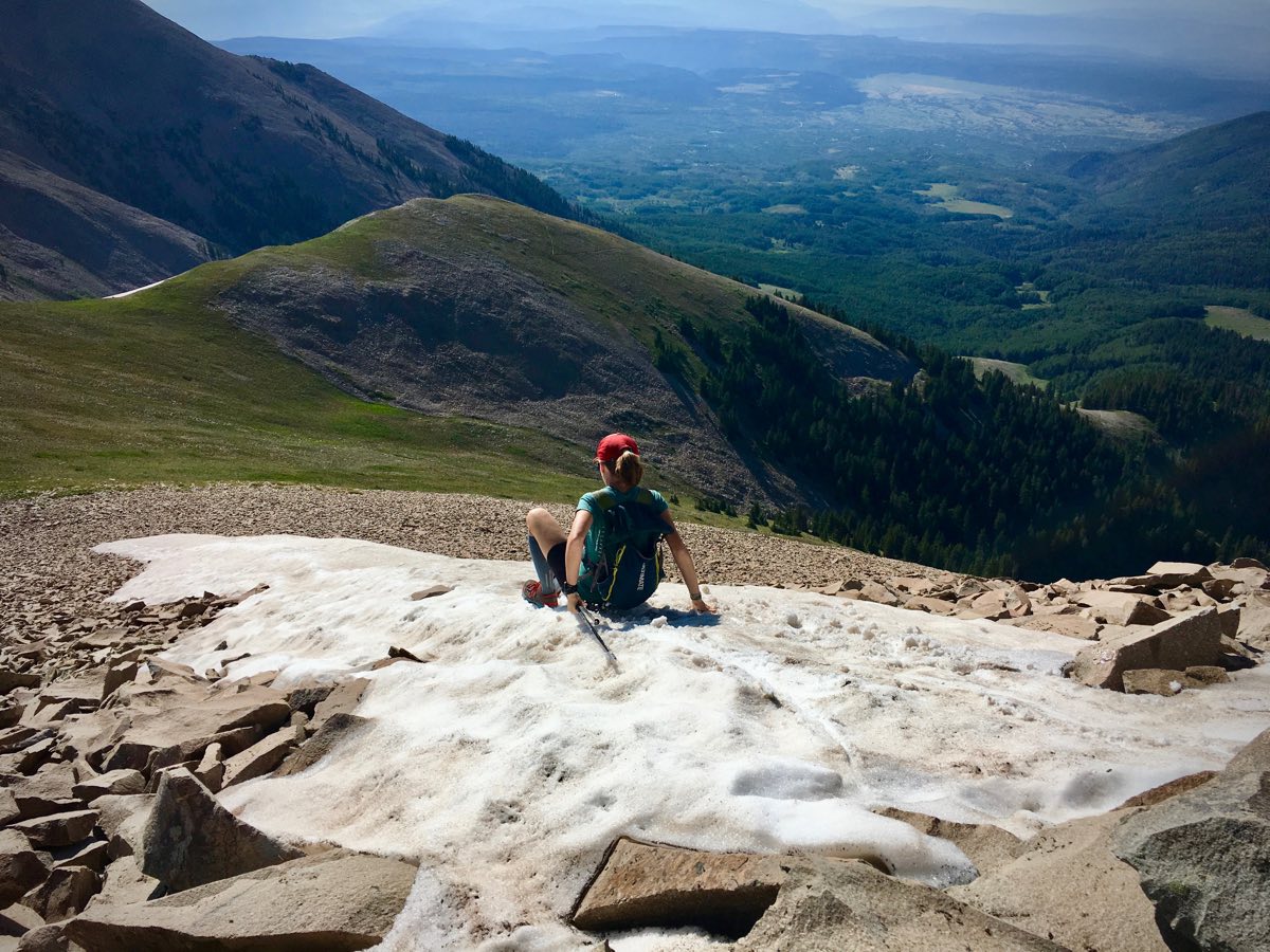
Meghan uses a finger of snow to descend from Mount Tukuhnikivatz a little faster.
Your next destination is located directly in front of you, a traverse of what locals call the ‘Fang’ toward Talking Mountain and Mount Peale. The tundra ridge narrows for about a half mile into crappy rock exposure. It’s best to stay close to the top of the ridgeline, dropping around the couple fangs of rocks to their south. Stay as high as you’re able, though, because the quality of the (already poor quality) rock degrades into nasty scree the lower you go. You can travel across that scree, and you’ll see a social/goat trail doing so, but the cleaner line is higher up, and there’s also a social/goat trail through here. Make it through the ‘Fang’ and traverse the summit of Talking Mountain, peak 3. It’s unranked but about 12,225 feet in height. You’ll be at about 12 miles on the GPS now.
Peak 4 and the La Sals’s tallest point, Mount Peale at 12,726 feet, is now clearly in view to the southeast. A social/goat trail goes all the way through the rocks to the summit, just under one mile one way from Talking Mountain. Return the way you came for a mile, this time proceeding due north on the off-trail tundra ridgeline.
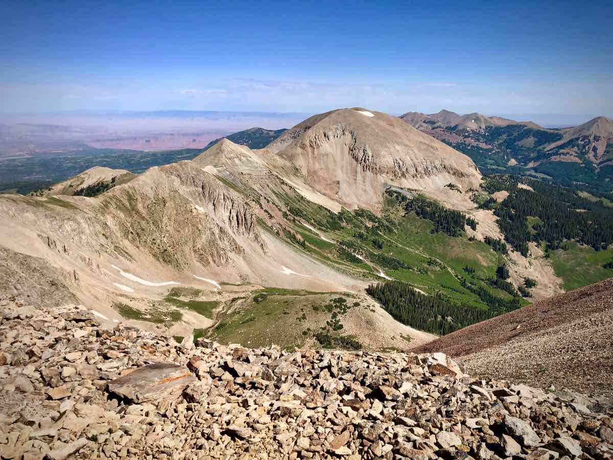
Looking from Mount Peale roughly north to Mount Mellenthin and mountains you traverse to get there.
Traverse unnamed peak 5 of the La Sal Skyline at about mile 14. It’s about 12,198 feet tall. Continue north to Laurel Peak, peak 6. The easiest way up it is to follow the social/goat trail which contours around its west side, and then to proceed to the summit on the switchbacking social/goat trail from the west. Laurel Peak is 12,271 feet tall.
The imposing Mount Mellenthin and its scree await to your north. A good social/goat trail goes all the way from where you are to the mountain’s summit, though. Mount Mellenthin is the La Sals’s second-tallest summit at 12,645 feet, and it’s peak 7 of the route. Once you reach the flat summit block, you should be at about mile 15.5 on the GPS. Make your way down the northeast ridge of Mount Mellenthin. At times, there’ll be a hint of a social/goat trail, where the blocky boulders have settled a bit. Resist the urge to leave the ridgeline and head toward the finger of forest to the north until you have cleared the steepest part of the ridge and it begins to flatten out. Then, beeline across the boulders to that forest finger. The GPS should read about 16.3 miles when you enter the trees.
Travel 1 mile off trail through the forest, bearing mostly north. There’s a social trail in here that you might run across, but it’s meandering and ineffective for helping you get where you want to go. If you nail your forest navigation, pop out at the three-way dirt-road intersection of FS0129 (to the right) and FS0071 (locally called Geyser Pass Road, to the left and straight ahead). Proceed straight on FS0071. In a short distance there’ll be an outhouse on the left and another road intersection after it where FS0071 continues right and FS0243 goes left. Turn left following the signs for Burro Pass and the Whole Enchilada Trail, turning right in a very short distance onto singletrack again. This intersection is marked with trail signs. If it sounds complicated, it is a wee bit. Use a GPS track to help you get through this brief maze. You’ve been passing through the Geyser Pass area, the pass in between the middle and northern groups of the La Sals, and a popular recreation area. The GPS should read about 17.5 miles as you turn off onto the singletrack.
Continue for about 1.3 miles on the singletrack, graded for mountain biking. It’ll briefly intersect, turn left onto, and travel on a doubletrack before crossing a cow guard/fenceline and going back to singletrack again. Stay the course until the trail clears the trees and you can see the open, steep, off-trail ascent route to Mount Tomasaki on your right. Leave the trail and head up at about 19 miles on your GPS, a total of about 1.5 miles since you started on the singletrack. Note that just before the singletrack intersects the doubletrack, it may have passed a small, intermittent spring. If it’s not running or too small to collect from, the second of the 3 reliable water sources is just ahead, shortly after you leave the trail behind. As you begin the off-trail ascent to Mount Tomasaki, look for a good spring springing from the gully a couple hundred feet above the trail.
From the spring, continue steeply uphill, bearing looker’s left of the gully through scree, tundra, and a few trees. Soon you’ll gain the main ridgeline which makes up the northern group of the La Sals. Turn right to the Mount Tomasaki summit, following a social/goat trail. Mount Tomasaki is peak 8 of the La Sal Skyline, it’s 12,239 feet tall, and your GPS should register about 20 miles now.
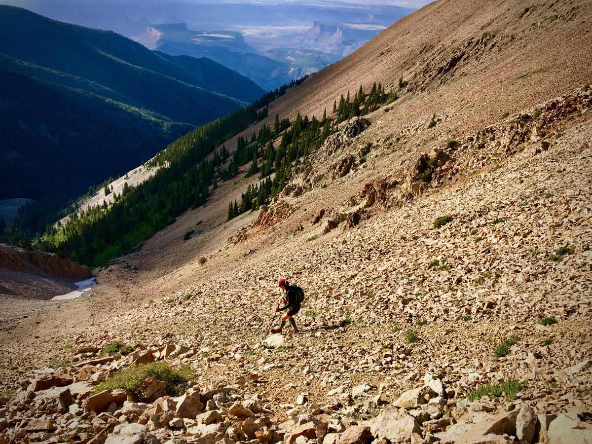
Meghan on Mount Tomasaki looking north at the peaks in the northern group of the La Sals, including Mount Waas, the prominent triangular peak in the background.
From the summit, return to the saddle from whence you came, this time proceeding straight along the main ridgeline. The peaks will start coming fast now. The social/goat trails skip some of the summits, but you won’t! Stay in the sky. The next one is labeled on some maps as Point 11,947 (feet), is at about 20.8 miles on the GPS, and is peak 9 of the skyline. From Point 11,947, Manns Peak is now in view straight ahead, go! It’s peak 10 at 12,272 feet. There’s an official trail which comes up from Burro Pass to the southwest that continues off the northwest ridge of Manns Peak until the intersection of the Dry Fork Trail a short distance below the peak to the northwest. Follow that trail generally toward the Dry Fork Trail intersection for a short distance, breaking free of it to go up over Point 11,849 (feet), peak 11 of the skyline, before dropping to cross the Dry Fork Trail. Continue off trail uphill again. Pilot Mountain is peak 12 at about 22 miles on the GPS and at 12,200 feet altitude. Green Mountain comes next as peak 13, and really quick. It’s 12,163 feet tall. Up here there are some old mining tracks that have turned into social/goat trails and that make the going pretty smooth.
Mount Waas is peak 14 of the traverse, ahead of you now. If it looks imposing, don’t let it. There’s a decent pathway up and down the summit through the rocks. At 12,331 feet, Mount Waas is the tallest point of the northern group of the La Sals. You should be at about 24 miles on the GPS now. Peaks 15 and 16 of the traverse come quickly too, Castle Mountain (12,044 feet) and La Sal Peak (12,001 feet). Celebrate at the top of La Sal Peak; this is the last one!
Of course, it’s a long way down to the finishing trailhead from here. We know of two ways to get off La Sal Peak, but have only tried one ourselves, which is to backtrack to the saddle between Castle Mountain and La Sal Peak, and to descend the scree slope to the west which leads into a drainage going downhill and northwest to the Bachelor Basin Trail. We know that others have used the northwest ridge of La Sal Peak too, but we don’t have first-hand experience with it. The first 1,500 vertical feet of the scree descent from the saddle is heinous, especially with the day on your legs. Use care to not knock boulders on your friends and to descend in a way that doesn’t cause erosion. Both can be done, but it takes concentration. Your stewardship of this sensitive-to-erosion area is important!
Once you clear the steepest scree, we found it easiest to follow the bottom of the drainage for just under a mile. The water in this drainage is the third of 3 reliable water sources on the route. The terrain is variable, from boulders to exposed rock bands to clawing rose and raspberry bushes. When the drainage finally goes into thick tree cover, you’ll find a lot of downed trees. We went to the north of the main drainage to avoid them before cutting back west to intersect the Bachelor Basin Trail. Turn right and head downhill.
Looking back at La Sal Peak from the Bachelor Basin Trail.
At about 27 miles on the GPS, the trail intersects and travels on doubletrack for a couple winding switchbacks downhill. At the bottom of the pair of switchbacks, the doubletrack goes right and the Bachelor Basin Trail goes left. This intersection is unsigned, but cairned. Use care to navigate this intersection, and after that you are truly home free. Run the remaining 3 miles downhill on the Bachelor Basin Trail to the trailhead. A couple notes, this trail is little used, so expect blowdowns and overgrowth. Also, near the bottom, about a half mile from the trailhead, the trail splits with the old trail going left and beelining to where your shuttle vehicle is parked at the trailhead and the new trail going right, crossing the creek you’ve been running next to, and popping out on the paved FS0207 a bit east of the trailhead. The old trail to the left is the shorter distance, but it’s heavily overgrown. The new trail may require you to get your feet wet at the creek crossing, is a bit longer, but is faster since you go quickly to the pavement. Run downhill to your car at the trailhead.
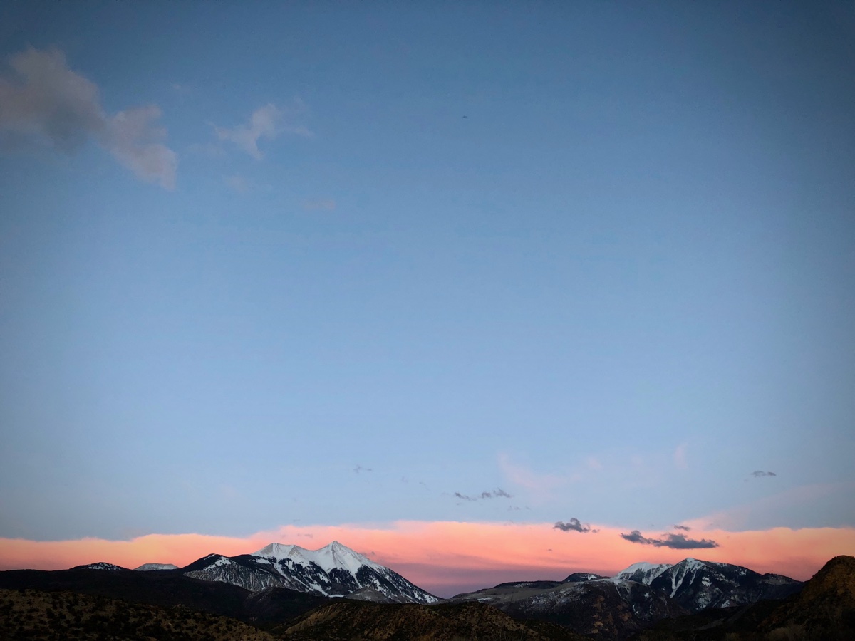
Part of the La Sal Skyline, the south group to the right and middle group on the left, viewed from the desert to the west in winter.
