[Editor’s Note: This article was composed by guest contributor Scott Yates. In July 2017, the data collected in this 2016 project was made available on Google Maps. To experience it, navigate to the Western States Trail on Google Maps and zoom in to utilize its ‘street view’ feature. As an example, here’s a link to the Watson Monument/Emigrant Pass Marker, and you can continue along each direction on the Western States Trail from there using ‘street view.’]
The American Trail Running Association (ATRA) partnered with the Google Maps team to capture 360-degree panoramic ‘street-view’ imagery of the entire Western States Trail, the trail over which the iconic Tevis Cup horse race and Western States Endurance Run running race travel, using Google’s Street View Trekker backpack. Volunteers began mapping the trail on Sunday, June 19 and finished all 100 miles on Friday, June 25.
I walked with the Western States Trekker project from Last Chance to Michigan Bluff on last Wednesday, Day 4 of the project. I was still working through a shoulder injury and reluctantly chose not to carry the Trekker for any portion of the trail. Instead, I brought along camera equipment and planned to share images with iRunFar and make a short video about my experience.
Richard Bolt, Director of Online Marketing for ATRA, was the project lead and proved to be the supreme trekker. By the end of the week, with all 100 miles recorded, Richard had carried the 50-pound Trekker 25 miles.
Interview with Western States Trekker Project Leader Richard Bolt
iRunFar: How did you and Google get connected for this project?
Richard Bolt: I read an article last summer about Google opening its Trekker program to the public–the Trekker Loan Program. This seemed like a great opportunity for the American Trail Running Association and the historic, iconic Western States course was an obvious choice.
iRunFar: When did the initial conversations with Google start?
Bolt: I filled out the loan application online and received an email from Google within a couple weeks. After answering a few follow-up questions from the folks at Google, our application was officially accepted.
iRunFar: Did you have to travel to meet with Google? How many times?
Bolt: I live in Mountain View, California–home to the main Google campus–so it was really easy to drop in and pick up the equipment. That said, a visit was not necessary. Google has a comprehensive online training program for Trekker users.
iRunFar: What kind of support did Google offer?
Bolt: The support we received from the team at Google was friendly, responsive, and super helpful.
iRunFar: Anything else you would want future project leaders to know about in working with Google?
Bolt: You don’t need to be a tech person to participate in the Trekker Loan Program. The equipment is easy to use and the training and support is excellent.
iRunFar: Who were some of the key project partners that made the project possible?
Bolt: As a small Colorado based non-profit, ATRA doesn’t have a large operating budget. Thankfully we had several corporate members who stepped up to sponsor this project. Salomon Running, Trail Run Project, vFuel, Picky Bar, Squirrel’s Nut Butter, iRunFar, Myke Hermsmeyer Photography, Placer County Visitors Bureau, Auburn Endurance Capital of the World, Foresthill Miner’s Camp, and of course the Western States 100 Mile Endurance Run.
iRunFar: How many days did you have the rental van?
Bolt: Seven.
iRunFar: How many miles did you put on the van?
Bolt: 1,200.
iRunFar: How many hotel rooms and for how many nights?
Bolt: Five cabins times five nights at Foresthill Miner’s Camp. They are not your average cabins–they are newly renovated and rustic chic.
iRunFar: How many people total walked the trail during some part of the 100 miles?
Bolt: 15.
iRunFar: Who carried the Trekker the second farthest and how far did he/she go?
Bolt: Robotics engineer Jon Souliere joined the team on Thursday and Friday–17 miles.
iRunFar: How many miles did Max King carry the Trekker?
Bolt: 3.5. We had equipment issues on the day Max joined the team and could only trek from No Hands Bridge to the finish. I’m sure he could have carried it a lot more miles.
iRunFar: Did Ann Trason make it out to support the project?
Bolt: We were extremely privileged to have Ann join us for the 16 miles from Foresthill to the river crossing. She had some great stories about the race and the unique personalities who make our sport special. Ann has an ACL injury and was unable to carry the Trekker.
iRunFar: How much time did the Trekker spend on the trail in order to travel the full distance?
Bolt: 39 hours and 20 minutes, including stops. 30 hours and 15 minutes of moving time.
iRunFar: How much disk space did the imagery take up?
Bolt: About 2,500 gigabytes. The Trekker imaging system has 13 high-resolution cameras and takes one photo per second.
iRunFar: What prompted you and ATRA to take this on?
Bolt: ATRA’s mission to promote trail and ultrarunning but we also work to ensure trail access for users on foot, and encourage trail maintenance and good environmental stewardship. The Western States Trekker project is a great way to share the beauty of the trail with people who may not have the ability or means to visit in person. There’s also the practical purpose of enabling fans, crew, and first-time racers to see locations along the course in detail. This can be helpful when planning for what kind of equipment would be ideal for the race.
iRunFar: Why the Western States Trail?
Bolt: Because the Western States Endurance Run is one of the most well known ultra-trail running races in the world.
iRunFar: Did you consider other trails as well?
Bolt: Yes, but I wanted to select a race course that was iconic but also known beyond the ultra-trail running community.
iRunFar: Will you do another trail? If yes, which one, when?
Bolt: If Google is running the Trekker Loan Program again in 2017, we’d like to image the Pikes Peak Marathon and Ascent course in Manitou Springs, Colorado. It’s adjacent to Colorado Springs, the home of the American Trail Running Association.
iRunFar: When do you expect the finished product will be available for viewing?
Bolt: The images should be available on Google street view in early August, 2016. We will have a launch announcement at the 2016 Outdoor Retailer Show in Salt Lake City, Utah.
iRunFar: Who is the audience for the finished product?
Bolt: Everyone! Trail runners, hikers, horseback riders, and all trail users where their choice of conveyance is allowed.
iRunFar: How do you imagine people might use the finished product?
Bolt: There are some really good practical, scientific, and inspirational use cases for this imagery. For someone crewing a Western States runner, it would be helpful to know exactly what some points along the trail look like. For sun-exposure considerations, knowing if an aid station is in the trees or out in the open can be good to know. For a pacer or racer, knowing the exact trail surface will help inform shoe choice. For scientists or land managers studying changes to areas along the course, this imagery provides a record of what it looked like in June, 2016. For the thousands of fans of the Western States race, this imagery gives them the opportunity to see what the racer sees along their journey from Squaw to Auburn.
iRunFar: Did you learn anything about yourself or the trail?
Bolt: I learned that I prefer running to hiking. In the later stages of each day’s trek, my feet hurt a lot and it actually felt better to run (without the Trekker) than walk.
iRunFar: Anything else to share from the experience?
Bolt: I was struck by the enormous variations in scenery and land uses along the race route. Having never set foot on any of the trail prior to last week, I envisioned the race course being more wild and remote than it actually was. Yes, there were many trail sections like the Granite Chief Wilderness which were truly wild but other areas which were being actively logged or along the river west of Foresthill where hundreds of people were enjoying whitewater rafting. None of this made the journey or the race course any less impressive. It was just a more diverse landscape than I had envisioned.
Finally, I want to mention that the street-view images from this project are not intended to replace the experience of running the race or otherwise using the trail. Runners who have the privilege of racing from Squaw to Auburn are accomplishing an amazing physical and mental challenge. Viewing the Western States Trail street-view imagery will give the rest of us a small peek into their experience.
Ann Trason’s Western States Trekker Project Thoughts
“It was an honor to hike with the group. Interesting projects attract really interesting folks. Bad-ass people carry the Google Trekker. Super, super fun. One of the highlights of my year for sure.”
Max King’s Western States Trekker Project Thoughts
Myke Hermsmeyer’s Western States Trekker Project Thoughts
Western States Trekker Project Photos
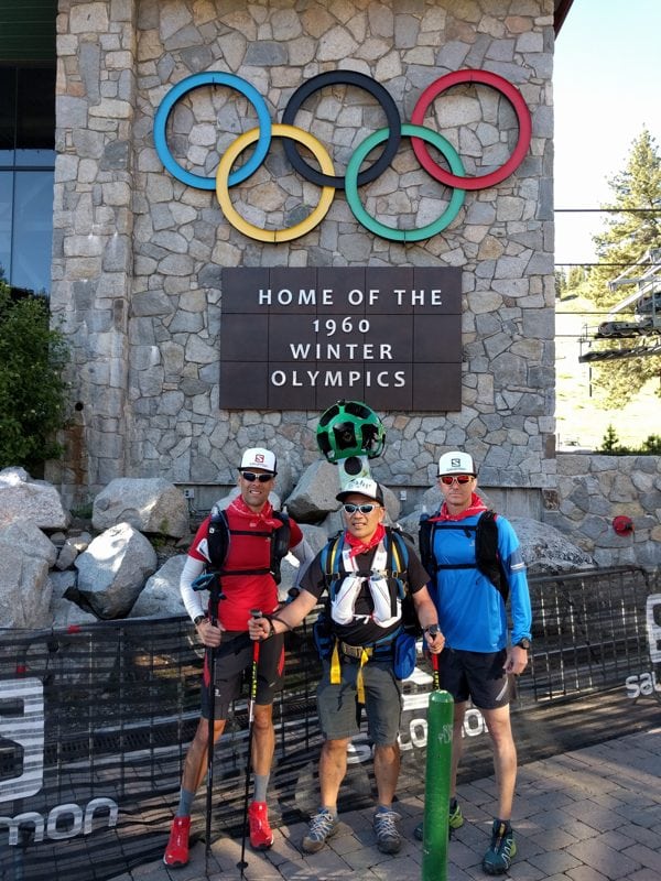
The Western States Trekker project departs Squaw Valley with project leader Richard Bolt (left) at the helm. All photos courtesy of ATRA/Richard Bolt.
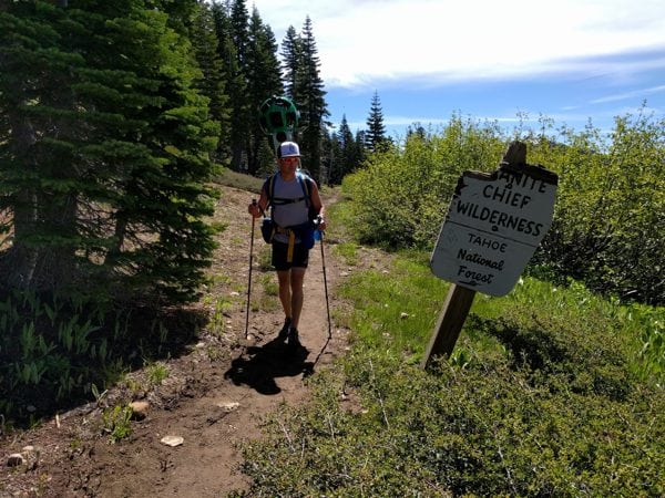
The Google Street View Trekker on the move in the high-country miles of the Western States Trail.
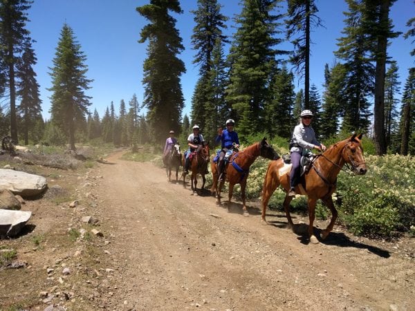
The Western States Trail is used by many kinds of recreationists.
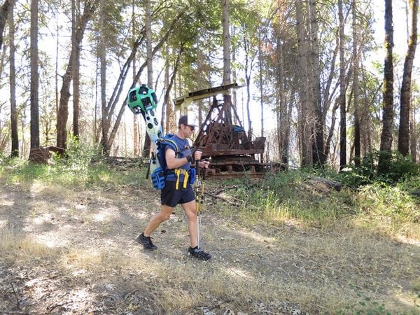
The Google Street View Trekker passes by historic mining equipment along the trail.
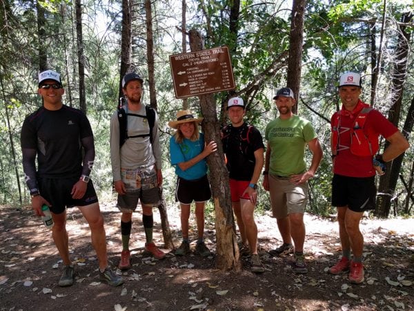
The project passes CAL 2/Peachstone, between Foresthill and the Middle Fork of the American River.
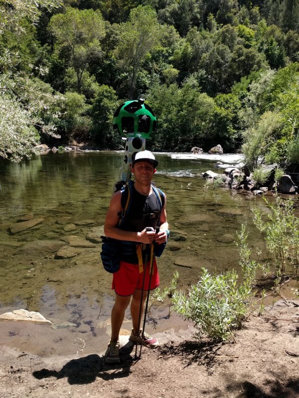
The Street View Trekker at the Middle Fork of the American River at mile 78 of the Western States Trail.
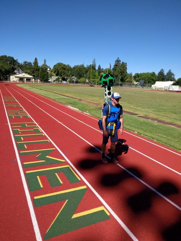
The device along with Max King on the Placer High Track in Auburn, California, where the Western States Endurance Run ends.
Scott Yates’s Western States Trekker Project Day 4 Video
Call for Comments (from Meghan)
What might you find use for in Google ‘street-view’ imagery of the Western States Trail?
