Recent significant changes to the Angeles Crest 100 Mile Endurance Run’s course struck a nerve in the ultrarunning community. An online appeal petitioning the White House to reverse the alterations was initiated. [Author’s Note: The petition has been archived because it failed to reach the 100,000 signatures needed for an official response.] The subsequent discussion among runners and the public indicated that:
- Trail runners are extremely passionate about our sport, and
- An introduction to federal land-use processes may help explain many of the questions that surface when the debate on race routes arise.
Why must courses, like Angeles Crest’s, change? Why are off-road event participant numbers extremely limited on federal lands? Why can’t races be held on epic routes like the Bright Angel or John Muir Trails?

John Muir Wilderness Area. Photo: Ian Torrence
Manifest Destiny?
The historic ebb and flow of federal-land ownership follows an ironic take-and-give-and-take narrative. Beginning with the conclusion of the American Revolution, the nation fought, bought, and seized land in order to grow in prominence and worth alongside the other countries of the world. Subsequently, to encourage western expansion into these newly acquired territories and exploit the resources therein, the federal government began to off-load much of this amassed public land.
Starting in 1850, through a series of Homesteading Acts, settlers, farmers, and businesses willing to fulfill each of the acts’ specific requirements could, for free or at very little cost, turn public land private and call it their own. These acts succeeded in privatizing much of the lands east of the Mississippi. However, in the western U.S., these programs failed due to fraud, poor record keeping, unrealistic binding-contract requirements (such as planting an inordinate amount of trees, producing crops in unproductive soils or building costly homes and structures), conflict with indigenous cultures, and the simple infallible fact that living in the dry, remote west was a cruel ordeal.
Finally, in 1976, Congress formally approved the Federal Land Policy and Management Act (FLPMA), which did away with homesteading (except in Alaska until the mid-1980s), declared that all remaining public land would remain under public ownership (unless it’s exchanged for land of equal value or sold for a fair price) and officially charged a few specific federal agencies to manage these areas for multiple uses while preserving their natural resources.
Federal Public Land Agencies
Four federal agencies currently manage the bulk of America’s public land: the National Park Service (NPS), Fish and Wildlife Service (FWS), Forest Service (USFS), and Bureau of Land Management (BLM). There are other popularly visited public land managing agencies, like the United States Army Corps of Engineers (CoE) and Bureau of Reclamation (USBR), which administer smaller acreages. Figure 1 describes these bureaus and where they’re situated in the land-management hierarchy (largest-acreage holder to smallest).
Figure 1. Federal Public Land Managing Agencies
| Bureau | Government Department | Year Founded | Total Acreage (in millions of acres) | Units | Number of National Monuments Managed (some are co-managed between agencies) | Wilderness Acreage (in millions of acres) | Purpose/ Responsibility |
| BLM | Interior | 1946 | 247.3 | Multiple districts mostly over the 12 western states (including Alaska) | 25 | 8.7 | Manages mostly rangeland, subsurface minerals, oil, gas, grazing, timber, wildlife habitat, recreation |
| USFS | Agriculture | 1905 | 192.9 | 154 national forests, 20 national grasslands | 11 | 36.5 | Manages mostly forest, grazing, timber, wildlife habitat, recreation |
| FWS | Interior | 1940 | 89.1 | 560 | 7 | 19.8 | Conserves plants & animals, wildlife-related activities (hiking, hunting, education) have priority over consumptive uses |
| NPS | Interior | 1916 | 79.6 | 412 | 84 | 43.9 | Preserves unique resources, provides for visitor enjoyment, little to no consumptive use |
| CoE | Defense | 1802 | 12.0 | 2,500 recreation areas | None | None | Manages public-works projects, provides water-based outdoor recreation |
| USBR | Interior | 1902 | 7.1 | 12 national recreation areas (administered by NPS & USFS), 11 FWS-administered projects | None | None | Manages western US water resources (including irrigation, water supply, hydroelectric power) |
Today, roughly 640 million acres, or almost a third of the country, fall under the auspices of the federal government. As you move west, land-ownership asymmetry becomes apparent. In the 11 most contiguous western states a whopping 47% of the land base is public or federally owned, while east of the Mississippi River the federal government manages a scant 4%.

Colorado National Monument. Photo: Ian Torrence
Managing For Multiple Use
Conceptually, due to numerous levels of administration, federal-land governance appears pyramid-like. At ground level, the vast majority of public land is open to the greatest utility and regulated by legislation open to wide interpretation by their managing agency. However, as you climb upward, regulations on certain relatively small, unique parcels become very specific. Add to this the fact that each agency’s enabling responsibilities are packaged with weighted emphasis on certain functions (see Figure 1) and confusion inevitably ensues deciphering what the public can do and where.
The overarching purpose of public land is to supply the nation with “multiple use” opportunities. These liberties include recreation, timber harvesting, research, mineral extraction, habitat conservation, grazing, watershed protection, wilderness, and wind-, water-, and solar-power generation. However, these uses can contradict one another. For example, how does one mine for copper without impacting the local watershed and wildlife? How can timber be acquired without affecting the scenery? How will a trail race be held without disturbing non-participatory visitors?
Here are two government-orchestrated pathways developed to answer the question, “Is a ‘use’ justifiable in this location and, if so, how will it be implemented?”
National Environmental Policy Act (NEPA)
This 1970 environmental law requires all federal agencies to develop detailed reports that outline the impacts of any action taken on federal land. Its purpose is to prevent damage to the environment while developing an extensive understanding of the proposed activity. There are three levels to NEPA compliance.
- Categorical Exclusion (CATEX): CATEX, the least detailed report, includes actions that do not “individually or cumulatively have a significant effect on the human environment.” Examples include routine maintenance duties (like snow and trash removal), law enforcement, or routine government business such as paying salaries.
- Environmental Assessment and Finding of No Significant Impact (EA/FONSI): If an action isn’t covered by a CATEX, a detailed EA is required. An EA contains the need for the proposed action, a list of alternatives, the impacts of each of those alternatives, and a list of consulted agencies and specialists. If “no significant impact” to the environment is discovered during the EA process, a FONSI document is created. The FONSI explains why the action can move forward without further review. EAs may be needed for approving competitive events, pest control, adding new campsites to a campground, or the expansion of a parking lot. Here is an EA for non-motorized competitive events in the Rio Grande del Norte National Monument including the Angel Fire Endurance Runs, Taos Ski Valley Up and Over Trail Run, and the Low O2 Challenge. Here’s the resulting FONSI approval.
- Environmental Impact Statement (EIS): If a CATEX or FONSI can’t be justified, an EIS must follow. When impact to the environment is imminent, this process enables the responsible agency to make the best-informed decision. Input from many sources, including the public, experts, and other agencies, are sought. A list of adverse impacts, mitigating alternatives, and short- and long-term effects are considered. EIS examples include building new roads, wind farms, pipelines and visitor centers, or changes to timber-management practices.

Joshua Tree National Park. Photo: Ian Torrence
Federal Land Designation
With a pen stroke, the most powerful and precise manner in which the federal government can declare, irrefutably, land intent. Figure 2 describes the most prevalent designation titles and what activities can and cannot take place.
Figure 2. Federal Public Land Designations
| Designation | Designators | Management Description & Restrictions | Acreage (in millions of acres unless noted otherwise) |
Examples |
| Wilderness Area (WA) | Congress, managed by NPS, BLM, FWS, USFS | Wilderness Act of 1964, highest form of protected public land because of its great natural value and character. No roads, motorized use, structures, logging, mining. | 109 (including Alaska and Hawaii), 52 in lower-48 states | John Muir WA, Gates of the Arctic WA, Bob Marshall WA, Florida Keys WA |
| National Park (NP) | Congress, managed by NPS | Land preserved for natural & historic character. | 52 | Yellowstone NP, Yosemite NP, Shenandoah NP, Glacier NP, Great Smokies NP |
| National Monument (NM) | Congress or President (by authority of The 1906 Antiquities Act), managed by NPS, BLM, USFS, FWS | Set aside to protect & enhance enjoyment for future generations. Activities allowed depend on purpose of monument, land-managing agency, pre-monument use. | See this comprehensive list. | San Gabriel Mountains NM, Canyons of the Ancients NM, Belmont-Paul Women’s Equality NM, Ocmulgee NM |
| National Conservation Area (NCA) | Congress, managed by BLM | Set aside to protect & enhance enjoyment for future generations. | 3.7 | Red Rock Canyon NCA, El Malpais NCA, none east of Mississippi River |
| Wilderness Study Area (WSA) | BLM | Roadless areas studied & managed for possible future wilderness-area designation. No permanent improvements but may allow bikes and ORV use. | 12.7 | Behind the Rocks WSA, Handies Peak WSA, none east of Mississippi River |
| National Recreation Area (NRA) | Congress, managed by BLM, USFS, NPS | Designated due to abundance of land & water recreation opportunities. | 3.2 managed by USFS, 3.7 by NPS, 8.1 by BLM | Lake Mead NRA, Lake Meredith NRA, Santa Monica Mountains NRA |
| National Forest (NF) | Congress, managed by USFS | Land managed for multiple uses. | 188.3 | White Mountain NF, George Washington NF, Ouachita NF |
| National Wildlife Refuge (NWR) | Congress, managed by FWS | Managed by FWS to protect wildlife & habitat. | 89.1 | Desert NWR, Wapack NWR, Shawangunk Grasslands NWR |
| Wild, Scenic, and Recreational River (WSR) |
Congress, managed by BLM, USFS, NPS, CoE, and some states | Protect free-flowing water. Dam building, mining prohibited. | 12,700 miles of 208 rivers designated | Verde River WSR, American River WSR, Red River WSR |
| Roadless Areas | USFS | Preservation of clean water & critical wildlife habitat. Road building, logging, ORV use prohibited. | 58.5 | See a 2011 summary here. |

Grand Canyon National Park. Photo: Ian Torrence
Misinterpretation, Conflict, and Rebellion
Environmental law and federal designations were designed with the public’s best interests in mind. However, when conservationism collides with potential business opportunities and nationwide interests don’t mesh with local ways of life, emotions run high and conflict results. Here are some prominent land-use disagreements.
- Sagebrush Rebellion: During the ’70s and ’80s, Sagebrush Rebels demanded the federal government do away with land designations by giving control of western land to state and local authorities. Rebels criticized that federal land ownership deprived states of income and interfered with local lifestyle. Today, many states still push for legislation that would facilitate federal to state land transfers.
- Jarbridge Shovel Brigade: In 2000, in northern Nevada, a group of 300 protesters defied the USFS by clearing a road closed for habitat conservation. After arbitration, the dissenters got what they wanted, “A nice new road farther away from the fish paid for by the feds.”
- Revised Statute 2477 (RS 2477): Passed by Congress in 1866 to encourage the settlement of the west, this bill granted states and counties unlimited right-of-way across federal and private land for highway construction. Today, local governments and organizations often exercise this outdated statute to justify continued vehicular access to otherwise federally restricted areas, like wilderness and roadless areas.
- The Bundy standoff: A 20-year dispute between the BLM and Cliven Bundy over unpaid grazing fees. In 2014, a government task force was sent to round up Bundy’s ‘trespass’ cattle, but their duties were thwarted when they were met by a group of armed protestors. Bundy’s cattle still roam unhindered.
- Occupation of the Malheur National Wildlife Refuge: In January 2016, armed anti-government militants seized the refuge’s headquarters, demanding the government cede ownership of the refuge. After more than a month, the siege ended with 27 arrests and two militants shot by law enforcement, one succumbing to his injury.
- Mountain biking and wilderness access: Though no notable armed disagreements have resulted, the mountain-biking community and wilderness advocates have exchanged jabs for years. In an April 2016 story in the Flathead Beacon, Ted Stroll, head of the Sustainable Trails Coalition, stated, “We keep hearing that we’d be weakening the Wilderness Act and paving the way for things like mining and motorcycles in Wilderness. No congressional office we’ve talked with wants to do anything more than we want to—allow cyclists back onto some trails in some Wilderness areas and the PCT. Second, this domino-theory argument is regularly trotted about by people who oppose any kind of societal change.” Andy Wiessner, High Country News board member, countered in the May 2016 edition of High Country News’ Letter to the Editor. “Not everyone needs to be able to use every acre of our public lands as they see fit,” says Wiessner. “It shouldn’t be all about us humans and our machines, cell phones and Go Pros. With more and more people moving to the West every year, putting increasing pressure on public lands, the last thing we need is to open the sanctuaries of our Wilderness System to ever-greater human intrusion.”

Yellowstone National Park. Photo: iRunFar/Meghan Hicks
Competitive Events On Federal Land
Our sport doesn’t escape the great public land use debate. Occasionally, a favorite trail event gets cancelled, must alter its race route, and/or operate under restrictions due to governmental decisions. Figure 3 illustrates several events that have been or are currently affected by federal land policy.
Figure 3. Trail Races & Ultramarathons Affected by Federal Policy
| Race | Agency | Reason for Action | Result |
| Angeles Crest 100 Mile Endurance Run | USFS | Pleasant View Ridge Wilderness Area | Course rerouted in 2016 because of wilderness area. |
| Badwater Ultramarathon | USFS | John Muir Wilderness Area | Course shortened to finish at Whitney Portal instead of Mt. Whitney summit because of wilderness area. |
| Badwater Ultramarathon | NPS | Death Valley National Park safety review | Event suspended within park boundaries in 2014 pending safety review. |
| Las Vegas Red Rock Fat Ass | BLM | La Madre Mountain Wilderness Area | Event permitted and course rerouted around wilderness in 2010. |
| Western States 100 Mile Endurance Run | USFS | Granite Chief Wilderness Area | Participants capped at 369 in 1988. |
| Timberline Trail Marathon | USFS | Mt. Hood Wilderness Area | Course rerouted in 2009 because of wilderness area. |
| Kilauea Volcano Runs | NPS | Hawaii Volcanoes Wilderness Area & area’s cultural significance to native Hawaiians | Event cancelled after 2008 because of wilderness-area designation and area’s cultural significance. |
| 49er Double Marathon | NPS | Phillip Burton Wilderness Area | Event cancelled because of wilderness area. Miwok 100k created on alternate course as a result. |
| Hardrock Hundred Endurance Run | BLM | Handies Peak Wilderness Study Area | Environmental Assessment (EA) completed to approve a multi-year Special Recreation Permit. |
As evident in Figure 3, events take a backseat when the two most tightly protected land designations, wilderness areas and national parks, are involved. Similarly, numerous proposed races don’t reach fruition because of the outcome of the NEPA decision-making process. Here’s a look at how and why the strictest land designations and law compliance affect trail-race organization.
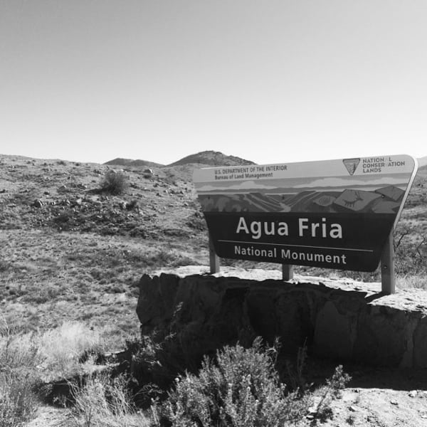
Agua Fria National Monument. Photo: Ian Torrence
Wilderness Areas
The United States set worldwide precedence with the creation of the Wilderness Act of 1964 by becoming the first country to legislatively define and designate wilderness. The Act describes wilderness as:
“…lands designated for preservation and protection in their natural condition… an area where the earth and its community of life are untrammeled by man… an area of undeveloped Federal land retaining its primeval character and influence, without permanent improvement or human habitation… has outstanding opportunities for solitude or a primitive and unconfined type of recreation… shall be devoted to the public purposes of recreation, scenic, scientific, educational, conservation and historic use.”

High Uintas Wilderness Area. Photo: iRunFar/Meghan Hicks
Wilderness designation can begin at the grassroots level. Citizens and/or advocacy groups recommend potential wilderness areas to their elected representatives. If approved, Congress finalizes its boundaries and sends it on to the president for ratification. Wilderness isn’t elusive and can be found in the mountains, deserts, swamps, and grasslands that span our nation. All four major land agencies (NPS, USFS, BLM, and FWS) manage these areas. “There’s also still a lot of roadless country that could be designated as wilderness,” says Paul Torrence, a former board member of the Wilderness Land Trust. “We could theoretically double the size of the existing Wilderness Preservation System with what’s still out there. If we don’t protect the wild then we’re shooting ourselves in the foot. I don’t think any trail runner can live in a concrete jungle.”
The Act dictates what can and cannot take place on wilderness-designated land: “…there shall be no commercial enterprise and no permanent road… there shall be no temporary road, no use of motor vehicles, motorized equipment or motorboats, no landing of aircraft, no other form of mechanical transport, and no structure or installation within any such area.”
However, the Act does allow for mining on valid claims, access to private lands within or adjacent to wilderness areas, fire control, insect and disease control, grazing, water-supply structures, and many forms of recreation, including trail running.
That said, trail races are extremely difficult to hold in wilderness areas. According to University of Montana’s Wilderness.net, “Competitive events in wilderness tend to lessen the wilderness experience for others. There are many opportunities for such events outside of wilderness.”
Permit applicants often misinterpret the Act’s special provision in Section 4(d) as justification for an event: “…commercial services may be performed within the wilderness areas… to the extent necessary for activities which are proper for realizing the recreational or other wilderness purposes of the areas.”
“Words and phrases can be cherry picked from any legal document,” says Torrence. “However, you must consider the Act’s purpose as a whole when interpreting a piece. This provision was added to allow for horseback, backpacking, fishing, or hunting outfitters to guide ill-equipped or inexperienced users through the wilderness safely.”
Nevertheless, there are exceptions. When local organizations and their federal counterparts work in unison, concessions can occur. “You have a voice. All you have to do is speak up,” says Torrence. “Invest the time. Once land managers see your interest and hear your input they’ll learn you’re a stakeholder. You can’t be ignored.”
There are at least three major trail races that occur in wilderness areas today: The Western States 100 Mile Endurance Run, Highlands Sky 40 Mile Trail Run, and La Luz Trail Race (See Figure 4). The Hardrock Hundred Mile Endurance Run passes through a BLM Wilderness Study Area, which for all intents and purposes is managed as wilderness. “Getting permission to hold Hardrock through a wilderness study area was a huge accomplishment,” says Hardrock race director Dale Garland. “It required us to work with and communicate extensively with the BLM and develop a great working relationship with political leadership at the federal level.”

Flat Tops Wilderness Area. Photo: Ian Torrence
National Parks
In 1872 Yellowstone became the United States’s first national park. Today, 59 national parks, administered by the National Park Service, can be found in 27 states. The purpose of the NPS is, according to its founding legislation, the 1916 Organic Act, is to:
“…to conserve the scenery and the natural and historic objects and wildlife therein, and to provide for the enjoyment of the same in such manner and by such means as will leave them unimpaired for the enjoyment of future generations.”
“Proposed units to the National Park Service must pass specific criteria,” says Nancy Hendricks, the Supervisory Environmental Protection Specialist at Sequoia and Kings Canyon National Parks. “According to NPS 2006 Management Policies, newly added areas must be nationally significant, not already adequately represented within the NPS, big enough for the public to enjoy, and capable of being administered by the Service cost-wise.”

Big Bend National Park. Photo: iRunFar/Meghan Hicks
The Organic Act doesn’t disallow competitive events. For example, Crater Lake, Black Canyon of the Gunnison, Saguaro, Death Valley, Acadia, Hot Springs, and Bryce National Parks all host road races. Trail events also occur but less frequently (See Figure 4). There are three key reasons for this discrepancy.
- Conflicts with the park’s mission statement: An event may be turned away if it disrupts a visitor’s experience or affects the environment. For example, the Grand Canyon National Park’s foundation statement states the park will provide the visitor the ability to “experience solitude, natural sounds, clean air, and dark night skies.”
- Safety concerns: It’s extremely difficult and expensive to access injured people in the backcountry.
- Specific laws can prohibit events. For example, the Wilderness Act and Endangered Species Act of 1973 can forbid an event from passing through an area.
“The policies are clear,” says Hendricks. “Special events, including competitive events, may be permitted by the superintendent when (1) there is a meaningful association between the park area and the event, and (2) the event will contribute to visitor understanding of the significance of the park area. Permits are intended to mitigate damage to park resources. The NPS won’t permit an event when it’s conducted primarily for the material or financial benefit of a for-profit entity, awards participants an appearance fee or prizes of more than nominal value, or charges a separate public-admission fee. Lastly, permits will not be issued in NPS wilderness areas.”

Canyonlands National Park. Photo: iRunFar/Meghan Hicks
National Monuments
The President of the United States can expand the protections given to federal land by using the 1906 Antiquities Act:
“…in his discretion, to declare by public proclamation historic landmarks, historic and prehistoric structures, and other objects of historic or scientific interest that are situated upon the lands owned or controlled by the Government of the United States to be national monuments.”
Many of our beloved playgrounds, like the Grand Canyon, Zion, Joshua Tree, Olympic, and Death Valley were national monuments before they became national parks. Established to safeguard significant historical, archeological, and natural areas, national monuments are found throughout the west and administered by the NPS, BLM, USFS, and FWS.
Congress can also designate monuments.
The Antiquities Act doesn’t prohibit competitive events. Activities that existed before a monument ‘upgrade’ usually continue. Similar to national-park policy, the local administrative office still make the final permit decisions. For example, the Grand Staircase-Escalante and California Coastal National Monuments do not allow races. However, many monuments allow for competitive events by avoiding other recreational and natural conflicts (See Figure 4).
Figure 4. Trail Races & Ultramarathons Held in Wilderness Areas (and Study Areas), National Parks & National Monuments
| Race | Agency | Surface | Designation |
| Badwater Ultramarathon | NPS | Paved road | Death Valley National Park |
| Western States 100 Mile Endurance Run | USFS | Trail | Granite Chief Wilderness Area |
| Hardrock Hundred Endurance Run | BLM | Trail | Handies Peak Wilderness Study Area |
| La Luz Trail Run | USFS | Trail | Sandia Mountains Wilderness Area |
| Angeles Crest 100 Mile Endurance Run | USFS | Trail (& now paved road) | San Gabriel Mountains National Monument |
| Dipsea, Double Dipsea, & Quad Dipsea | NPS | Trail | Muir Woods National Monument |
| Burning River 100 Mile | NPS | Trail, paved road | Cuyahoga Valley National Park |
| Towpath Marathon | NPS | Trail | Cuyahoga Valley National Park |
| Highlands Sky 40-Mile Trail Run | USFS | Trail | Dolly Sods & Roaring Plains West Wilderness Areas |
| Platte Valley Companies Nebraska’s Monument Marathon | NPS | Paved road, dirt road | Scotts Bluff National Monument |
| Miwok 100k | NPS | Trail | Muir Woods National Monument |
| Eco-Extreme Trail Run | NPS | Trail | Channel Islands National Park |
| The North Face Endurance Challenge 50-Mile Championships | NPS | Trail | Muir Woods National Monument |
| Mount Disappointment Endurance Runs | USFS | Trail | San Gabriel Mountains National Monument |
| Death Valley Trail Marathon | NPS | Dirt road | Death Valley National Park |
| Angel Fire Endurance Runs | USFS | Trail | Rio Grande Del Norte National Monument |

Handies Peak Wilderness Study Area. Photo: iRunFar/Meghan Hicks
Where Does This Leave Trail Racing?
Land designation and government paperwork may seem restrictive and cumbersome. However, we can leverage these elements in our favor. Utilizing public land opens trail running to great opportunity, improves event organization, and promotes us as leaders in land advocacy. Here’s why:
- This is our chance to place trail running at the forefront of all recreational activities. “Create an event that is known for its responsible use of the resource,” says Garland. “Make sure the permitting agencies know what you are doing. Adopt Leave No Trace policies and give back whenever you can.” By operating our events discreetly, completing voluntary trail work, and providing managers valuable backcountry recon we cement ourselves as reliable, valuable land stewards.
- Our playground is huge! Competitive events are restricted from a very small percentage of public land. Only 2.7% of the lower-48 states, an area roughly the size of Minnesota, is designated wilderness. National parks (including a sizeable amount of the aforementioned wilderness) encompass 52 million acres, slightly larger than the states of New Mexico and New Hampshire. What remains is access to a vast and diverse public-land system open to great potential. The American Trail Running Association, whose mission is to represent and promote mountain, ultra, and trail running, shared these statistics: Between 2010 and 2014 there was significant growth in both the number of trail running events (41% increase) and participants (38% increase) in the United States. Clearly, new and creative events are on the rise and runners are flocking to participate in them. Simply put, there is no shortage of trail-racing territory and interest.
- Opportunity beckons. The above-mentioned availability and nationwide distribution of public land allows for all burgeoning enthusiasts to take advantage.
- Avoid mistakes with a second opinion. Evaluation of your event by a federal-land manager allows for a skilled and knowledgeable individual to review and make improvements. “It’s really important to have the permitting agencies view themselves as active and helpful partners,” says Garland. “This year we invited BLM and San Juan County officials to join us during Hardrock. They visited aid stations, hiked the course, and visited with our staff. The purpose of the visits was to evaluate our procedures, help us improve, and to educate them on how we operate.”
- Preserve originality. Federal-land managers prevent events from stepping on each other’s toes by avoiding similar courses and race dates.
- Public land is the best deal in town. Federal-permit fees are cheaper than those of most private or municipal locations. Lower organizational costs lessen entry fees and provide more potential funding to philanthropic organizations the events support.
- Become familiar with land-use administration. “Realize this is a give-and-take relationship and that land-use managers have guidelines and rules that they have to follow,” shares Garland. “Educate yourself about policies and the procedures that they have to abide by, so you know where they’re coming from. Permits take time to work through. One to two years lead time isn’t uncommon.”
No race? No problem. Competition isn’t a prerequisite for exploration. Discover for yourself, sans bib, course marking, or aid station, what magic the backcountry has to offer. Instead of amassing a pile of finisher medals, our spirit might be better satisfied seeking out a few wilderness experiences.
Call for Comments (from Meghan)
- Do you know what kinds of federal public lands are nearest to your home? And do you know the kinds of federal public lands on which you most often run? What are their names and which federal agency manages them?
- What knowledge about federal public lands do you think trail runners should know prior to trail running? How does that knowledge vary in different areas?
- What have you learned about federal public lands with this article that you didn’t know before?

Kachina Peaks Wilderness Area. Photo: Ian Torrence
References
Bui, Quoctrung, and Margot Sanger-Katz. “Why the Government Owns So Much Land in the West.” The New York Times. The New York Times, 05 Jan. 2016. Web. 30 July 2016. <https://www.nytimes.com/2016/01/06/upshot/why-the-government-owns-so-much-land-in-the-west.html?_r=0>.
“Bureau of Land Management Directory.” Audubon Wildlife Report 1987 (1987): 561-62. Web. <https://www.conservationlands.org/wp-content/uploads/2013/10/Types-of-Designation-copy1.pdf>.
“Federal Footprint Map.” House Committee on Natural Resources. Committee on Natural Resources United States House of Representatives, n.d. Web. 30 July 2016. <https://naturalresources.house.gov/federalfootprint/>.
“National Environmental Policy Act.” Wikipedia. Wikimedia Foundation, 26 June 2016. Web. 30 July 2016. <https://en.wikipedia.org/wiki/National_Environmental_Policy_Act>.
“National Environmental Policy Act Review Process.” EPA. Environmental Protection Agency, 5 July 2016. Web. 30 July 2016. <https://www.epa.gov/nepa/national-environmental-policy-act-review-process>.
“National Landscape Conservation System.” Wikipedia. Wikimedia Foundation, 6 May 2016. Web. 30 July 2016. <https://en.wikipedia.org/wiki/National_Landscape_Conservation_System>.
“National Workshop on Large Landscape Conservation.” National Landscape Conservation System: National Monuments 39.7 (2014): 322. Feb. 2016. Web. <https://www.blm.gov/style/medialib/blm/wo/Law_Enforcement/nlcs/monuments.Par.37811.File.dat/Monuments_Q4_2014.pdf>.
“Parks Directory of the United States: A Guide to 3,700 National and State Parks, Recreation Areas, Historic Sites, Battlefields, Monuments, Forests, Preserves, Memorials, Seashores, and Other Designated Recreation Areas in the United States Administered by National and State Park Agencies.” Choice Reviews Online 30.03 (1992): n. pag. Table 15 – National Recreation Areas by State. US Forest Service, 20 Feb. 2014. Web. <https://www.fs.fed.us/land/staff/lar/LAR2013/Table_15.pdf>.
Powell, Bryon. “Racing and Politics.” Racing and Politics. Running Times, 8 Dec. 2009. Web. 30 July 2016. <https://www.runnersworld.com/print/trail-racing/racing-and-politics>.
United States. National Park Service. “NPS Archeology Program: Antiquities Act Centennial.” National Parks Service. U.S. Department of the Interior, 30 July 2016. Web. 30 July 2016. <https://www.nps.gov/archeology/sites/antiquities/monumentslist.htm>.
Vincent, Carol Hardy, Laura A. Hansen, and Jerome P. Bjelopera. “Federal Land Ownership: Overview and Data.” Federal Land Ownership: Overview and Data (n.d.): n. pag. 29 Dec. 2014. Web. <https://www.fas.org/sgp/crs/misc/R42346.pdf>.

Behind the Rocks Wilderness Study Area. Photo: iRunFar/Meghan Hicks
