![]() [Editor’s Note: Welcome back to our “Destination Dirt” series! In this article, guest contributor John Vanderpot offers an introduction to trail running in San Diego, California. While we’ve written about many trail running destinations over the years as part of this occasional article series, we’d love to cover more urban trail running locations. If you live around a city anywhere in the world with good trail running and would like to write a “Destination Dirt” article about it, we’d love to hear from you!]
[Editor’s Note: Welcome back to our “Destination Dirt” series! In this article, guest contributor John Vanderpot offers an introduction to trail running in San Diego, California. While we’ve written about many trail running destinations over the years as part of this occasional article series, we’d love to cover more urban trail running locations. If you live around a city anywhere in the world with good trail running and would like to write a “Destination Dirt” article about it, we’d love to hear from you!]
San Diego, California, perched on the Pacific Ocean in the southern part of the state with its population of some 1.4 million people, is an outdoor lovers’ city. Boating, beaching, and… trail running?! Yep, dozens of miles of trails, both of the singletrack and doubletrack varieties, exist within city limits. And, you’ll find a lifetime of exploration if you travel to the high country east of the city. In this article, we’ll look at three trail running areas, two within the city’s boundaries and the massive area out of town and up high.
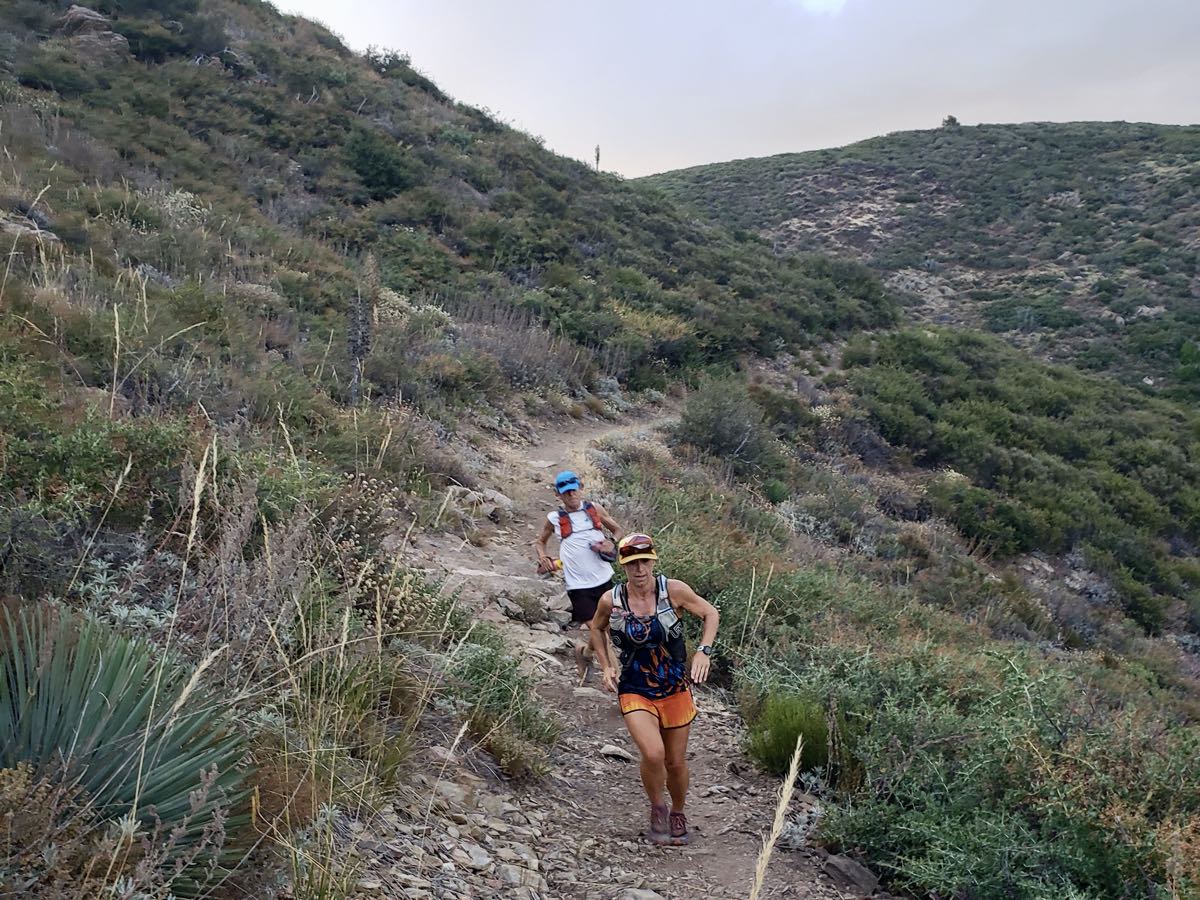
Ultrarunners Angela Shartel (front) and Tracey Moore at Pine Creek in the Laguna Mountain Recreation Area of the Cleveland National Forest east of San Diego, California. Photo: Scotty Mills
Cowles Mountain and Pyles Peak
There’s any number of places to run in San Diego, from the streets to the beaches and boardwalks. But if trails are–or could be–your thing, then there’s probably no more popular place than Cowles Mountain. Not 15 minutes from downtown, Cowles offers something for everyone–from those just trying out trail running to advanced ultrarunners.
In terms of a representative cross-section, there may be nothing more San Diego than Cowles as a variety of ages and abilities show up for hiking and running, from children with their parents to seniors with their walking sticks. All members of the community visit, sports teams and military personnel use it for training, and over the years everything from people in bathing suits to Zen monks in their white robes and sandals have been seen there.
These trails are a part of Mission Trails Regional Park, which is 7,200 acres and has over 65 miles of trails. The park is divided into three regions, and Cowles Mountain and Pyles Peak are in the southeast Cowles Region. Here’s the park’s trail map.

Cowles Mountain. Photo: Bob DuHamel
The standard starter course in this area is up and down Cowles Mountain once for about three miles with about 1,000 feet of vertical gain.
But you need not stop there. Those who appreciate more challenge can access the Pyles Peak Trail at the top of Cowles. It’s just 30 feet to the left as you face the summit monument. This out-and-back adds another three miles with similar, though rolling, climb.
Still need more? Then go down to the fire road’s trailhead and back up again after your return from Pyles for, yet again, another 3 miles with about the same elevation gain. Approximately a mile down the fire road, for those who want to make a real morning of it, marked and to your left, is the Big Rock Trail. This trail is also similar in length and vertical gain. All told, you can get about 12 miles with nearly 4,000 feet in climb if you’re looking for some decent mileage.
Plan ahead, and know that there’s no water along the way. There is a water fountain that’s usually working at the base of Cowles before you start, but don’t count on it and bring your water from home. Here in SoCal, it can be well into the 80s Fahrenheit from March until November. Trail conditions are generally decent. If you’re newer to trail running, you may find it rocky, but you’ll grow used to it quickly. This is not the smooth sand of our beaches, but not the technicality of what you get in, say, Colorado or Utah or points north.
Mission Trails
If you’re looking for something a little less popular, and a lot longer, then just five miles away is what locals call “Mission Trails,” where there are upward of 50 miles of trails to work with. To be clear, this is still Mission Trails Regional Park, and this makes up the two northwest regions of the park. Once more, here’s the park’s trail map.
There’s so much here that as a local I rarely run the same route twice. However, a common variation is to tag the area’s three peaks–Kwaay Paay Peak, South Fortuna Mountain, and North Fortuna Mountain. Since there are so many course options and variations, distance and vertical gain will necessarily vary, depending on your choices.
Mission Trails Regional Park. Photo: Dmadeo
The 5-Peaks Challenge, combining Cowles and Pyles with Kwaay Paay, South Fortuna, and North Fortuna, comes to about 15 miles (assuming you drive from Cowles Mountain to Mission Trails and don’t run through the neighborhoods, which is also an option) and close to 5,000 feet in gain, so you will no doubt be ready for lunch when you’re done.
On the whole, trail conditions are a little cleaner here, however there are some challenging sections and you should again plan on carrying all the water you need. As a multi-use public park, there are also bird watchers, family picnics, photo shoots, dog walkers, mountain bikers, and even a little bit of urban fishing in the streams and pond.
East County Mountains
Advanced trail runners looking to see what local ultrarunners do can drive 40 to 60 miles east on Interstate 8, to Sunrise Highway at exit 47. Sunrise Highway, or S-1, stretches from there north to Highway 79 for about 30 high-country driving miles. I’ll mention but one course at each standard distance; the Noble Canyon 50k, PCT 50 Mile, Cuyamaca 100k, and San Diego 100 Mile all take place in the area. This whole area is called East County, and is still part of San Diego County.
Angela Shartel on the Pacific Crest Trail at Mount Laguna. Photo: Scotty Mills
The easiest option when you first arrive up here is to access the Pacific Crest Trail (PCT) on your right once you’ve driven the 13 or so miles uphill and the Sunrise Highway has leveled off, say after Thing Valley Road. Once you’re on the PCT and depending on your mood and inclination, head toward either Canada or Mexico. Maybe you don’t want to go that far on this incredible trail that really does stretch for 2,650 miles through the United States to each country border, but there’s plenty of mileage for whatever kind of run you’d like. Parking passes can be purchased at the local businesses along the Sunrise Highway.
When you’re ready to explore some more, gather maps and elevation profiles from those previously mentioned race websites and plan out a route. A week wouldn’t be enough time to do half of what’s possible.
Almost all of what you’ll find up here is public land, but it’s a mixture of federal and state managed. A lot of the terrain on the east side of this region is federal-level Cleveland National Forest. Elevation here is up over 5,000 feet, it’s pretty remote, and phone reception is inconsistent. Also, there can be snow from October to May, so plan ahead, as always, and don’t count on anyone being around to help should you need it.
That’s probably enough to get you started, and don’t forget to enjoy yourself–happy trails!
Call for Comments
Know some more trails in San Diego, California? If so, leave a comment to add to your beta here!
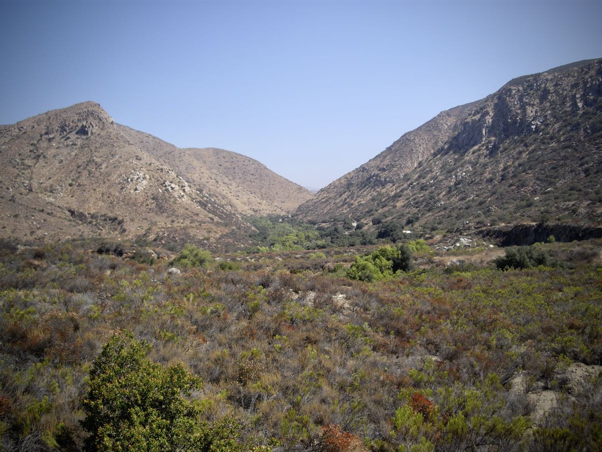
The scenery of Lake Cuyamaca. Photo: Scotty Mills
