I’ve fallen, and I’ve fallen hard for western China. In writing this article, I might crystalize why that is, but I’m not holding my breath. The air’s too thin up there.

Thanks to Coros for making this trip and report possible.
Last autumn, I took my third trip to western China. In 2015, I ran what’s now known as the Ultra Gobi, a 250-mile non-stop event in the Gobi Desert in northwest China. In 2016, I headed to the Tibetan Plateau in western Sichuan province to run the Yading Skyrun.
After two failed attempts to race in China in the interim, late last October and early November, my chance to once again visit western Sichuan province came up, this time to run the Ultra Tour Mount Siguniang (UTMS) 110k. UTMS is a set of four trail races in and around Siguniang National Park, named after Mount Siguniang, which translates to Four Sisters Mountains after the mountain’s four distinct peaks and tops out at 20,510 feet (6,250m). It’s also why UTMS is sometimes called the Four Sisters Ultra. Mount Siguniang is on the Tibetan Plateau in western Sichuan province, a few hours’ drive northwest from the metropolis of Chengdu, the home of 10 to 20 million people, into which I’ll fly.
The closest town to the park and the race is Rilong, also known as Siguniangshanzhen. I’ll spend a week here at 10,000 feet (3,100m) before the race with the town’s 3,000 mainly Tibetan residents.
[Thanks to Coros for making this trip to Mount Siguniang possible and to Kailas for the race entry!]
[Author’s Note: While many of my favorite photos are below, I’ve posted another 50 on Facebook to give more insight into my experience as well as to share experiences that didn’t make this narrative.]
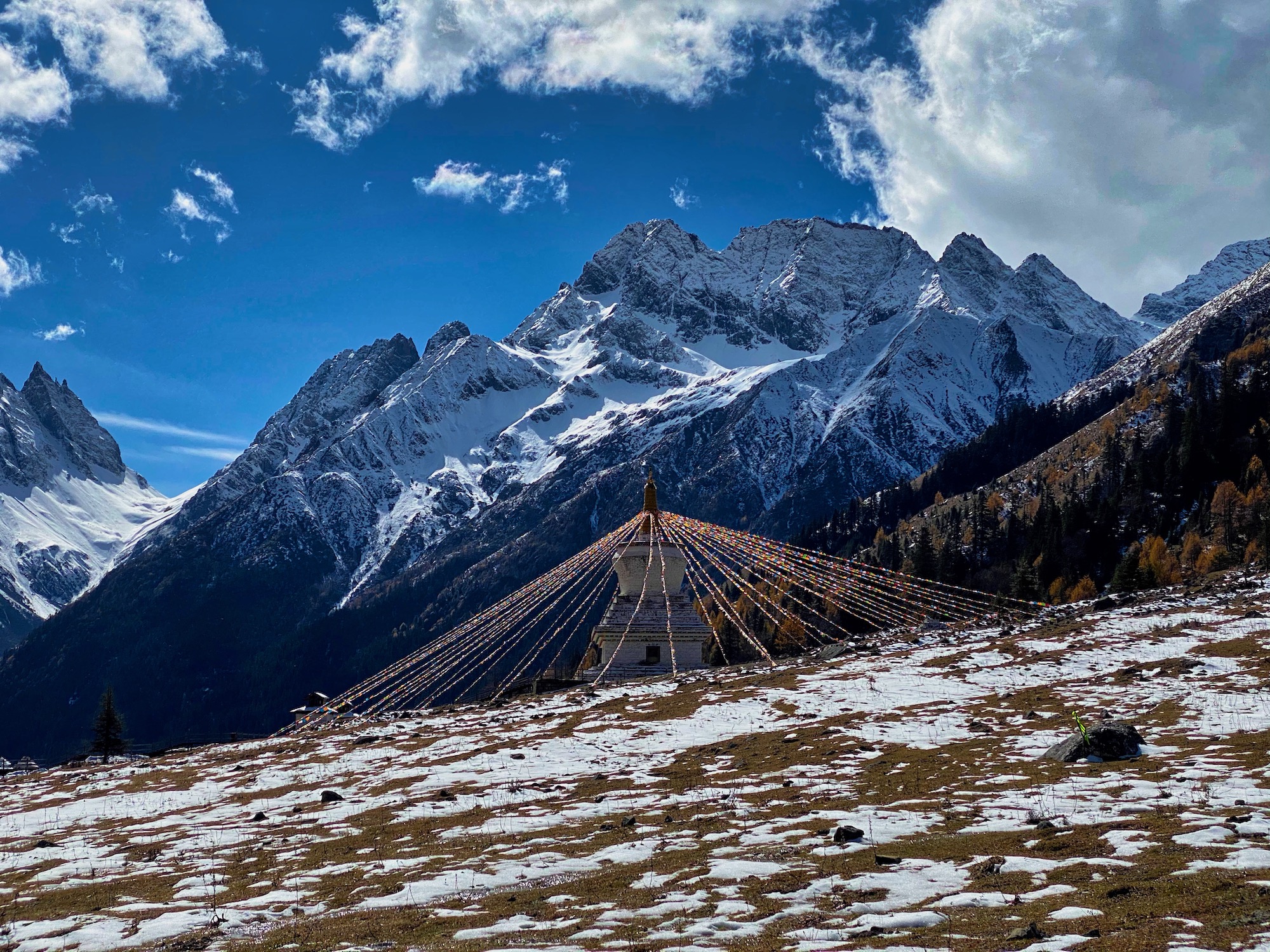
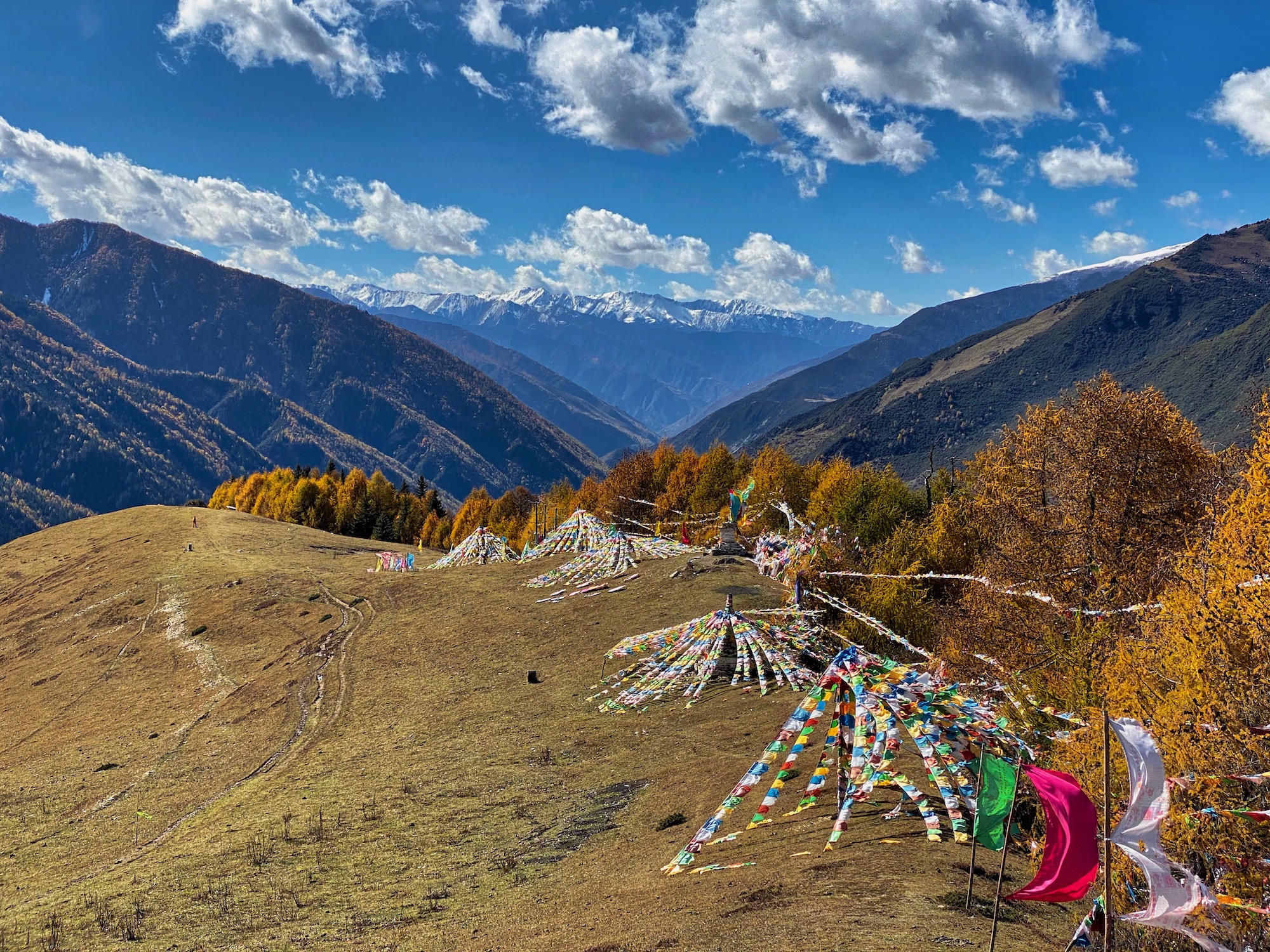
A stupa in Shuangqiao Valley. All photos: iRunFar/Bryon Powell unless noted.
On to Siguniang!
After a long red-eye flight, I touch down in Chengdu at 6 a.m. and make my way to the metro. I navigate two subway lines to a stop in northwest Chengdu where a shared car will pick me up in three hours to take me to Rilong. Clean and nearly empty at this hour, the metro takes me swiftly and easily to my designated stop where I have two-and-a-half hours to kill in a light drizzle before my pickup. I pull out my phone to try and find a cafe or coffee shop to kill time.. No luck. I wander down a huge block looking for a spot to hole up. There it is, well down the block, a literal hole-in-the-wall noodle shop. I engage the shop’s only worker, point to a photo of food high on the wall, and exchange a series of hand signs and nods. Five minutes later, I’m eating the tastiest bowl of spicy noodles I’ve ever had. It’s barely 7 a.m. After taking my time in the 10-seat joint, I park myself on my roller bag out of the rain under the awning of a small business that’s not yet open.
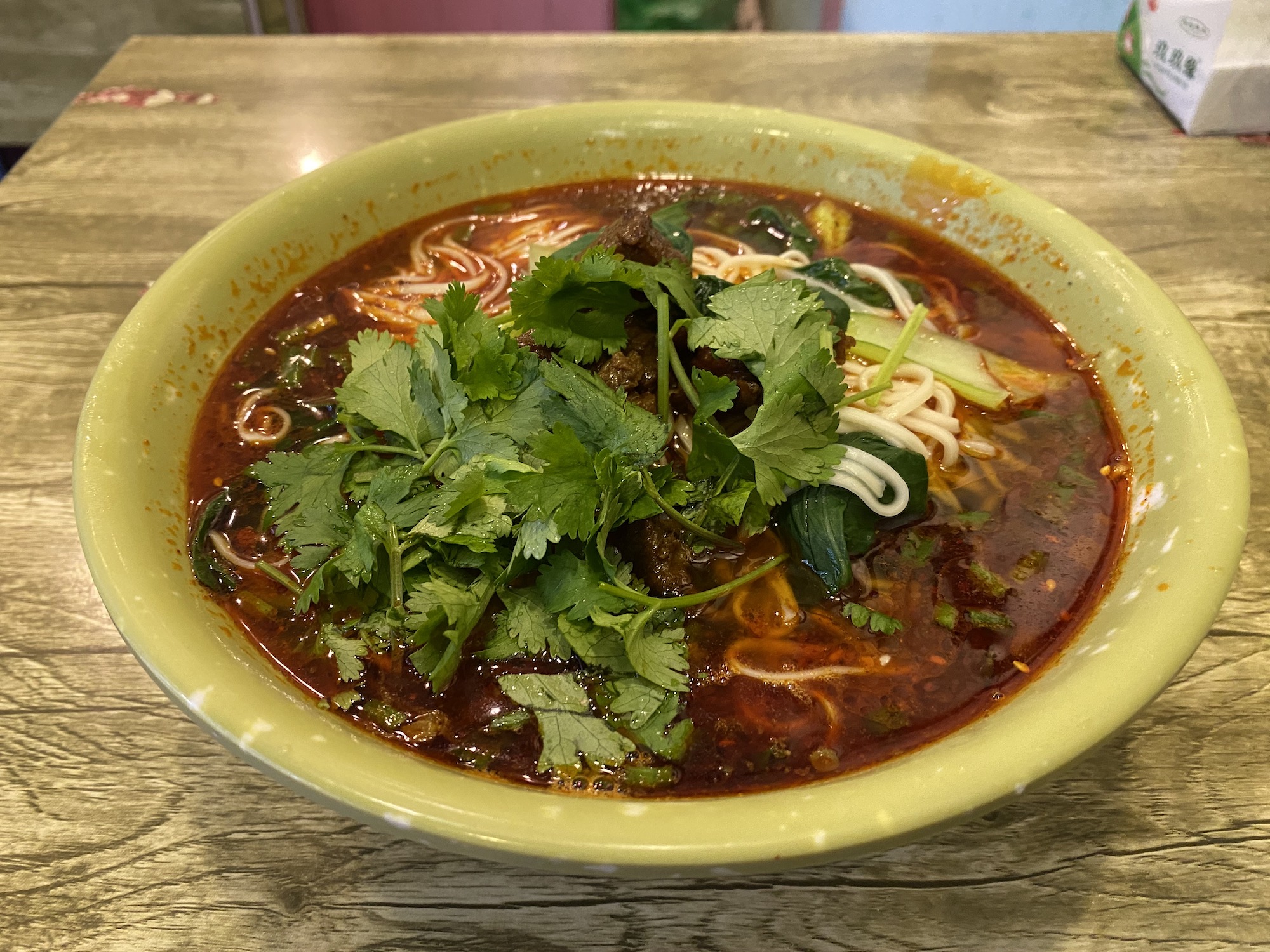
Spicy noodles for breakfast!
I’m the first rider to the shared car. We wait half an hour for a Tibetan mother and daughter as well as a Chinese couple from the big city. I’m already in the foot-room-optional far backseat intending to sit sideways when the tall Chinese gentleman quite courteously joins me back here. This is going to be a long drive!
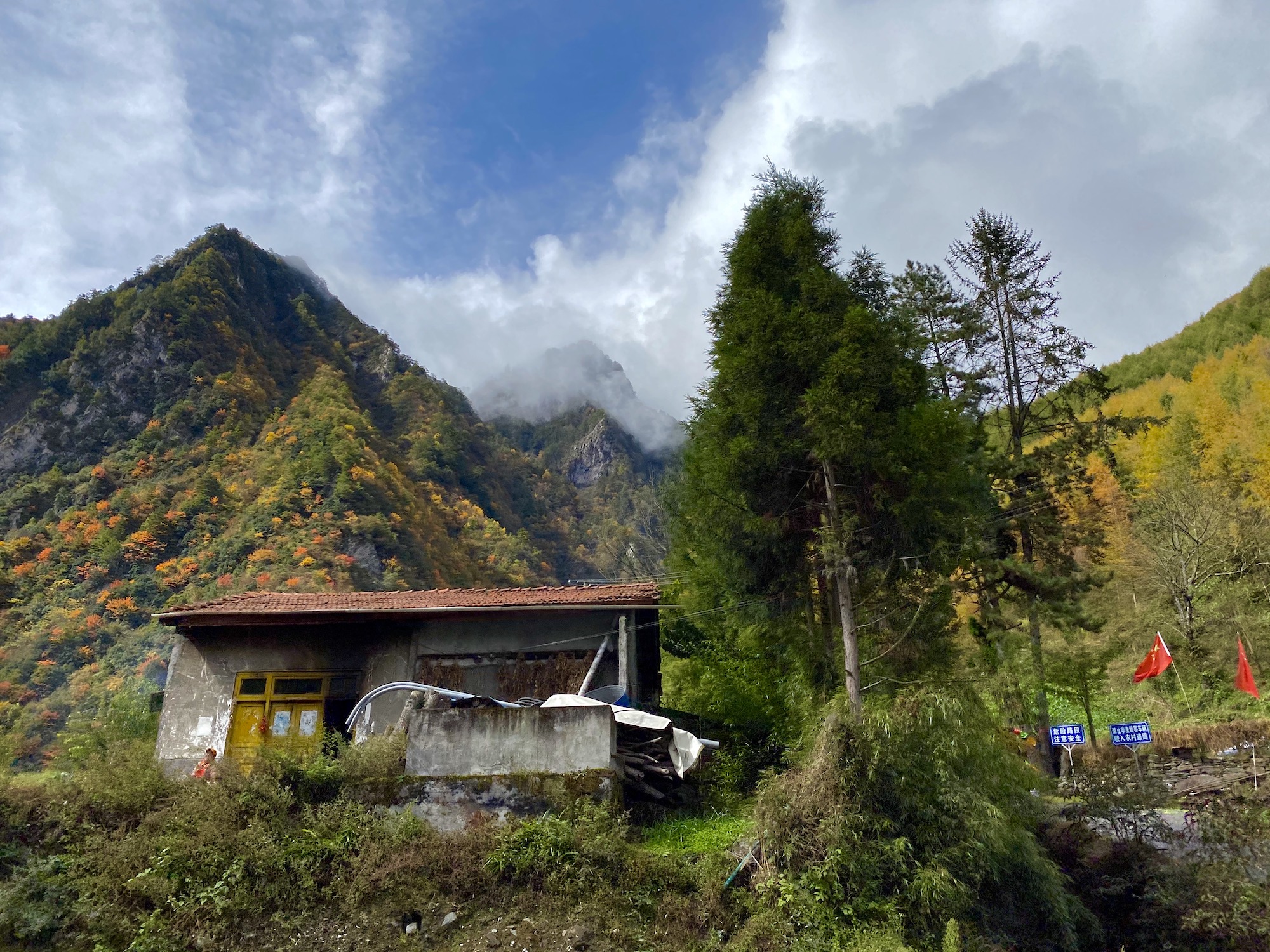
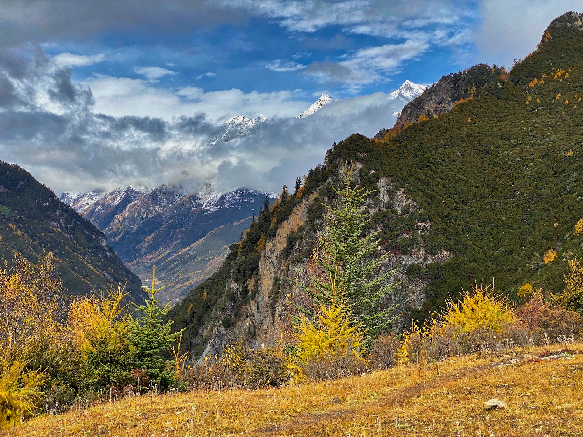
Before we leave the outskirts of Chengdu we stop for a bathroom, grocery, and smoking break. I stay in the van and take in the entirely foreign scenes. I’m mesmerized. I could do this all day. Soon after restarting, we hit a wall of mountains. We consistently climb from 1,600 feet (500m) to over 12,700 feet (3,850m) over the coming hours. It’s a gorgeous drive as we climb a river valley chock full of autumnal splendor. At one point, we come upon some randomly parked cars. Our driver stops, too. It’s monkeys. It’s awesome. We watch the troop for ten minutes before they wander off, and we do, too.
Continuing on, we eventually emerge from a long tunnel at 12,700 feet, and I catch my first sight of Mount Siguniang and the surrounding mountains. I’d not prepared myself for their scale. They’re huge. They’re stunning. They’re breathtaking.
The countryside en route to Rilong.
We descend 2,000 feet (600m) to the town of Rilong. The other riders depart before we drive through and out of town. Hmmm… where am I headed? We turn off the road and descend a steep, single-lane, concrete path. We pull up in front of a quaint guest house with beds of vibrant flowers between it and a beautiful, boulder-filled, glacier-fed river. Towering larch-covered mountains rise around me. Wow. I’m glad we drove out of town. This will be my quiet retreat for the next week and a half.
Exploring Rilong and its Environs Before the Race
As much as the natural beauty of western China blows me away, I’m just as thankful to take in its cultures. I don’t know the demographics for Rilong specifically, but the Ngawa Tibetan and Qiang Autonomous prefecture in which it’s located is just over half Tibetan. This Tibetan heritage is obvious in the stupa–dome-shaped Buddhist shrines–found throughout the area, prayer flags all over the place, architectural nods in town and more prominent at its outskirts, and the ceremonial dress used for some interactions with tourists.
Another part of what I love about visiting western China, whether it’s in rural Sichuan province or the Gobi, is that it feels like the wild, wild west. Not only am I experiencing the rural cultures of another continent, but I’m also experiencing their non-sterilized versions. Yes, folks have cars, electricity, and running hot water, but you might also see a goat being slaughtered in the gutter or a yak being butchered in the park, you’ll definitely get to experience squat toilets, and rooms will be cold. This is not London or Beijing, or a cleaned-up-for-tourists version of life, for that matter. This is an adventure that’s likely to push many people’s boundaries and comforts. Know and honor this before you decide to go.
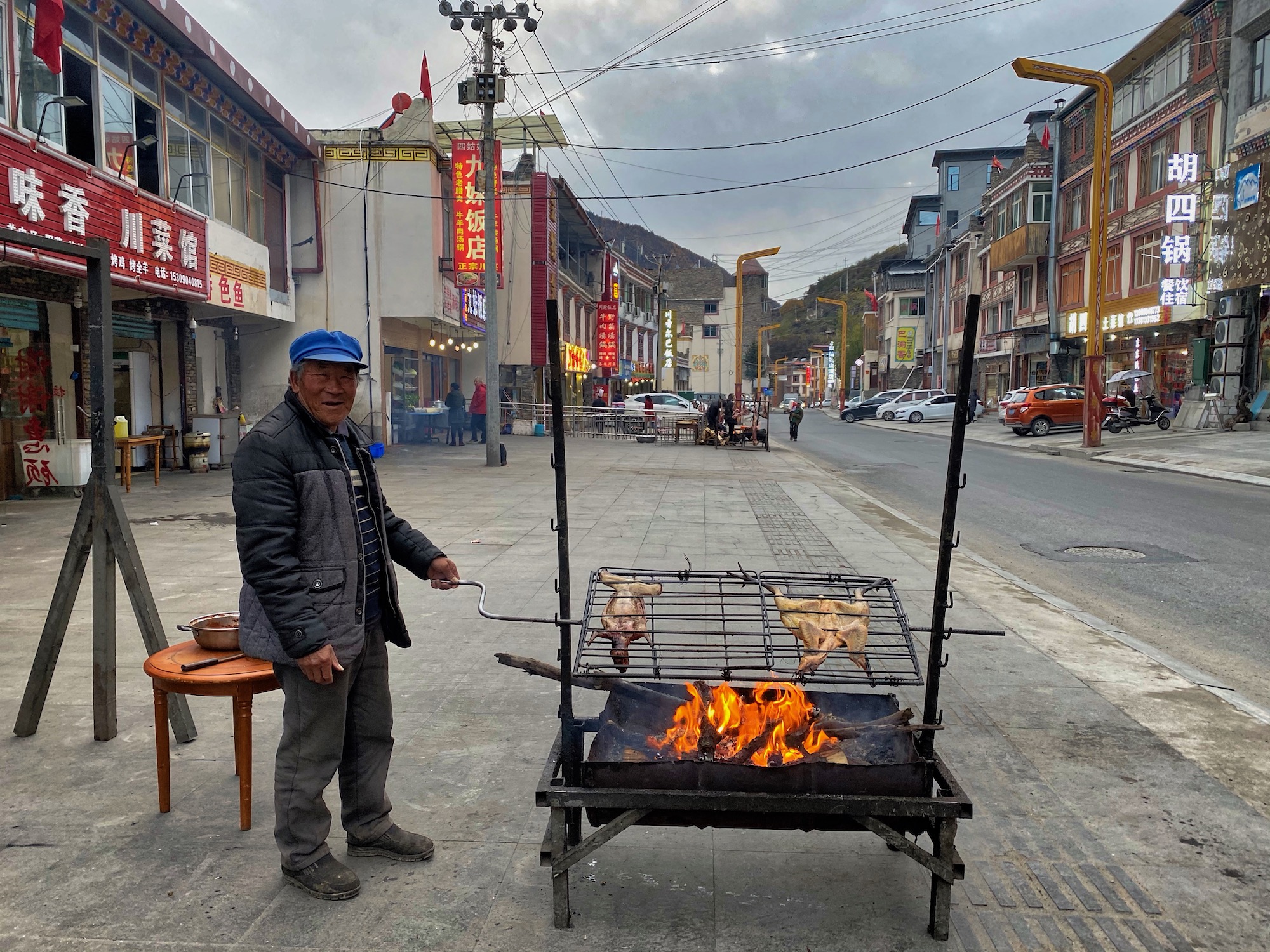
The grandpa from my guest-house family roasting chicken downtown.
Part of the Family
After a short shakeout run the afternoon I arrive, I head to the guest house’s small dining room. The English-speaking hostess asks me what I’d like for dinner, and I demurely gesture toward something on another party’s table. Immediately, this table full of Chinese tourists invites me to join them. We share food, beiju (China’s national liquor), and laughs. More than any other place, western China has taught me that language doesn’t separate us. Hospitality, kindness, and happiness are universal. They’re human. They bring us together no matter where we’re from.
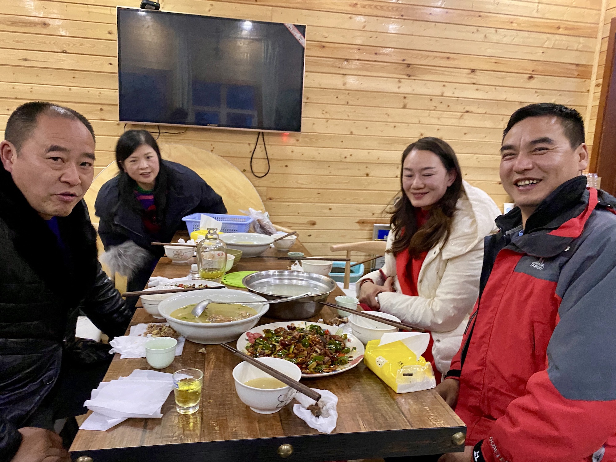
Complete strangers make me feel like family.
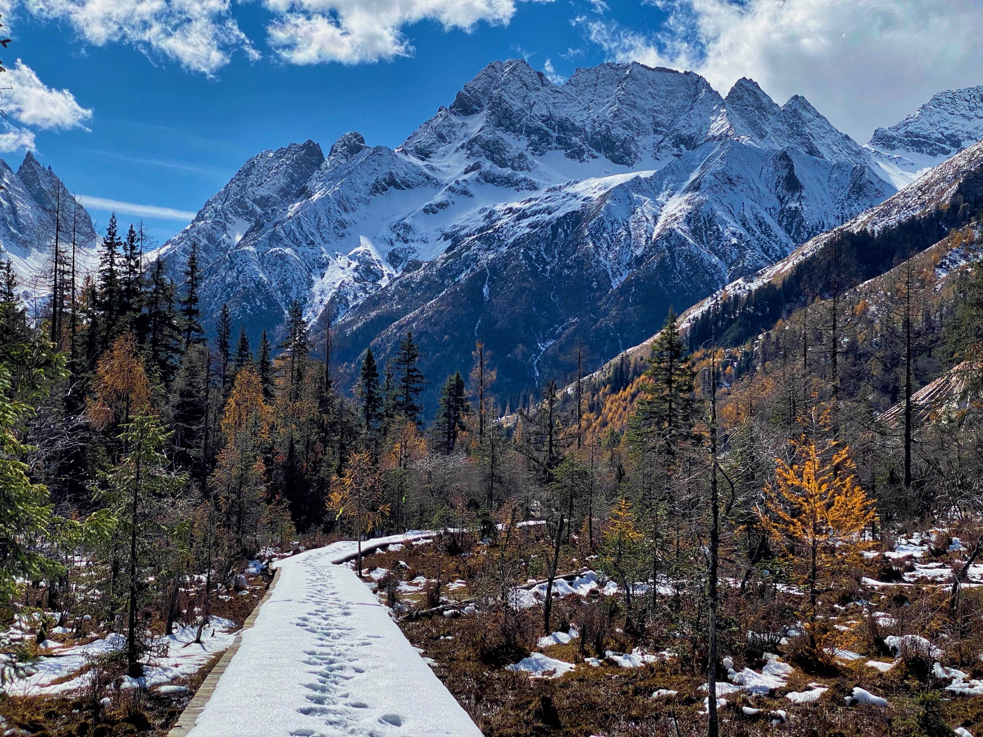
Running in Changping Valley
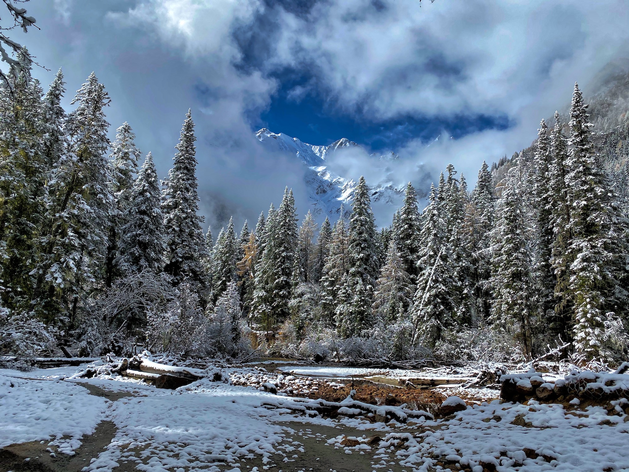
My first full day in Rilong, I head to the Changping Valley, the middle of the three valleys that make up Siguniang National Park. It’s a snowy morning with a low cloud deck. While the weather mostly hides the views, it makes for a more intimate feeling and likely limits the number of other tourists, or at least the distance they venture into the park. Even so, the first two or three kilometers are full of tourists on a new boardwalk. (The countless tourists would quickly destroy any trail in this wet, muddy environment.) Indeed, the first seven kilometers are all freshly built boardwalk, with plenty of steps to climb (and a few to descend). It’s fascinating to watch a national park be built, as small buildings and signs are going up around me. The use of rough beams, stone, and even grass and moss make for exquisite structures that blend in with the natural landscape.
On this snowy morning, a mix of larch, other conifers, and picturesque deciduous trees stand out in the foreground while fading away in the snowy distance. Occasionally, a cliff or mountainside peeks out from the cloud bank. The shallow, braided river next to the path provides a constant soundtrack.
The boardwalk abruptly ends at a Tibetan house and stable. From here, I enjoy a wide, well-churned horse and foot path that continues up the valley. Soon it’s time to turn around and make my way back down Changping Valley. This outing makes me I think I’m going to enjoy my time in Rilong. (The run on Strava.)
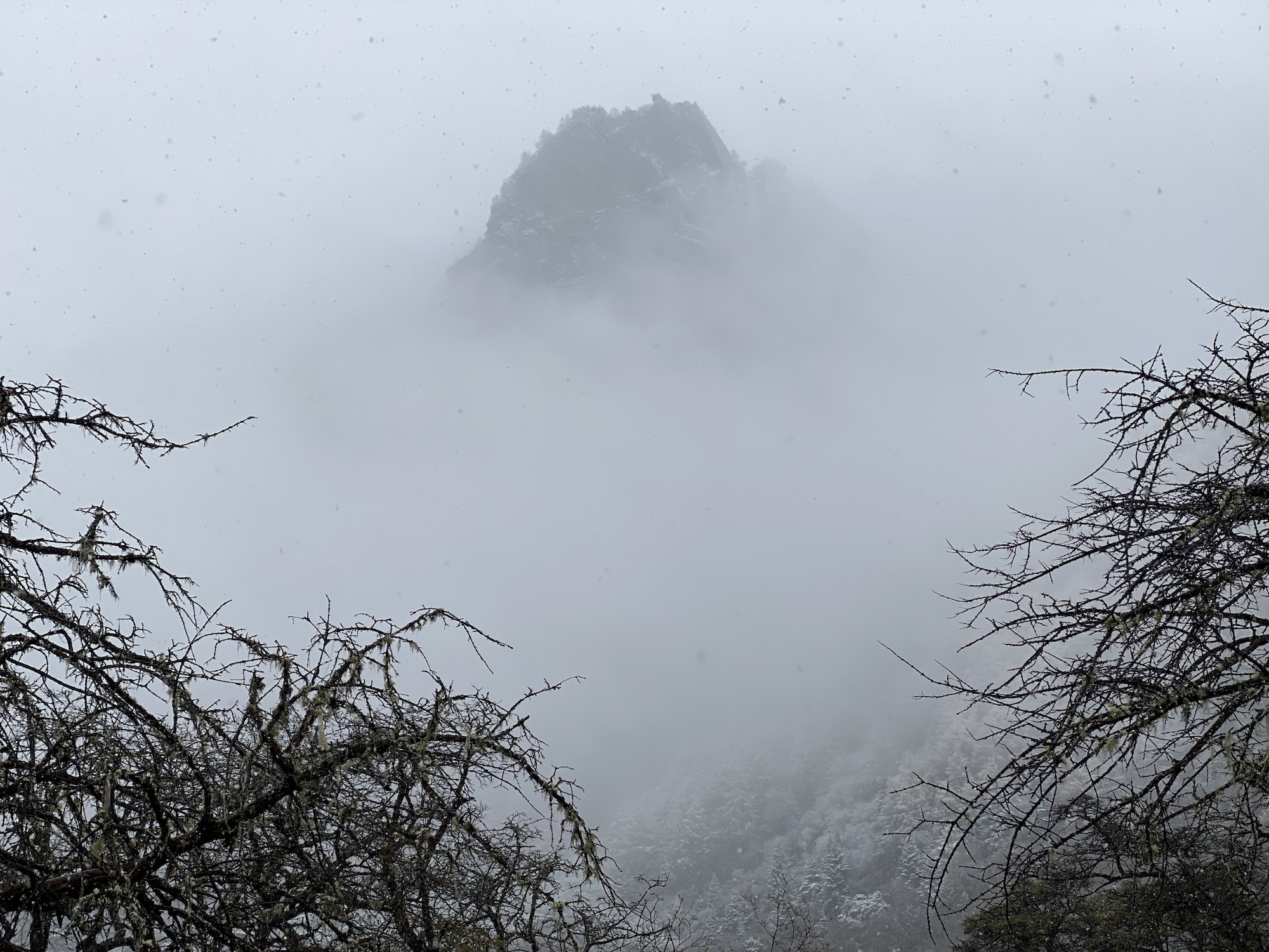
A peak peeks out from the clouds and snow.
Eating (Far) Out
During my time in Rilong, I don’t let language be a barrier. Gestures, a big smile, and the occasional use of Google Translate help me navigate my wants and needs. For example, one day I visit a restaurant in Rilong for a meal. For the past half year, I’ve been trying to learn how to cook Chinese, so I go up to the kitchen doorway, and through a combination of smiles and gestures, ask my way into the kitchen. Once there, more gestures get the okay to take photos of the cook at work. A minute or two later, the cook has me helping cook my meal! This experience and the cook’s hospitality are immediate highlights of my trip. It also gives me the confidence to later join the English-speaking hostess of my guest house as she whips up fried rice one night at dinner.
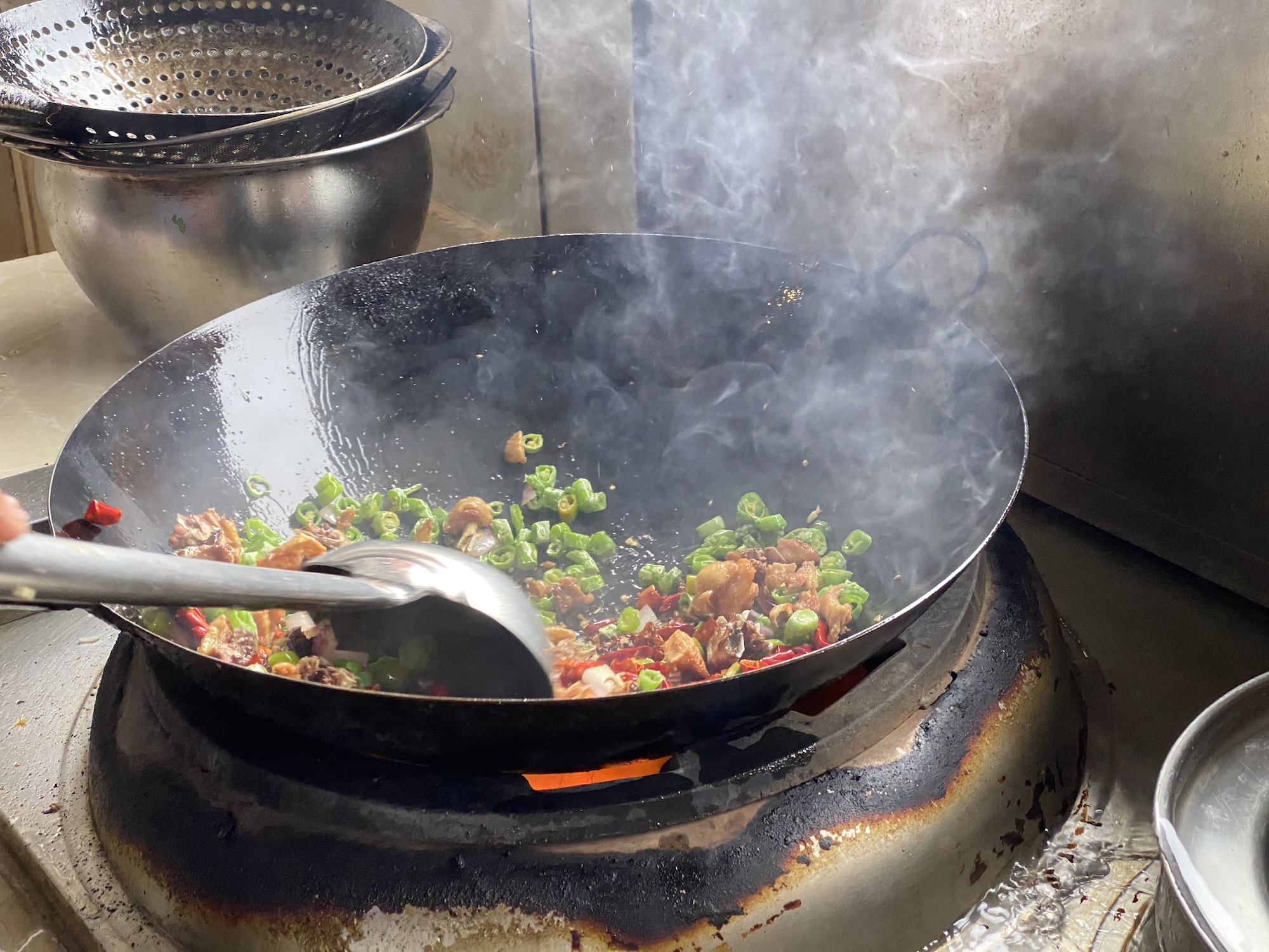
My meal in progress.
Running from “Home”
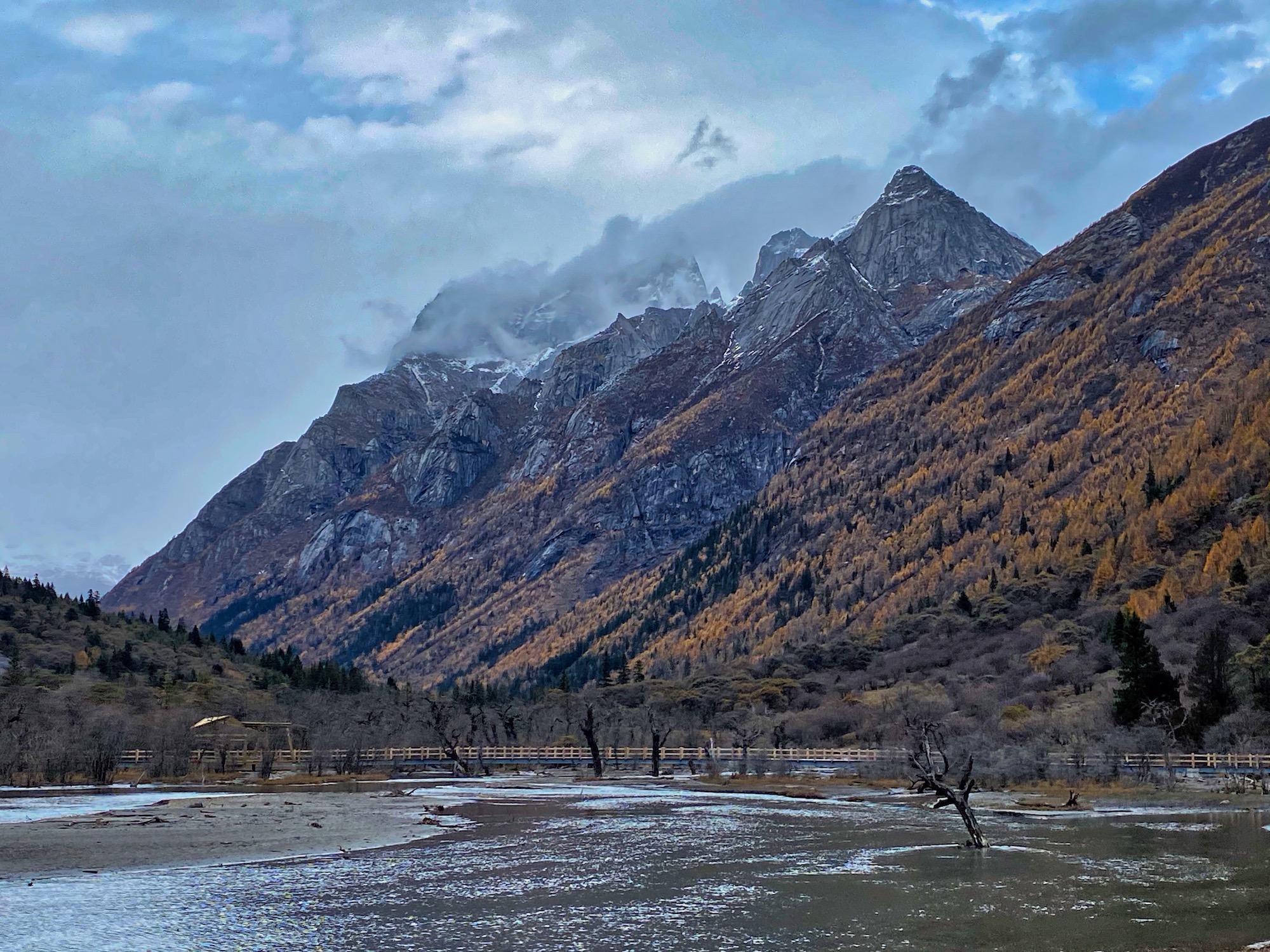
On my second full day in Rilong, I head up one of the many roads that quickly climb the surrounding hillsides near my guest house for a run. The road’s paved for a few kilometers before giving way to dirt. The road is lined with Tibetan homes complete with kitchen gardens and occasional livestock. It’s a nice day and plenty of elderly folks and kids are outside, generally just hanging out. I get some mildly strange looks, but plenty of cheers and encouragement, as well. As the village fades out, I turn off onto singletrack and visit a stupa I can see in the distance. Further singletrack exploration leads me to a ridgetop clearing overlooking the Shaungqiao Valley, one of the national park’s valleys that I’ll see during the race, but will both on an excursion and on race day. The soaring mountains are joined by soaring Himalayan griffon vultures and contrasted by a multitude of tiny alpine flowers that persist into November’s snowfalls. With the setting, the warm sun, and a peaceful mind, my spirit soars, as well. (The run on Strava.)
My first view of Shuangqiao Valley, complete with vulture and peaks!
Ridge Running Between the Changping and Haizi Valleys
With clear skies on my third morning in Rilong, I can better take in the mixed forest around me. I see the countless golden larches as well as Mount Siguniang itself as I climb the boardwalk to the ridge between the Changping and Haizi Valleys. After a mile (2km), a hairpin turn puts me on the ridge. The boardwalk continues upward, but braided human/yak/horse trails also crisscross the meadows and make for great running. It’s my understanding that the local Tibetans hold an annual festival in celebration of Mount Siguniang in the meadows further up the ridge.
The site of the annual Tibetan festival.
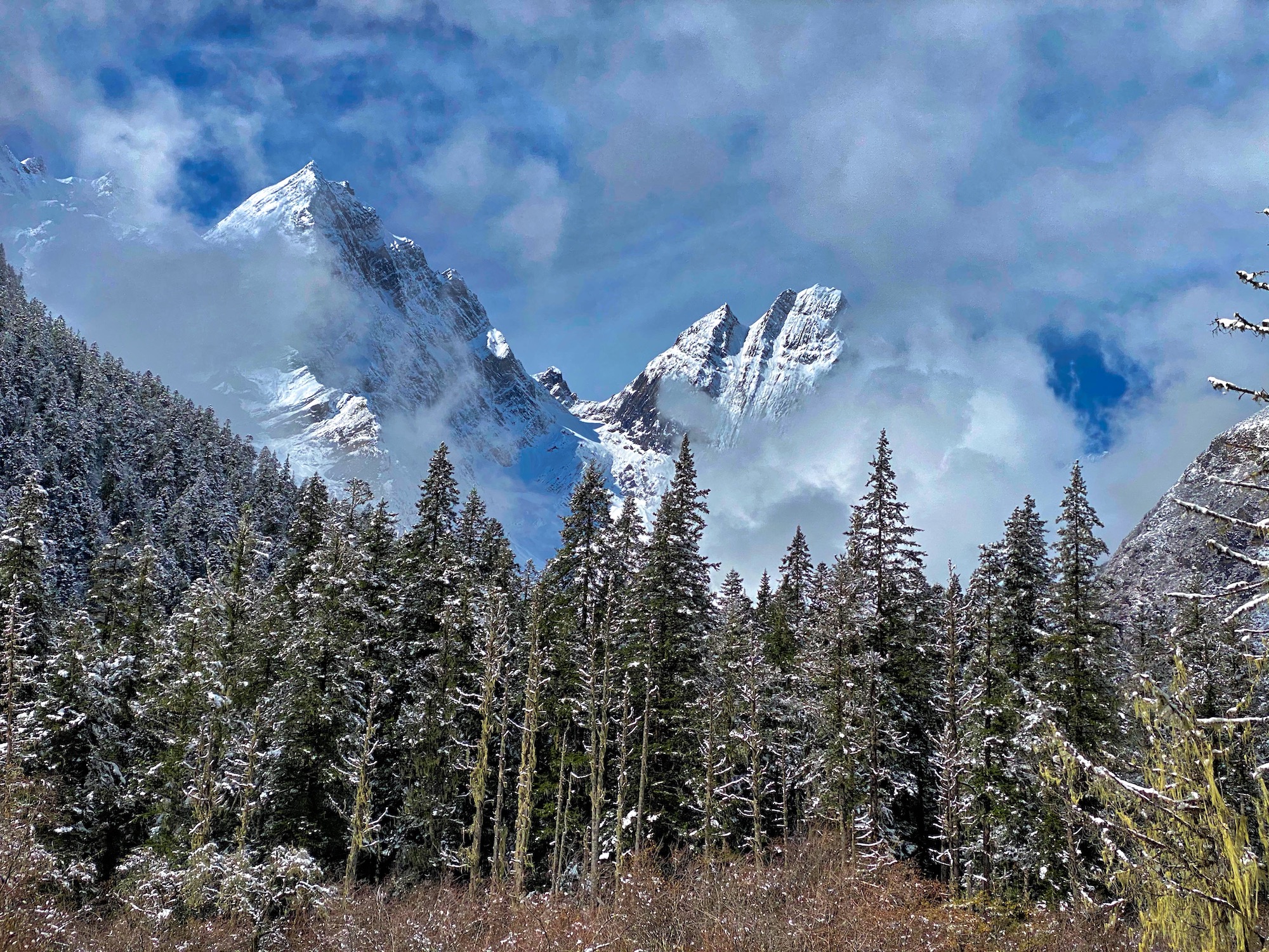
The ridge continues upward, generally offering 270-degree views–that is until I reach one of the flatter meadows that offers a full 360-degree view. It’s amazing to look around and see the 10,000 feet of vertical difference from the river valley beside Rilong to the summit of Yaomei Feng (the Youngest Sister) in a horizontal distance of 10 miles (16km)! Of course, when the ridge’s topography allows, the national park’s namesake peaks are stunning. Indeed, it’s from this ridge that I find the most striking views of this mountain. However, what impresses me most of all up here is that I can now see a multitude of 16,000-foot (4,900m) and a smattering of 17,000-foot (5200m) mountains surrounding me. Neither my GPS mapping applications nor any signage along the trail give names for these peaks. This is big country! (The run on Strava.)
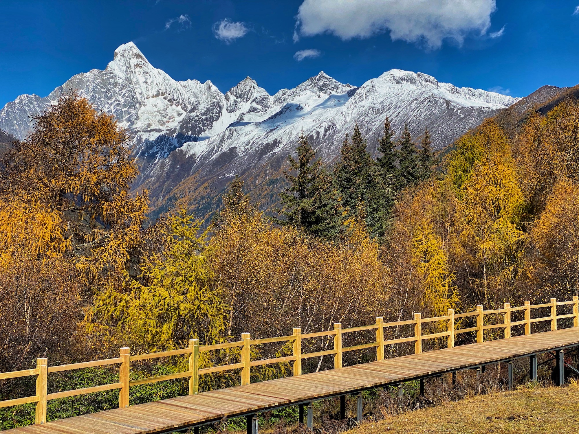
A view of Mount Siguniang over Changping Valley.
My Last Meal
Just a few hours before the race’s late-afternoon start, I make my way to the center of Rilong for a pre-race lunch. I’m flying solo as I approach a tiny restaurant with a kitchen at the front and three tables behind.
This place definitely doesn’t have photos of its fare on the walls, what’s helped me order in other restaurants as a non-Mandarin-speaking tourist. Over the years, I’ve learned the Mandarin names for some of the foods I enjoy, such as chao fan, or fried rice, what sounds like a good pre-race meal. I try to order this from the cook. He points at a few ingredients and I nod, thinking that I’m ordering fried rice with green peppers and “bacon” (i.e., pork fat).
A few minutes later, a plate of stir-fried pork fat, green peppers, and green onions is placed in front of me. Not exactly my pre-race meal of choice, but what the heck. I ask for some rice and roll with it. Just rolling with it is a crucial technique for eating in place where you can’t speak the language.
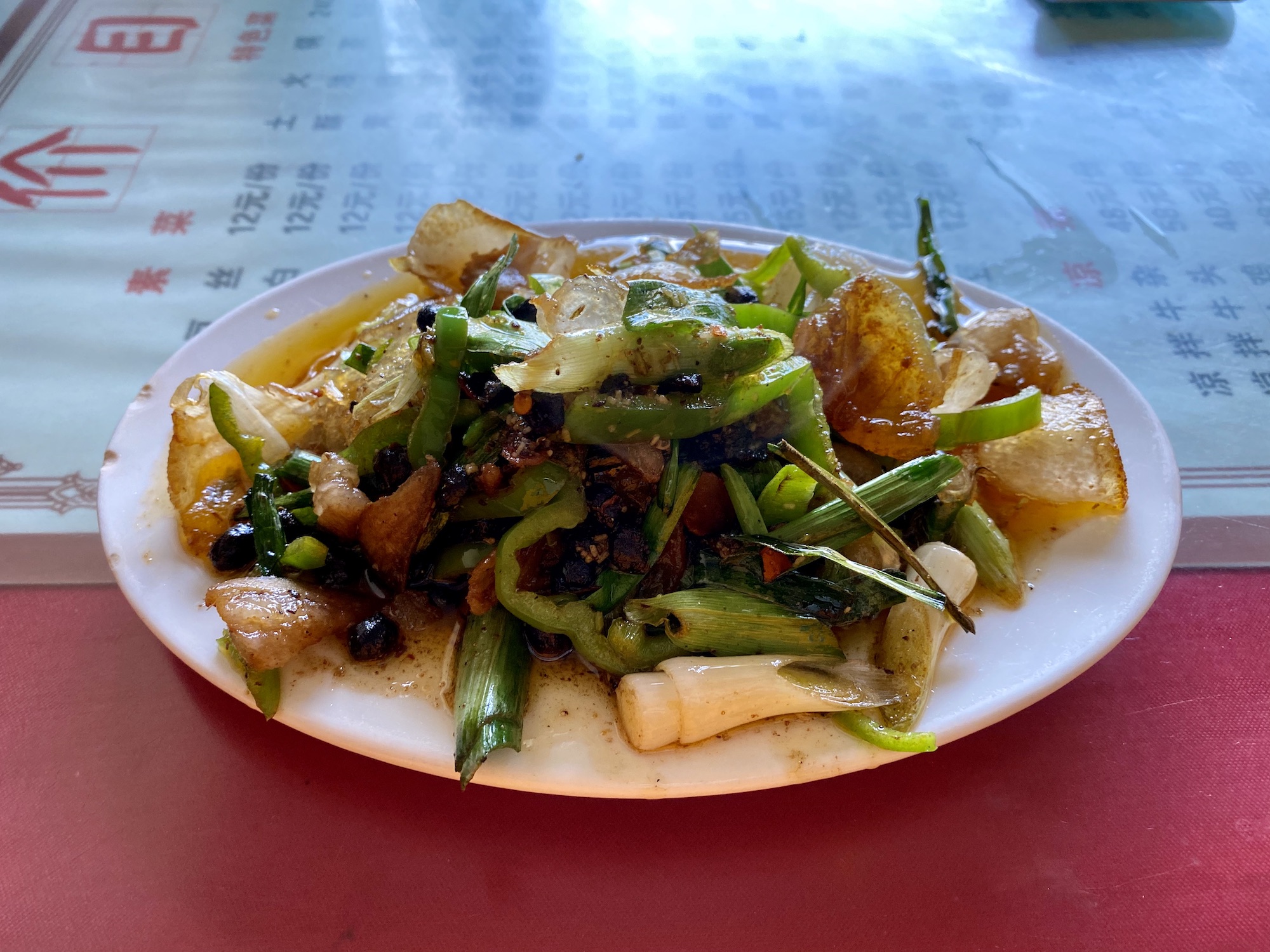
My pre-race meal of bacon, green peppers, and green onions.
Running Ultra Tour Mount Siguniang
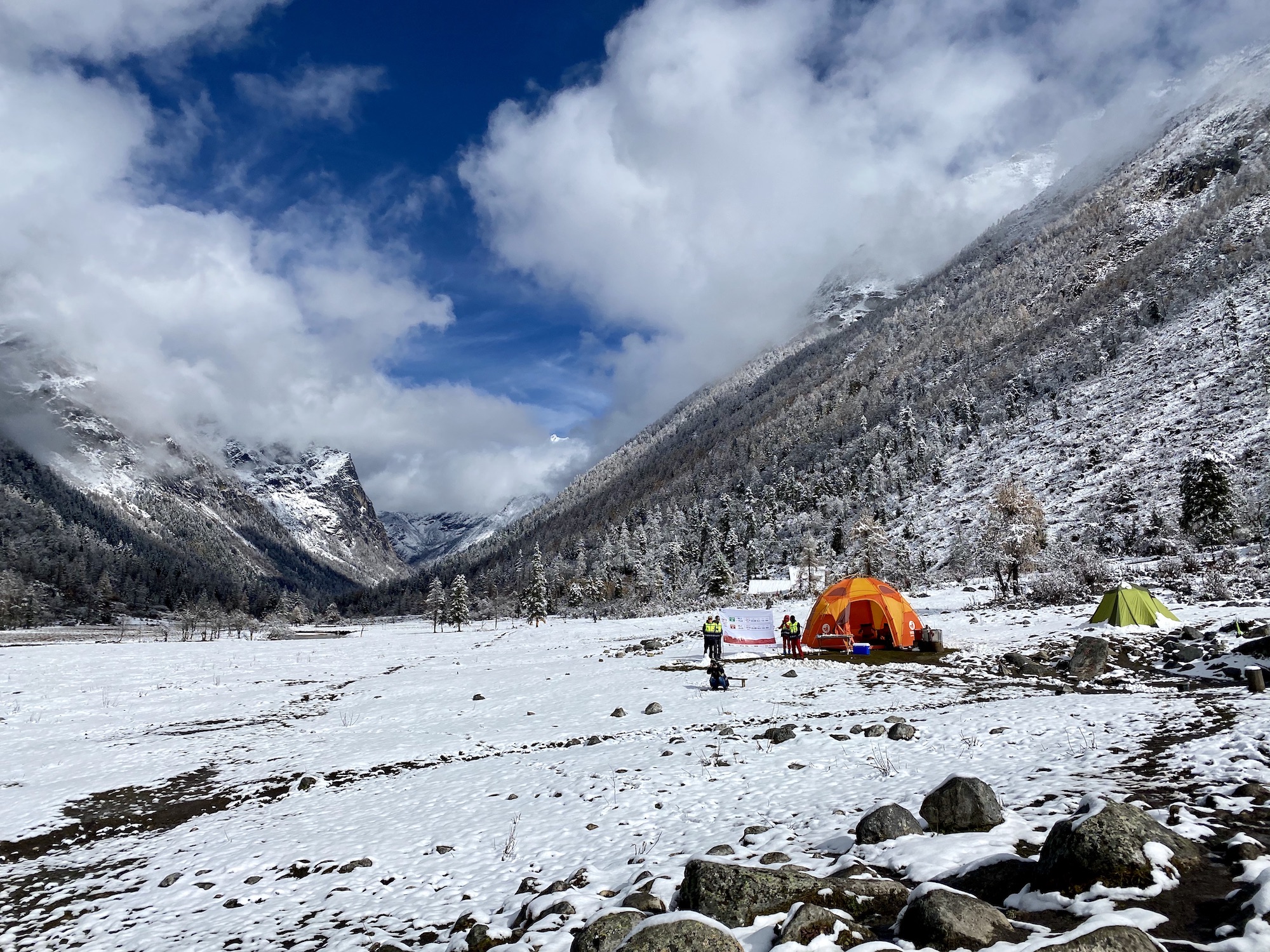
The race start finally arrives. The 110km event of the Ultra Tour Mount Siguniang (UTMS), which tops out at 14,750 feet (4,500m), begins at 4p.m. The start is way up the Shaungqiao Valley at 12,600 feet (3,850m) in the national park and a 40-minute group bus ride from Rilong.
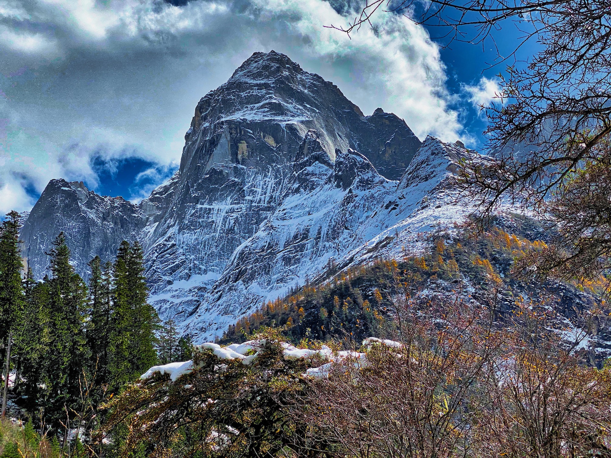
A peak high up Shuangqiao Valley a few days before the race.
A Downhill Start in the Shuangqiao Valley
After arriving at the start, we have a bit of time to move our legs amidst the majestic views. Light snow falls. I’m standing on a starting line in the most spectacular valley I’ve ever seen. It’s like Yosemite Valley, the Tetons, and Tre Cime got together and put on a joint exhibition.
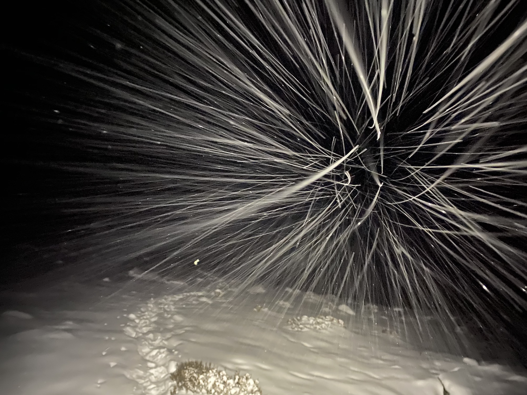
At 4 p.m., the race begins and the course immediately leaves the asphalt parking lot for a boardwalk covered in fresh snow. Unsurprisingly, folks spring out of the gate, practically sprinting. I let them. We have nearly a marathon of descending almost 3,000 feet (900m) down this valley on relatively quick terrain before the race’s first significant climb. It’d be easy to blow myself and my race up before dark. I don’t fight the snow and settle into a comfortable effort while taking photos and taking in the scenery.
Snow-covered boardwalk a few miles below the head of Shuangqiao Valley two days before the race.
A few miles into the race, as we are descending and the temperatures are rising, the boardwalk surface is covered with melted snow. The frequent bends and corners through the forest are slick and require attention. For the moment, the precipitation has stopped. The boardwalk is still in great structural shape here and the flagging is frequent.
To say the next ten miles are uneventful is to not give the scenery adequate credit. I take in the massive mountains as well as the river, trees, and meadows around me. The field is spreading out and everything feels less hurried. During this stretch, we pass a picturesque stupa that I’d visited earlier in the week. I also find myself running with Fritz Hartmann, a German living in southern China. We chat away, both trying to maintain a moderated pace all while having a good laugh at the deteriorating condition of the elevated boardwalk here. In places, the boards don’t look trustworthy while many randomly intermittent 10-meter stretches are entirely missing. In a few spots, the boardwalk is missing for a longer stretch. As needed, we jump down, run on the ground, and then hop back up.
Clouds cover Shuangqiao Valley on race day.
I’m alone again at nightfall when I hit the second stretch of prolonged singletrack trail and it’s burly. It’s rocky and muddy and altogether difficult to run at all. At times, I switch to walking even flat sections because it feels more efficient. It’s a prelude of what’s to come.
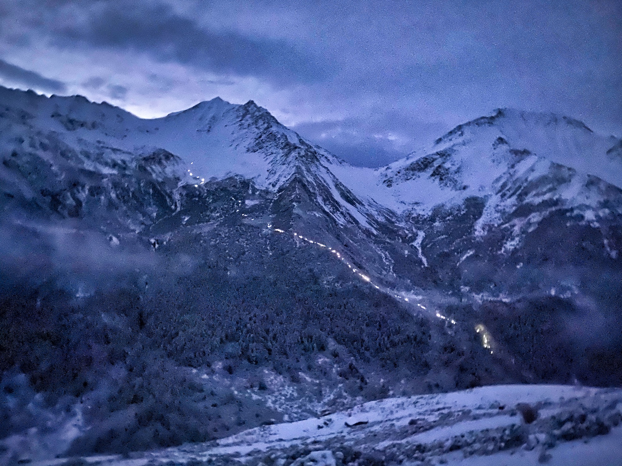
After nightfall, the river valley narrows significantly and so the course hops on the paved road as there’s no alternate path. Having driven this stretch of road three times including a pre-race visit to the valley, I know it’s butter-smooth, new asphalt that’d make a road cyclist drool. With perfect footing, I largely keep my headlamp off save for turning it on briefly when a car approaches. In the near pitch dark, I run effortlessly with the entire universe hugging me.
It’s during this section that I come across an unofficial aid station that a group of locals has set up on the side of the road. I try to run by it, but the friendly beckons of the ten or so folks win me over. As such, I eat some local treats, a nice apple and some mala-flavored (a spicy/numbing combination-flavor common here) yak jerky, on my way down the road.
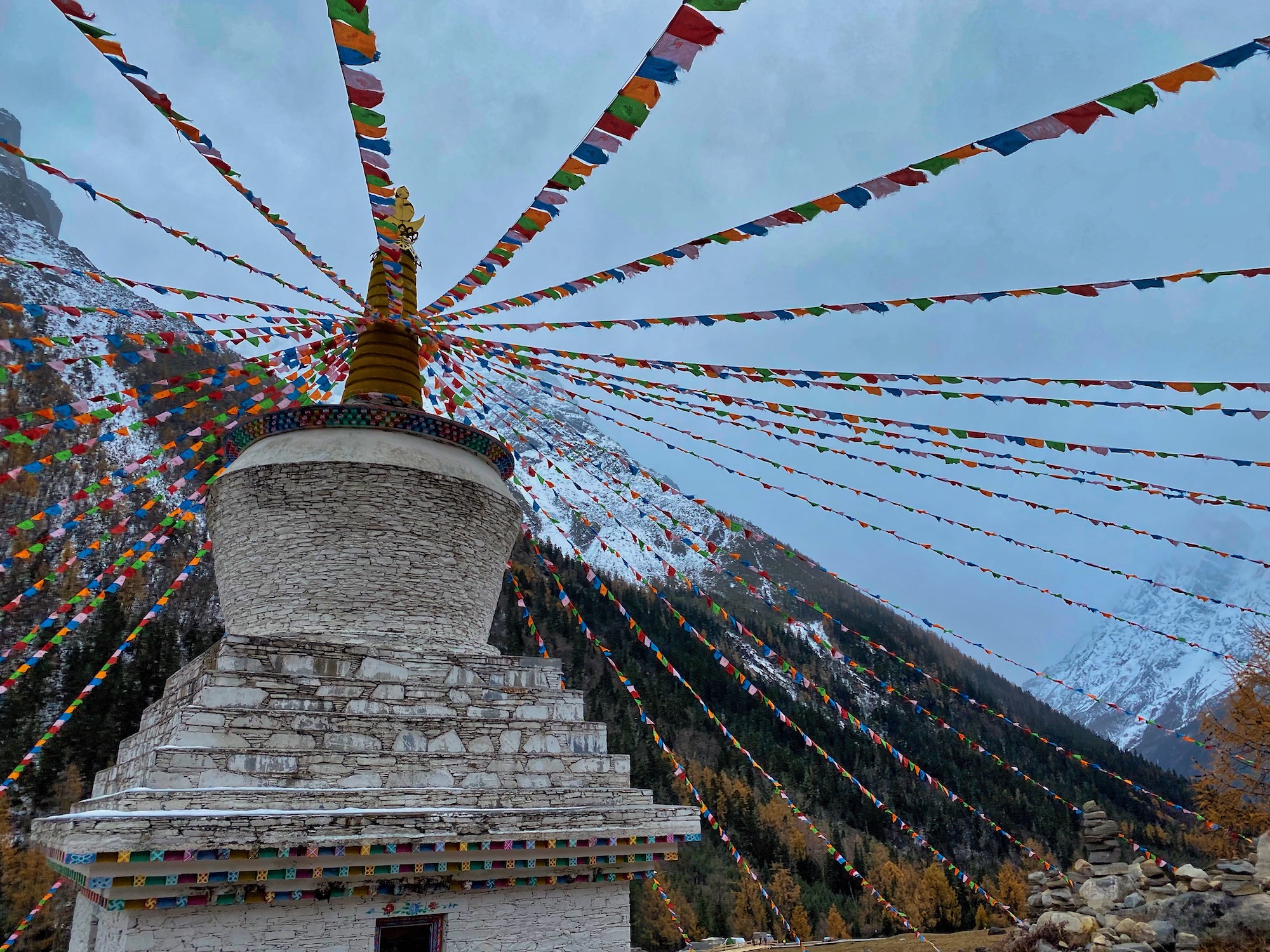
A stupa in Shuangqiao Valley on race day.
The First Hill
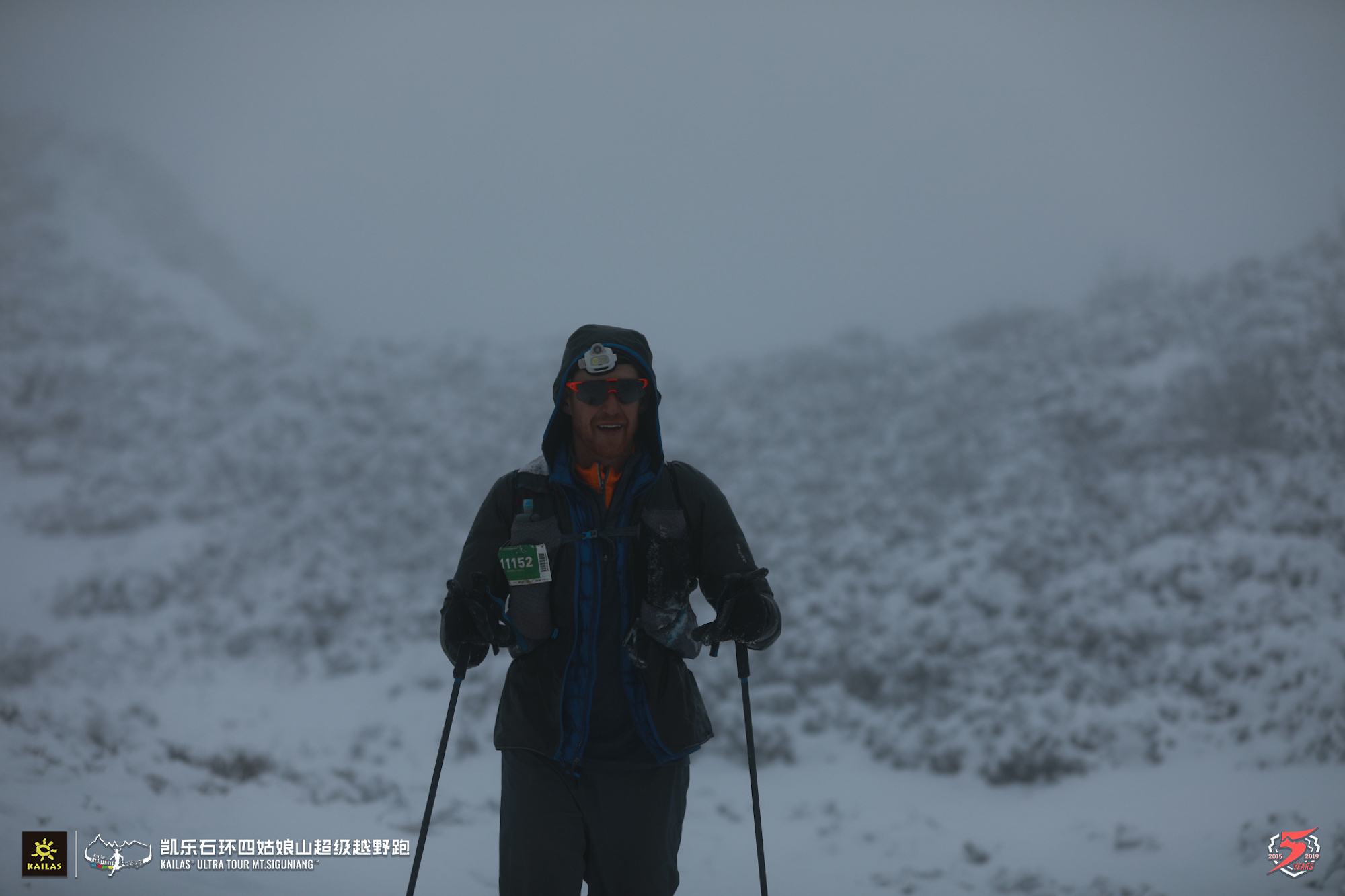
Nearly a marathon and three-and-a-half hours into the race, everything immediately changes as I make the sharp turn from the smooth valley road up a hillside. And, by up, I mean hands and feet, pulling myself up the hill up. It’s like I’m starting an entirely different race! It’s also started lightly precipitating again–at this point a cold, drizzly rain, but that will soon change. First, I have to get up the hill. For the first time in the race, I need to stop and catch my breath as I try to make progress. However, it’s not the first time I question whether this race is real! This climb is several thousand feet in total.
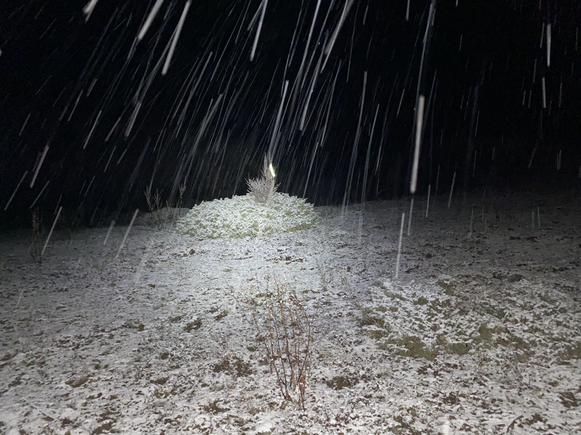
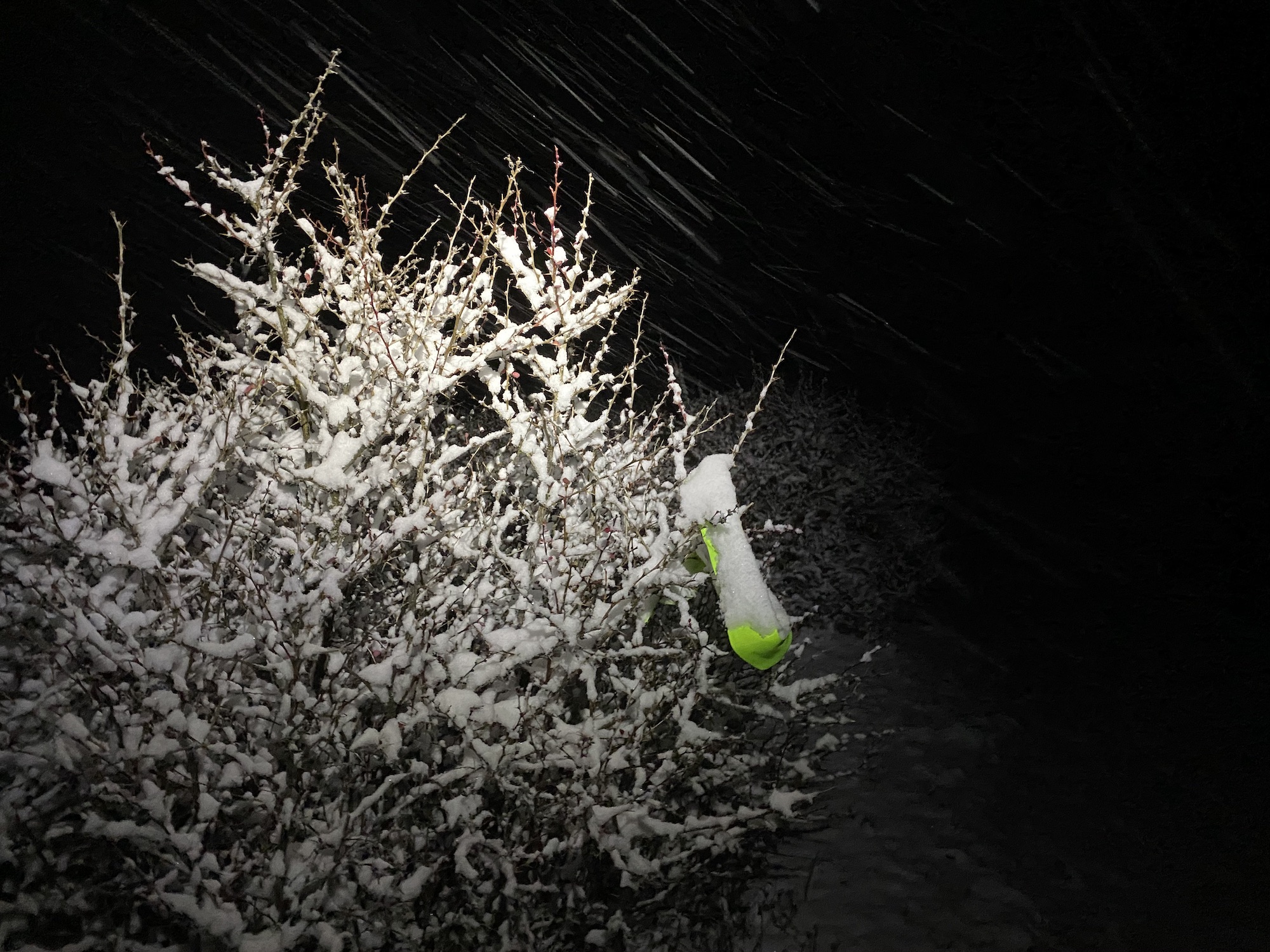
After a flatter section and an aid station, the course goes straight the heck up again! The quick accumulation of ascent also means the rain transitions to snain and then snow, with a slight accumulation beginning. The vegetation grows sparser as I go higher.
Up here there’s no visible path, sparse markings, and few obstacles, so the course turns into a choose-your-own adventure. Going directly from marker to marker up the moderately steep hillside at this altitude sometimes feels too taxing, so I prudently (I hope) zig zag my way up. Snow continues to build on the meadows and shrubs.
It’s choose-your-own-adventure time!
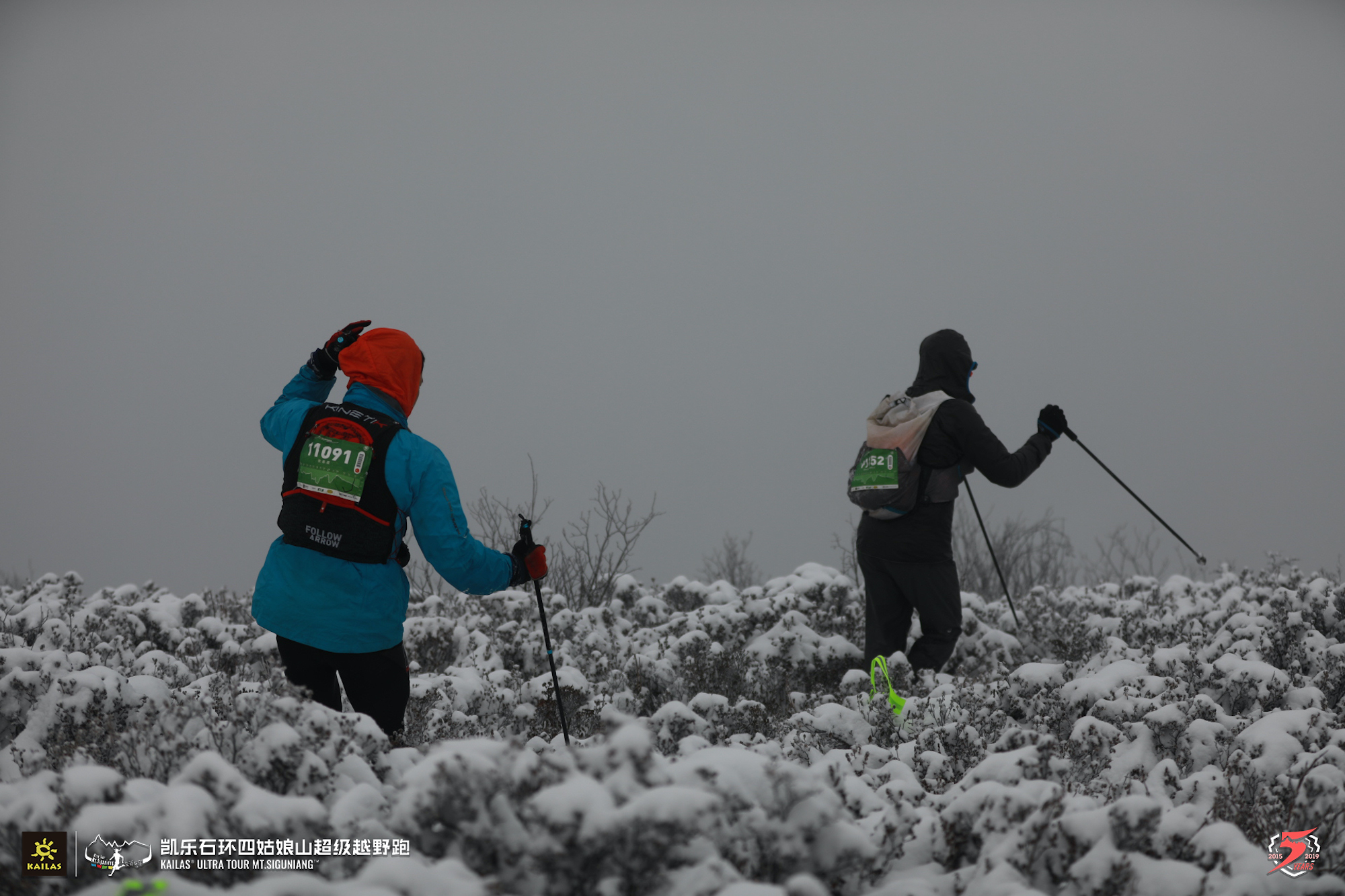
What goes up, must come down and that quickly becomes an additional challenge or, rather, challenges. By now, the race’s green reflective ribbons tied to bushes are snow covered and made indistinguishable from their shrubby hosts. With no obvious route amidst the countless possible paths the locals’ yaks and horses have woven into the hillside, navigation becomes a bit intuition, frequent checks of the GPS route on my phone, and shouts (in English or Mandarin or Japanese!) of route confirmation among the couple other runners around me.
Playing hide-and-seek with the race markers.
Even when the route down the mountain is known, staying upright is a challenge that keeps getting harder as we descend onto wetter, slidier snow. I throw on some YakTrax Pros and, while they help, I still fall plenty, including a full 10-meter slide. Even without injury, the risk of falling and prolonged slides makes for very slow, cautious going in the increasingly wet snow. I began to wonder if (and, occasionally fantasize that) we’ll learn the race is canceled due to these deteriorating and at times dangerous conditions when we pull into the next aid station at Rilong.
Passing Through the Town of Rilong
Eventually, I make it off the mountains and into Rilong. Down here, a cold, steady rain falls. At the aid station, I share with someone who speaks some English how dangerous the conditions are and ask if there’s any talk of the race being canceled. I’m told there is not, so I will go on. I grab my drop bag and go about swapping gear, changing shoes, and filling my pack with plenty of food. The slow progress down the hill to Rilong was useful in shifting my perspective toward more time on the course than I’d have expected from the race’s early, fast progress.
After resupplying, I drink some tea and eat a bit from the aid station. Folks beckon me to a little heater and chair. A Japanese runner, Yokoyama Minehiro, who I’d passed on the long descent comes in and sits with me. We chat about how dangerous the course is before I head out again.
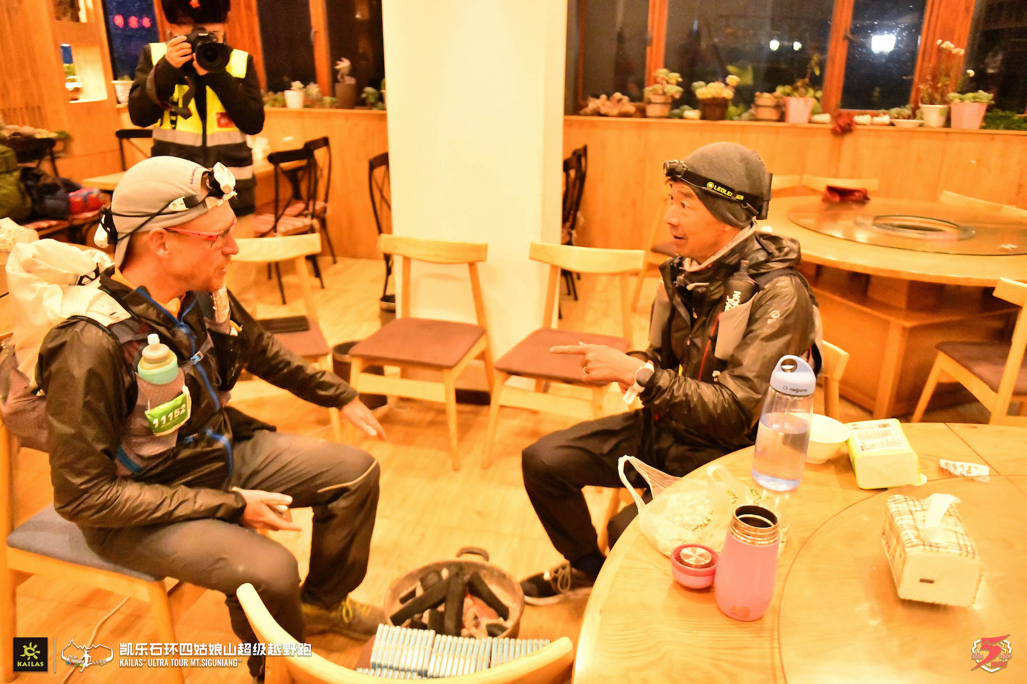
Chatting with Minehiro in Rilong. Photo courtesy of race.
To the Very Top
A few miles after leaving Rilong, I am very much alone. Just me making progress down the rutted, slick, and puddle-filled path on a pitch black, rainy/snainy night. I can’t see a thing beyond my headlamp. It’s not easy, but not hard either and with this tunnel vision, I carry on.
At some point in the night, I come upon a bridge over a swiftly flowing stream. The bridge is all of three logs tied together. With several inches of snow upon them, any previous footprints covered by fresh snow, and a decent enough drop to the water, I get down on all fours and crawl across. No shame.
After a short traverse along the river, the route turns upward. This is it. The climb. It will be 2,250 feet in 1.4 miles to over 14,700 feet, the course’s high point. I’m in good spirits, well fueled, and well acclimated. I climb the steep trail while the snow deepens. Eventually, there’s older snow under the fresh.
As I climb, the pitch, snow, and altitude combine to slow my progress. My heart rate’s low, but I just can’t move quickly. Both the surroundings and I are becoming cold. I pull out my trekking poles and get to work. Instantly, I’m moving faster. Sweet! Nearly as instantly, my hands are really cold from clutching the poles, and so am I after my brief pause. Not so sweet!
I’m wearing my two pairs of gloves. I should pull out handwarmers and more clothes, but I think I’m closer to the next checkpoint than I actually am. I push on through the rest of the climb to the aid station nearly 40 miles (63km) into the race. I’m resolved to quickly add warm layers as soon as I get in the tent. I attempt this, but my meat-stump hands don’t make for quick work. I quickly start to shiver uncontrollably. The race folks offer me hot water, I accept, and proceed to gag on it. I ask if there’s a place I can lay down. They take me to a neighboring tent.
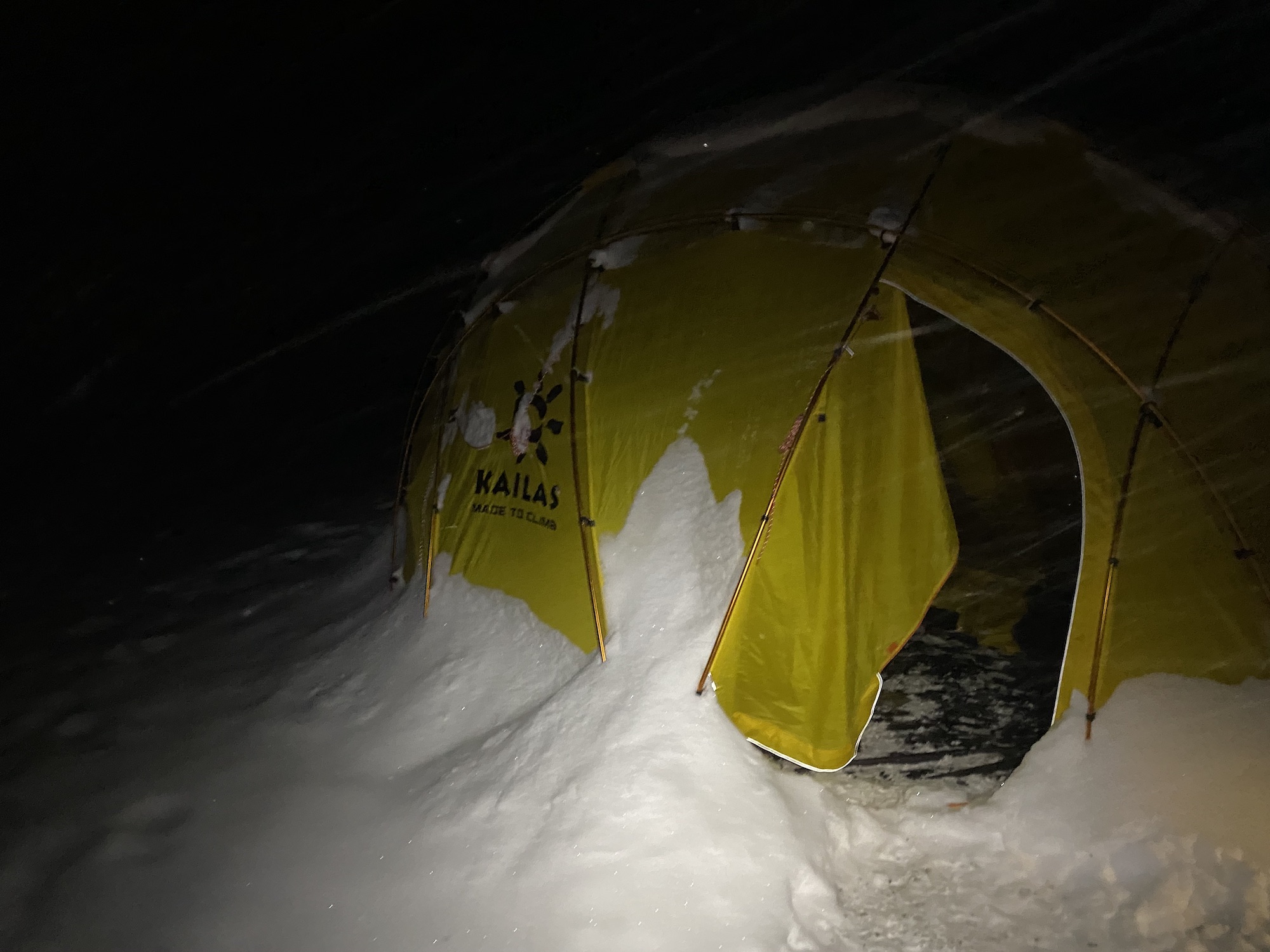
One of the snow-covered tents at the high-point aid station.
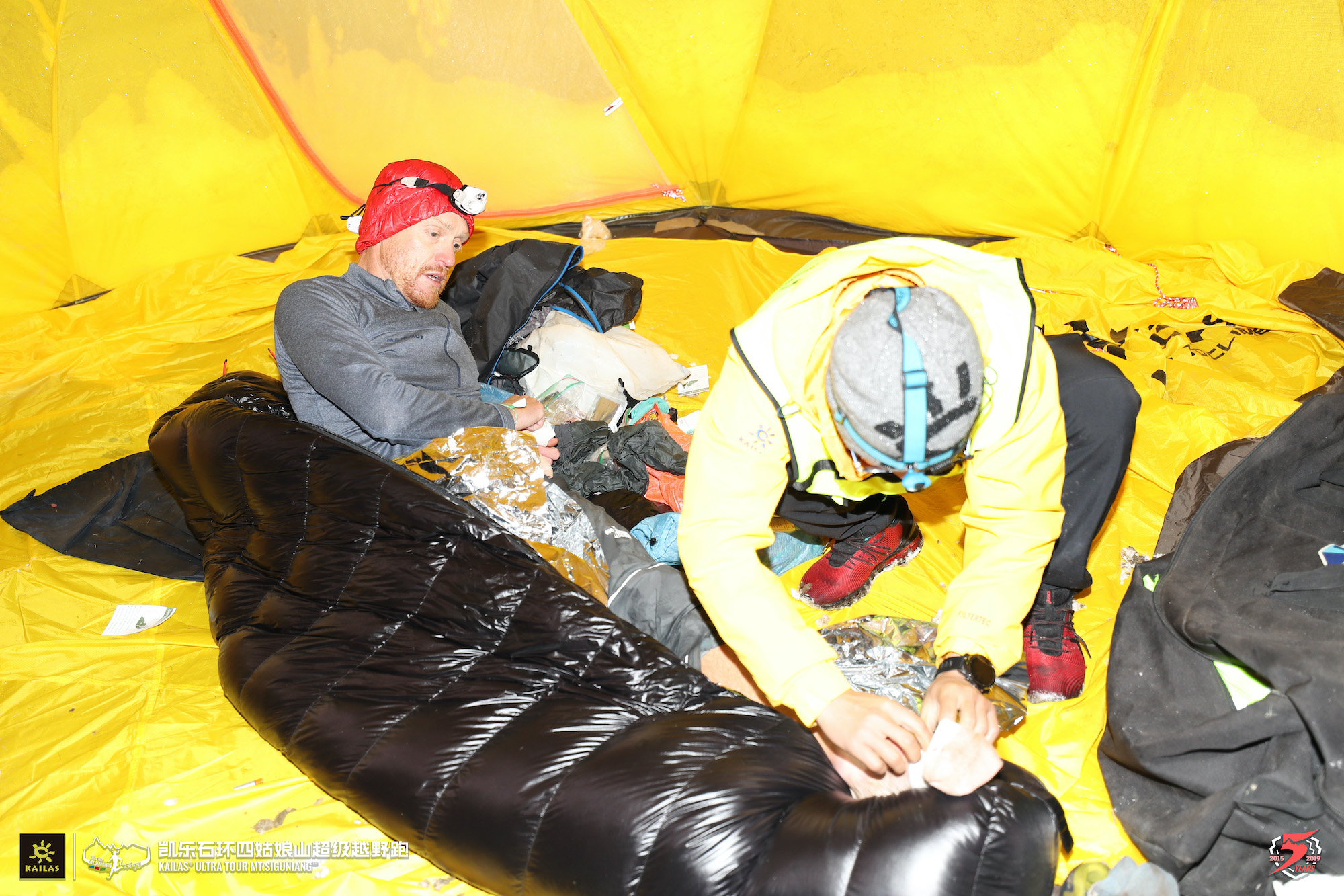
I continue adding layers while they wrap me in a sleeping bag. I ask for them to fill my two water bottles with hot water, which I place under my armpits. We work together to put chemical warmers on my core, hands, and feet.
With the initial scramble to warm up over, I set about eating and drinking. After some point, the race organization tells me I will have to turn back. I gather that the snow in the next section is thigh deep and that only the race leader will go through. (Apparently, I’m in second!) Eventually, I understand that they’ve made a last-minute decision to turn the race (and not just me because of my mishap with the cold) around here, that the race isn’t canceled, and that we are reversing back down the climb to take a lower traverse route to the next aid station.
The aid station staff took great care of me! Photo courtesy of race.
I head back into the snowy night, warmed and fed. In the hours that follow, I don’t know if I’m running an 80km or a 130km race at this point nor the route it will take. But I’m getting ahead of myself.
During my hour in in the aid station, two runners–Chunrong Zhang of China and Minehiro, who I met earlier–came and went, so there’s a bit of a trail back down the mountain. Although the descent is steep, the colder, deeper new snow on existing snow is quite stable. Between wearing my Yaktrax Pros and a half-glissading approach, I feel in control and enjoy the descent back down to the river. Soon I’m on the improvised traverse route. While the race has quickly mobilized and most of this section is marked, I do encounter and overtake the marking crew. Afterward, it’s clear that I follow this main path to the aid station.
The snow coming down as I leave the high point.
Once past this aid station and reconnected with the original race route, it’s off for another steep and challenging climb. I feel good and catch both Zhang and Minehiro. Despite my feeling well, this climb warrants frequent, short rest breaks. It’s brutal.
With the climb over, it’s time for some high-altitude traversing through half a foot or more of fresh snow. A few tracks and the lack of shrubs make it clear where I should go. I just need to pick efficient lines, so only the cold is taxing at this point.
Runners from another race climb a neighboring mountain.
As dawn comes 14 hours and 45 miles (72km) in, it’s now time for the most mentally challenging section of my race. For all its seeming benignness, it’s a doozy. First of all, first light doesn’t make it any warmer and it’s still dang cold high up on this mountainside. The terrain is mostly shrubs with some openings between them. Every once in a while, I see a marker and have to figure out the least horrible route there. I see no paths. Everything’s snow. Descents aren’t quick, the sidehilling slow, and uphills crushing at this point. I thought I had only a short stretch to the aid station, but it lasts seemingly forever. The falling snow gives way to just clouds. Sometimes, I see stars through the clouds. The weather’s done.
I half expect and more than half hope that the race will be re-routed from this next aid station. Before the race (and before any snow had fallen), the organization warned of how dangerous the extremely steep descent from the next aid station would be. Given how dangerous the first big descent actually was and having heard that this one was more difficult, I’d more or less decided that I’d withdraw from the race and make my own way back to the finish if the race wasn’t rerouted. (Based on my pre-race exploring, I knew of longer, but safer way down.)
Coming into the aid station after the long traverse. Photo courtesy of race.
Racing for the Podium in the Changping Valley
Finally, I make it to the aid station. A photographer here confirms that the race will continue on the full, original course. I slump. That’s it. I will quit the race and head back to town on my own. I really didn’t want to descend this trail! I share my thoughts, but the photographer explains that she’d come up the trail, it wasn’t that bad, and I could do it. It takes some convincing, but I’ll go on.
In this time, Zhang and Minehiro arrive at the aid station, and as I get up to leave, so does Zhang. He follows me most of the way down the hill, which is a ridiculously but manageably steep trail with lots of rocks. It’s all snow at the top, then the snow gets wetter, and, eventually, it’s wet snow on slick mud. All of it’s plenty slick and there’s plenty of sliding. The race has fixed ropes in some of the sketchier places. Once down in the mud/snow mix, Zhang takes off and is quickly out of sight. I have no interest in pushing my luck on this rugged trail!
Zhang following me out of the aid station toward Changping Valley. Photo courtesy of race.
So, now I’m down in the relative flat of the Changping Valley. It’s daylight and warming, but the footing is all mud and rock and the course heading up valley, so I’m mostly sludging along. I keep eating and drinking and taking care of myself. Relentless Forward Progress is the game. Though I believe I’m in third place now, I don’t care about my position and, besides, there’s no one around me.
Up high in this valley, the course heads two miles to an aid station before doubling back on the same trail. As I first start the out-and-back, a runner who I believe to be the race leader–Tianliang Yu of China, who I’ll meet at the finish line–zooms past. He’s got an hour on me. I keep waiting to see Zhang in second place, expecting him to come by at any moment. When I do see him, I time the span it takes me to get to the aid station. Seven minutes. So, with a few minutes of planned aid-station time to come, he has more than fifteen minutes on me. Phew… I didn’t even have to think about trying to catch him. He’s long gone.
A view up Changping Valley.
When I reach the aid station, I finally shed my running pants and grab an apple for the road. It’s little things like this, a tight connection between a place and a race, that really pull me into the locality. I love it.
The penultimate aid station, the turnaround spot in Changping Valley!
Heading back downstream, there’s just enough extra gravitational assist that I’m more or less running everything. Not fast, but I’m running. I feel good and am excited to make progress toward the finish. So I do.
A view down Changping Valley.
Maybe six miles (10km) from the finish line, I am surprised to come upon Zhang. He’s moving fine, but I guess I’m moving better. We both give one another encouragement and carry on.
Catching Zhang.
Damn it! I’m in second. Now, I’m gonna have to give some effort. I hold my pace down some boardwalk and can’t even remember stopping at the final aid station. I don’t think I did.
The course turns upward. I pull out my poles and start pulling. Up, up, up. The footing’s suboptimal, but it doesn’t matter on the climb. Then, time for a generally climbing traverse. Under fences, through bushes, up and over and around. There are lots of runners from the shorter races on the trail now, and everyone is encouraging. I’m moving really well. Near the top of the climb, the route settles onto a path and I can occasionally take in views of the valley below as well as the far-off mountains. I can sense how close I am.
I can’t see Zhang behind me, but I envision he’s not far off. I keep giving my best, even using my poles on the flats. I’m jamming out to music in my headphones, enjoying the fact that I’m still moving so well after 20 hours of effort, and appreciative that I’ve made it this far.
A mile or two from the finish, I see someone gaining very quickly from behind. I can only guess it’s one of the other 110km runners. He quickly catches me. It’s the USA’s Tim Tollefson who’d raced the 50k event earlier and is now out for a recovery jaunt. Ha! I appreciate his encouragement as he goes by.
With the finish now in sight, I negotiate my way through the maze-like walls and fences at the outskirts of Rilong before dropping onto the main streets. Emotions well up within me. I’m doing this! I cross the finish line. I did THAT!
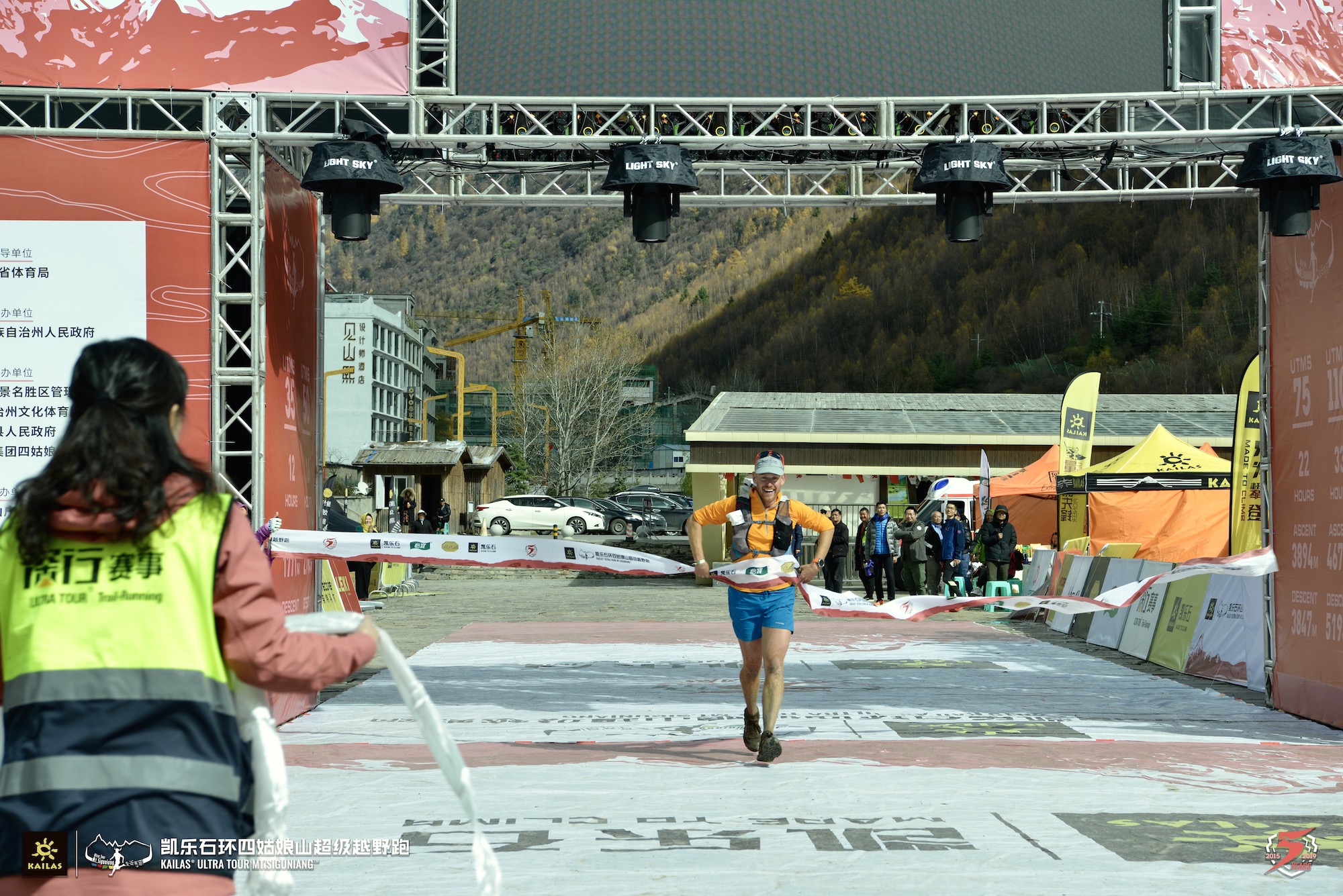
Crossing the finish! Photo courtesy of race.
Wow! What a journey. Rain and snow and mud. Slippery steeps. The cold. Endless route finding. Had I known what was to come, I might not have picked this journey. But it’s one that I do and will appreciate for a long time. Maybe this was Type 3 fun.
Post-Race, Stuff Face
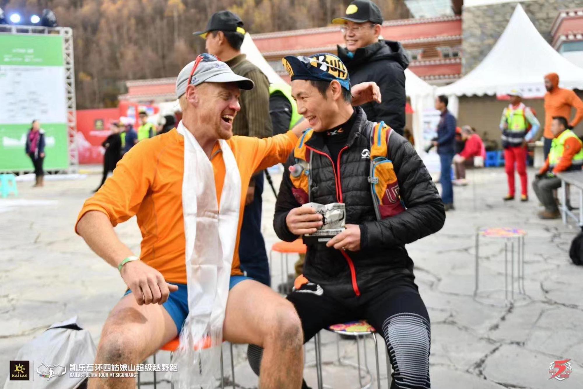
After 21 hours and 50 minutes on the course, I hang out at the finish with Tim along with Nate Fan and Jie “LJ” Lin, who work for Coros in China. I also have great exchanges with the race winner Tianliang Yu (20:35), the third-place finisher Chunrong Zhang (22:25), and members of the local sporting board. Eventually, I get a lift back to my hotel where I clean up and have a couple-hour lay down.
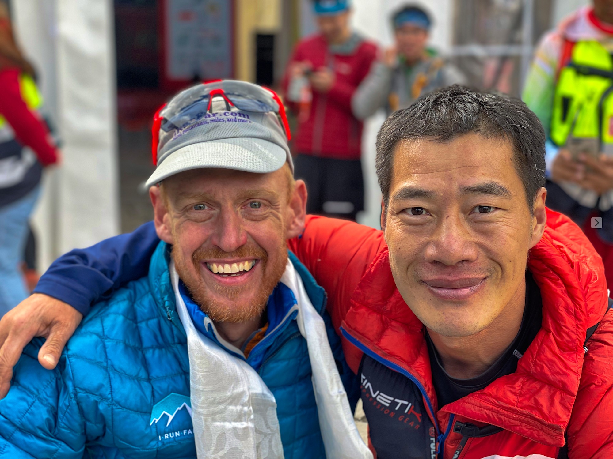
Chunrong Zhang and I at the finish. Photo: Nate Fan
I enjoy a nice dinner in town with the Coros crew before heading up to the awards ceremony. While I didn’t have much sense that I took second when I crossed the finish, the podium and amazing award help it to sink in.
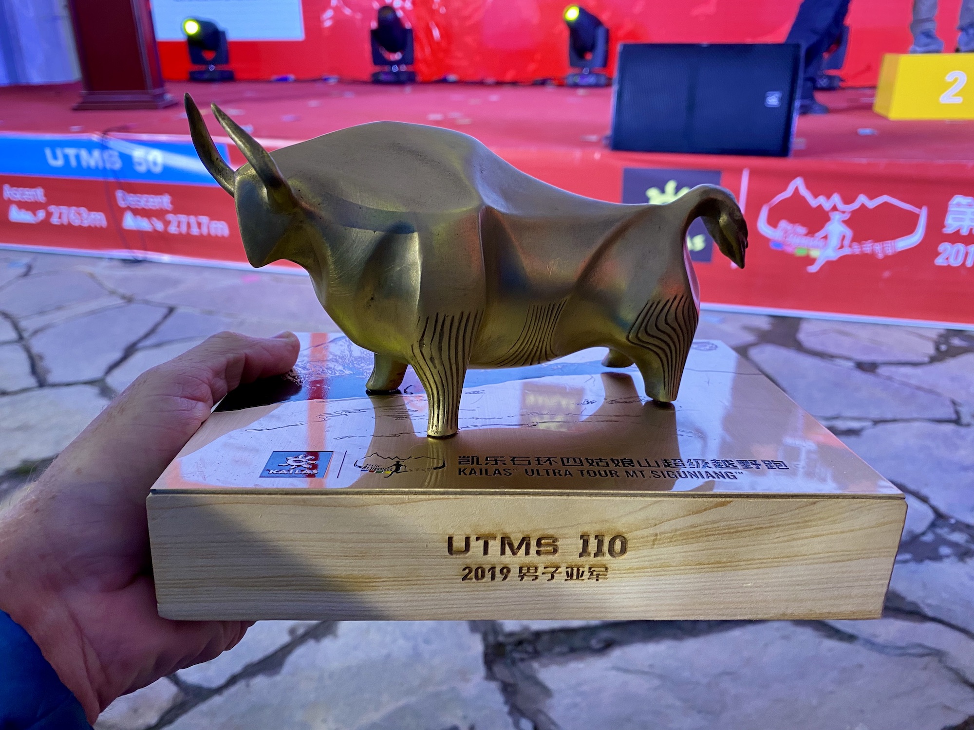
Race awards were these amazing yak statues.
The next day, after a full week in Rilong, I bid it good-bye and return to Chengu, where I’ll have a day and a half until I fly home. I feel the sudden and stark contrast between the rural life of Rilong and urban life in the heart of Chengdu.
One of my favorite things to do in a foreign city is to wander alone at night, so I set off for an hour’s meander. When I decide to head back, three similarly named hotels make my destination unclear. It takes some more wandering and, eventually, a taxi ride to reach my correct hotel! Ha!
I have the next day to myself and spend it wandering the city and collecting a few items to bring some of this special place home for me and my loved ones. First, I visit the Wuhou temple. What a place! It’s an ancient Buddhist temple last rebuilt in the 17th century and clearly retains those historic features, but it’s also awash in tiny, tourist-oriented shops and eateries. There, I pick up some nice chopsticks for home and a couple trinkets for my nieces. After leaving the temple, I spend at least as long sauntering around Little Lhasa, as the Tibetan Buddhist community in Chengdu is sometimes known. Here, I purchase a few Buddhist and Tibetan cultural items, which I find benefit my mindset back at home.
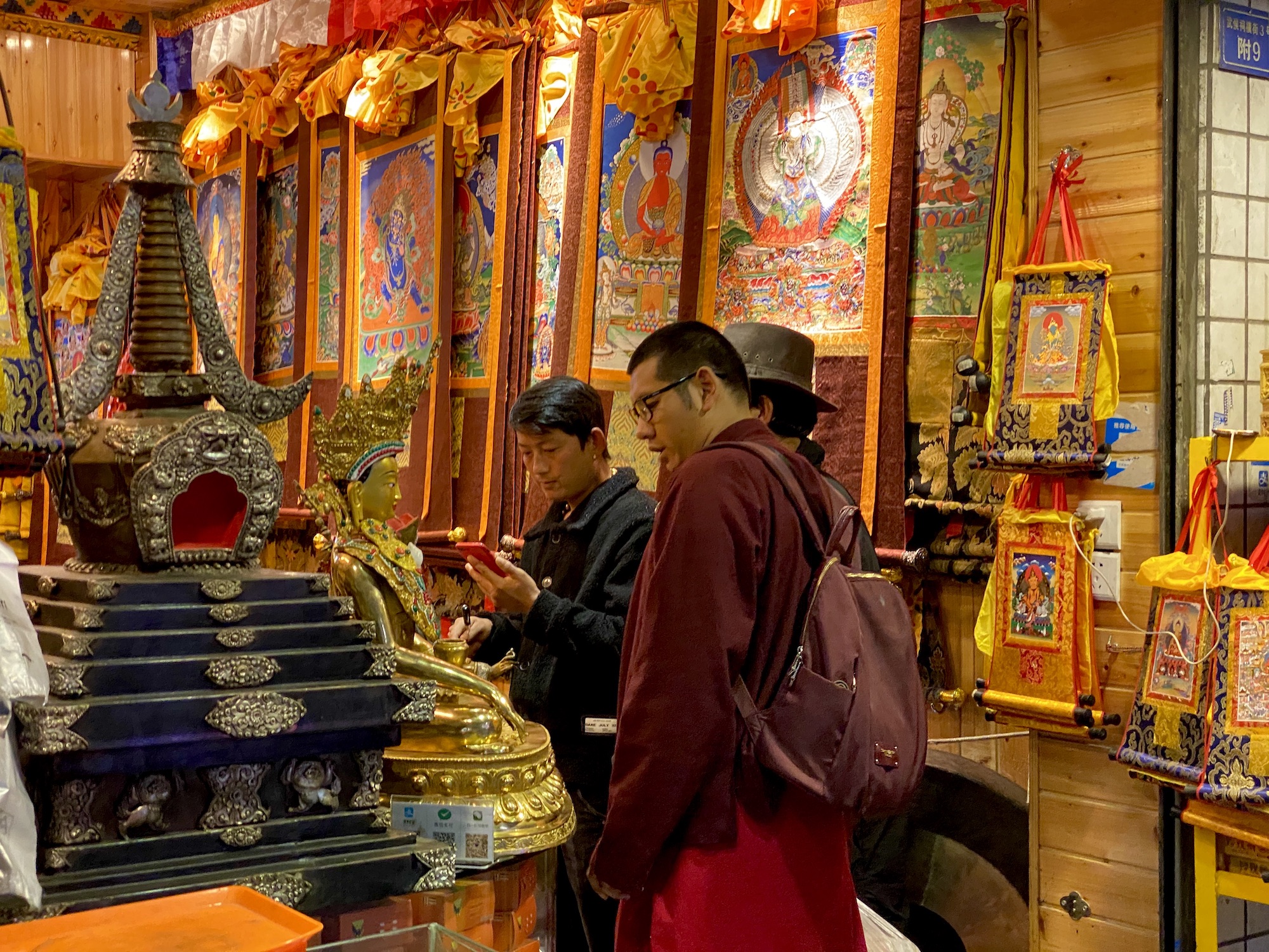
A monk shopping for supplies in Little Lhasa.
After a quick (both short and surprisingly speedy) run, I head back out for dinner with a couple Americans living in Chengdu. When I messaged friend Justin Andrews that I was visiting the city, he very kindly invited me to join him and his girlfriend Deana along with his friend Kyle for dinner. We spend a great evening chatting about running and adventuring in China. It’s a perfect wrap-up to a wonderful trip that leaves me awash with ideas for future trips here.
I don’t think I’ve yet distilled quite what it is about western China that I love, but the landscapes, people, food, and so-different-from-home feel all have something to do with it. I’ve certainly confirmed that I do love visiting it. I want to experience more of its people, places, and food. And I want to share that with you.
Me with winner Tianliang Yu after the race. Photo courtesy of race.
Call for Comments
Have you spent time in Sichuan province? If so, what did you enjoy most about the experience? Did you have anywhere you really enjoyed running there?
