![]() In the shadow of Pikes Peak, “America’s Mountain,” lies the small, eclectic town of Manitou Springs. Manitou is well known for its bizarre geological features, “olde time shoppes,” fudge, the cog railway, tourist t-shirts and natural mineral springs. But, just like tea leaves in hot water, M-tu is also steeped in trail running goodness. The trails are easy to access and the running community is, of course, welcoming. And while I could go on about the uniqueness of the area, I’d rather have you find out by trying the trails I describe below. You’ll become far better acquainted with Manitou by running than by reading my intro.
In the shadow of Pikes Peak, “America’s Mountain,” lies the small, eclectic town of Manitou Springs. Manitou is well known for its bizarre geological features, “olde time shoppes,” fudge, the cog railway, tourist t-shirts and natural mineral springs. But, just like tea leaves in hot water, M-tu is also steeped in trail running goodness. The trails are easy to access and the running community is, of course, welcoming. And while I could go on about the uniqueness of the area, I’d rather have you find out by trying the trails I describe below. You’ll become far better acquainted with Manitou by running than by reading my intro.
In this article, I provide examples of easy, moderate and advanced trail runs around Manitou Springs. After giving you some example runs, I’ll let you know where to find food and more awesomeness.
Without further ado, the trails!
Easy Trail Runs
Intemann Trail – The five-mile, point-to-point Paul Intemann Memorial Nature Trail is perfect for a mellow outing. I’m no calculus professor, but theoretically, you could make this a 10-mile run if you so desired. There are six main trailheads and several other access points, which can be found here. This rolling trail is extremely well maintained and marked. However, there are sections that cross onto roads in neighborhoods. To stay on the trail, look for the trail markers and follow the handy arrows. Considering its downtown location, the trail sees a relatively small amount of traffic, as most people are busy with the donuts on Pikes.

The Intemann Trail. Photo: Brandon Stapanowich
Garden of the Gods trails – Okay, so it can be a bit of a tourist trap, but if you go early and stick to the trails, you can run though some pretty spectacular geological features. Getting there is easy: from Interstate 25, head west at the Garden of the Gods Road exit and follow the signs. The garden is home to about 15 miles of rolling trails, which can be connected in any number of combinations, allowing for flexibility on how many miles you run. The trails are easy to navigate; just watch out for bikers, hikers and the occasional train of horses (Like I said, plan on arriving before the crowds.). Maps can be found at the visitor center or online here.
Red Rock Canyon trails – This open space is home to leisurely trails that, similar to the Garden of the Gods, can be combined into varying distances. The trails are ranked easy, intermediate and advanced for mountain bikers, but runners beware, some of the advanced trails are fun to scramble on. The main trailhead is located on Ridge Road. To get there from Interstate 25, exit west on Cimarron Street which turns into Highway 24. After the 31st Street light, make a left onto Ridge Road. There is a parking lot at the end of the road. For bonus miles, consider connecting to the Intemann trail via the Section 16 spur. Maps of the trails can be found here.
Moderate Trail Runs

The Incline.
Up the Incline, down the Barr Trail – I highly recommend that you begin this endeavor early for two reasons: 1) there will be less people on the route, and 2) watching the sun creep up over the horizon is fantastic. Once you’ve come to terms with your early wake-up, you need to know how to get there. The Incline is hard to miss, but if you aren’t sure, drive west down Manitou Avenue. Turn left on Ruxton Avenue and follow the signs for the cog railway. If you arrive early there is parking on the street or you can pay for parking at one of the dirt lots, but by midday it can be a total cluster. Get in bonus miles if you park in town and hike/run up Ruxton. The start of the Incline will be on the right. Head straight up it. Turn around from time to time and check out your changing perspective on Manitou and Colorado Springs.
Once you reach the summit of the Incline, your hard work is practically over. Snap a few photos, catch your breath and get ready for a few miles of downhill via the Barr Trail. To get to Barr Trail, at the top of the Incline make a 90-degree turn to the left. Barr Trail winds back down to the parking lots where you started. Bam, just like that you’ve run four miles, gained roughly 2,000 feet of vert and ruined your quads. Time to get custard and some fudge downtown.
Note: This route draws people of all shapes, sizes and abilities to its uneven wooden steps, so please be mindful of others on the trail. The key word here is “people.” Please refrain from bringing your dog, but that’s a whole different Oprah.
Mount Baldy/Almagre Mountain – Almagre Mountain is the second tallest peak in the Springs area (Pikes is the first!). Almagre is situated just north of Mount Baldy with Stratton Reservoir in between the two peaks. There are several routes to the summit, but I’ll describe one of the longer ways, which rings in at about 22 miles for the whole trip.
Start at the parking lot at the top of North Cheyenne Canyon Park (Take North Cheyenne Canyon Road to get there.). Run west on the closed portion of Gold Camp Road to Seven Bridges Trail. You guessed it; you’ll cross some bridges on this doozy. Make a left onto Trail 668. The trail can get a bit rocky at times, so just be quick on your feet. Then take a right at Frosty’s Park to Trail 379 and then another right up a dirt road, 379A. You’ll have to go around a gate to get up to Stratton Reservoir (between the peaks and it can be dry).From the res, go right up to Almagre or left toward Mount Baldy (Baldy has antennas on top.). From either peak you’ll enjoy nice views of the Springs, Pikes and surrounding reservoirs. Head back the way you came, ensuring some sore quads.
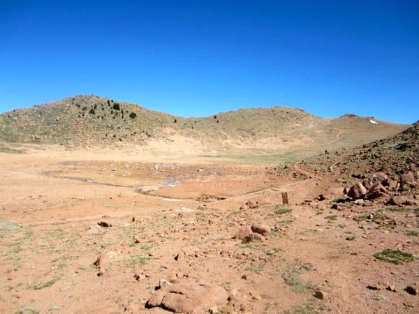
Almagre to the right with a dry Stratton Reservoir. Photo: Brandon Stapanowich
Advanced Trail Runs
Cameron Cone – This secret gem of Manitou is often forgotten or rarely visited thanks to its popular neighbor, Pikes Peak. While the lack of foot traffic is fantastic, the trail can be a bit hard to follow at times, making this 12-mile, roundtrip outing an advanced trail option. The trail also offers some nice vertical gain, a touch of easy scrambling and a bit of scree to fumble on. If you are still interested, read on.
To get there, you essentially have to bushwhack. Go to the end of Ruxton Avenue, take a left into the woods, look both ways, then cross the railroad tracks. Scramble up the hill and look for a faint trail. If you can’t find it, ask the man in the black trench coat for directions. Okay, well, just keep looking, it’s there.
Once you find it, empty your shoes of rocks, turn right (west) and head up the trail. The trail follows the train tracks for a bit, but eventually you start up switchbacks. You’ll come to a small creek crossing, which may be dry or low depending on the time of year you go. Cross that, don’t lose the trail. You should end up at a boulder “field.” Follow the “trail” by scrambling around. Keep this up for a while. You’ll know when you get to the rock formation of Magog.
Magog Rock on the way to Cameron Cone.
From there, head south on a doubletrack “trail.” If you get lost, just follow the path of least resistance toward the mountain in front of you; that’s your destination. Things get tricky from here. Keep heading up. That is key. The road winds for a bit and tapers off into singletrack. Luckily some kind soul has put ribbon up. Look for that and follow it south. You’ll have gotten lost a few times at this point; don’t be dismayed. Keep your wits about you! When all else fails, head up. When you do eventually reach the summit, you’ll forget about the toils it took to get there, until you head back down the same way you came, where you will likely find more “trails.” Sorry. It’s worth it. Bring a map and some flares if you are worried.

Pikes Peak
Pikes Peak via the Barr Trail – This as an advanced trail because it’s long, 24-ish miles, and a 14-er. Yes, there are hundreds of switchbacks leading you to a donut shop at the summit, but I refuse to demote it to easy out of sheer respect for elevation. To get to the Barr Trail, follow signs for the cog railway in downtown Manitou. The trailhead is located across the parking lot from the Incline.
Similar to other popular trails that I have mentioned, begin this one early to avoid the crowds of people schlepping up the trail with big packs and small children. The Barr Trail makes it essentially impossible to get lost on your way to the summit. There are large metal signs with distances and arrows. And better still, if you run out of supplies, you can buy more at Barr Camp or at the summit. It won’t be cheap, but it’s better than bonking. (Note: The donuts smell nauseating at times. Buy one for kicks, but don’t blame me for an upset stomach.)
The trail has long switchbacks all the way to the summit, making it fairly runnable. Right before you get to the summit you’ll need to huff it up the 16 Golden Stairs, which are essentially rocky mini-switchbacks. From this point, you can see the summit house. It’s great to use as a pit stop and for photo ops near the biggest summit marker, ever. For people looking to get up the mountain without so many switchbacks, you can avoid the first three miles on the Barr Trail by taking the Incline. It connects to the Barr trail via a spur if you continue straight once you get to the top of the steps.

Pikes Peak Summit
The combine-it-all route – It would be a long day – mileage is around mid 20’s – and would require two cars for a shuttle. But if you were really trying to kill some time and have an awesome run, you could do this proposed route: park one car at the Red Rocks Canyon main parking lot. Drive to the Crags Campground Trailhead on the west side of Pikes. From the Crags Campground, summit Pikes Peak via the Crags Trail. Descend via the Barr Trail. At the Barr Trail trailhead, connect with the Intemann Trail at the Iron Springs trailhead. From there, wind your way along the trail that parallels downtown Manitou Springs. Follow this trail until the section 16 intersection where the Intemann Trail goes down and to the right. Turn left and head into Red Rocks Canyon. Run down the Greenlee Trail to the parking lot. Feel awesome about your day, get a custard downtown, drink some tea, Instagram photos and tweet about the run. Get the other car from Crags eventually.
Food
Manitou has numerous eateries and cafes that will satisfy any craving. Follow your folly to one of these spots:
Sweet Tooth – Owned by a notable ultra runner, the Colorado Custard Company boasts some tasty treats. Located right on Manitou Avenue, this is a perfect way to end your Pikes Peak run.
Liquid Diet – Scientific studies show that hydration is the key to success for any runner. Test this science out at the Kinfolks.
The Other Liquid – More important than beer is tea! Kick back, blog on your Mac and upload photos to Facebook at the Mate Factor Café.
More Awesomeness
The Springs – If you have some free time and a water bottle, walk around M-Tu’s downtown area and look for the natural mineral springs spigots. Feeling anemic? The Iron Springs Geyser is located right near the Incline.
Coffin Races – The name says it all. Called the Emma Crawford Coffin Races, this ridiculous “race” is held every October. It’s fun to watch or participate in!
The Big Event – The Pikes Peak Ascent and Marathon began in 1956 and remains town’s big endurance event every August. The races are very popular.
Community – Holla’, many radical runners call these trails their home and are a part of the local (and famous) trail group, the Incline Club. Join one of their weekly trail runs.
Call for Comments (from Meghan)
- Pikes Peak, you’ve probably driven up it on a family road trip, but have you run the beast?
- Any inclination toward running, er, clawing your way up the Incline after this explanation? (After being marked as private property for over 12 years, the route was just made legal to the public again as of February 2013!)
- The Pikes Peak Ascent and Marathon are among the US’s best-known trail races. Have you run one of them or would you like to?
